Reports from the Field, 2018 --- Index
(click on any one to jump to detail)
(click on any one to jump to detail)
Christmas Lunch; Wednesday December 19, 2018
Chickamauga Battlefield; Wednesday December 5, 2018
Lula Lake; Wednesday November 28, 2018
Bald River; Saturday November 17, 2018
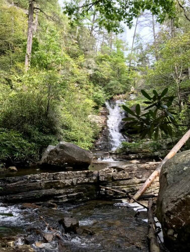
Laurel Falls; Wednesday November 14, 2018
Benton MacKaye Trail Section 20; November 9-12, 2018
McGill Creek; Wednesday November 7, 2018
Smokies AT Backpack, Newfound Gap north; Saturday-Monday November 3-5, 2018
Indian Rock House to Suck Creek Road; Wednesday October 31, 2018
Sycamore Creek; Saturday October 27, 2018
Charit Creek Lodge Overnight; Wednesday-Thursday October 24-25, 2018
Enterprise South; Wednesday October 24, 2018
Virginia Creeper Biking; Thursday October 18, 2018
Boyd Gap to Thunder Rock, Ocoee; Wednesday October 17, 2018
Benton Mackaye trail maintenance, Hiwassee; Saturday October 13, 2018
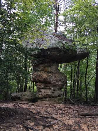
Mushroom Rock to N. Suck Creek; Wednesday October 10, 2018
Balsam Mtn, Smokies; Saturday October 6, 2018
Roaring Creek; Wednesday October 3, 2018
Pinhoti Trail; Saturday September 29, 2018
Lost Creek; Saturday September 22, 2018
Buggy Top; Wednesday September 19, 2018
CT Rock Creek Gorge Segment; Saturday September 15, 2018
Richie Trail Maintenance; Wednesday September 12, 2018
Smokies Balsam Mtn, Gunter Fork, Big Creek; Saturday September 8, 2018
Scenic Spur/Goforth Creek; Wednesday September 5, 2018
Big Soddy Gulf; Wednesday August 29, 2018
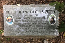
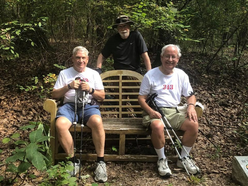
Betty Petty Memorial Hike; Saturday August 25, 2018
Bee Branch Loop; Wednesday August 22, 2018
Biology Trails; Saturday August 18, 2018
Glen Falls; Wednesday August 15, 2018
Greeter Falls; Saturday August 11, 2018
Grundy Forest Day Loop; Wednesday August 8, 2018
Gibbs Gardens; Saturday August 4, 2018
Red Clay State Park; Wednesday August 1, 2018
Fall Creek Falls Paw Paw trail; Wednesday July 25, 2018
AT to Charlie’s Bunion, Dry Sluice/Bradley Fork; Saturday July 21, 2018
Hiwassee Float Trip; Wednesday July 18, 2018
Benton MacKaye Project; Saturday July 14, 2018
Emery Creek; Wednesday July 11, 2018
Amadahy Trail, Carter’s Lake; Saturday June 30, 2018
Sycamore Creek BMTA trail maintenance; Saturday June 23, 2018
Hyatt Ridge, Enloe Creek, Hughes Ridge, Chasteen Creek; Saturday June 23, 2018
Castle Rock; Wednesday June 20, 2018
Little Hump/Big Hump, Roan Highlands; Friday June 15, 2018
Benton MacKaye Project; Saturday June 2, 2018
Stringer’s Ridge; Saturday May 26, 2018
Chilhowee Mountain; Wednesday May 23, 2018
Savage Gulf Day Loop; Wednesday May 16, 2018
Cove Mountain; Saturday May 12, 2018
Unicoi Mtn, Coker Creek Falls; Wednesday May 2, 2018
Big Creek, Camel Gap to AT, to Low Gap, down to Cosby campground; Saturday April 21, 2018
Estelle Mine trail to Crockford-Pigeon WMA; Wednesday April 18, 2018
Coker Creek Falls; Saturday April 14, 2018
Shakerag Hollow; Wednesday April 11, 2018
Laurel-Snow/Buzzard Point Pocket Wilderness; Wednesday April 4, 2018
Walls of Jericho; Wednesday March 28, 2018
Moonshine Trails; Wednesday March 21, 2018
Waterfall Tour led by Don Deakins; Wednesday March 14, 2018
Roaring Creek to McGill Creek; Wednesday March 7, 2018
Len Foote Hike Inn; Wednesday-Thursday March 7-8, 2018
Virgin Falls; Saturday March 3, 2018
Fiery Gizzard; Saturday February 24, 2018
Benton MacKaye Trail; Friday-Sunday February 9-11, 2018
Booker T Washington State Park; Wednesday January 31, 2018
Twenty-Mile to AT, Twenty-Mile Loop, Ridge Trail; Saturday January 27, 2018
Five Points; Wednesday January 24, 2018
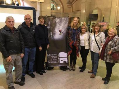
Lookout Wild Film Festival; Saturday January 20, 2018
Cumberland Trail, Soddy Creek; Saturday January 13, 2018
Cloudland Canyon West Rim Loop; Wednesday January 10, 2018
Gahuti Trail, Fort Mountain; Saturday January 6, 2018
CT Prentice Cooper; Monday January 1, 2018
Reports from the Field, 2018
|
Christmas Lunch; Wednesday December 19, 2018
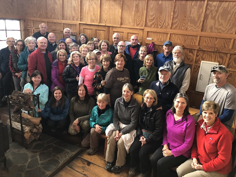
Another Wednesday Christmas lunch without precip! Thanks, Stormy! (About the only thing that didn’t get rained out in December!) After most did an enjoyable short hike on the Ritchie Trail while a few others went in another direction, the throngs regathered at the Pot House for the usual fantastic spread and great company. As always, it was especially nice to reunite with some long-time friends that we don’t see very often! And “Thank you” to our hosts, the good folks at TRGT! |
|
|
Chickamauga Battlefield; Wednesday December 5, 2018
Seventeen Club members and four guests braved the cold to join me on this 5-mile double-loop hike from the Visitor Center, on an easy combination of the red, yellow and blue trails. Despite a few muddy spots remaining from all the rain the previous weekend, we all enjoyed our walk in the woods. After the hike some of us chose to move on down the road to the Park Place Restaurant in Fort Oglethorpe for a nice lunch. A good day all around! Members attending: Barbara Miller, Betsy Darken, Bill Kinnaman, Boe Rudder, Charlie Breeding, Jenny Hopkins, John Budka, Mac Dean, Patti Giles, Renee Grace, Stormy McGauley, Susan Garrett, Suzanne Dorough, Teresa Dean, Tom Carter, Wanda McCarter, and William Needham. Guests participating in the hike were Carla Schunck, Cheryl Hale, Jackie Alvarez and daughter Elizabeth. Hike led and reported by Susan Basch.
Seventeen Club members and four guests braved the cold to join me on this 5-mile double-loop hike from the Visitor Center, on an easy combination of the red, yellow and blue trails. Despite a few muddy spots remaining from all the rain the previous weekend, we all enjoyed our walk in the woods. After the hike some of us chose to move on down the road to the Park Place Restaurant in Fort Oglethorpe for a nice lunch. A good day all around! Members attending: Barbara Miller, Betsy Darken, Bill Kinnaman, Boe Rudder, Charlie Breeding, Jenny Hopkins, John Budka, Mac Dean, Patti Giles, Renee Grace, Stormy McGauley, Susan Garrett, Suzanne Dorough, Teresa Dean, Tom Carter, Wanda McCarter, and William Needham. Guests participating in the hike were Carla Schunck, Cheryl Hale, Jackie Alvarez and daughter Elizabeth. Hike led and reported by Susan Basch.
|
Lula Lake; Wednesday November 28, 2018
Lula Lake Land Trust opened its gate for private access, and despite a frigid 21 degree start, hearty hikers bundled up to enjoy the beauty of this special property. We began by crossing Rock Creek via the foot bridge, hung a left on Middle Trail, and connected to North Creek Trail to reach the lake itself. Further downstream we enjoyed the view of majestic Lula Falls. Several daring hikers descended the steep (and icy) trail to reach the bottom of the gushing falls. We then backtracked a bit to ascend Bluff Trail and hike along the eastern edge of Lookout. By this time, everyone had warmed up significantly. The last bit of our hike was along South Creek Trail, a lovely serene spot lush with rhododendrons and mountain laurel. Braving the cold were: Barbara Miller, Betsy Darken, Bill Kinnaman, Charlie Breeding, John Budka, Joe Teringer, Joyce Campbell, Mac and Teresa Dean, Renee Grace, Susan Basch, Susan Garrett, Suzanne Dorough, Wanda McCarter, Bill Needham, Jennifer Yarbrough. Jenny Hopkins, leading and reporting. |
|
Bald River; Saturday November 17, 2018
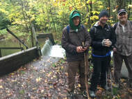
Eight of us hiked the length of Bald River Falls Trail from Tellico River Road to Bald River Road and back. The temperature in the river gorge was considerably cooler than Chattanooga. The mist from the falls was freezing on the bridge. The trail was very muddy in many spots due to the heavy rains and water crossings that are normally just stepped over had to be waded. But it was a beautiful sunny day, just made for hiking. We took a break at Bald River Road and the upper shoals for lunch and headed back. Even though the hike was only 9.5 miles it took almost five hours due to the trail conditions. We had two guests, Nancy Lewis and Colm Bane, from Montana join us. They are park rangers at Yellowstone National Park in visiting family. Participating in the hike were Joe Teringer, Nancy Lewis, Colm Bane, Cheryl Hale, Tim Chomyn, Shelly Claiborne, Rick Glisson and reporting, Boe Rudder.
Eight of us hiked the length of Bald River Falls Trail from Tellico River Road to Bald River Road and back. The temperature in the river gorge was considerably cooler than Chattanooga. The mist from the falls was freezing on the bridge. The trail was very muddy in many spots due to the heavy rains and water crossings that are normally just stepped over had to be waded. But it was a beautiful sunny day, just made for hiking. We took a break at Bald River Road and the upper shoals for lunch and headed back. Even though the hike was only 9.5 miles it took almost five hours due to the trail conditions. We had two guests, Nancy Lewis and Colm Bane, from Montana join us. They are park rangers at Yellowstone National Park in visiting family. Participating in the hike were Joe Teringer, Nancy Lewis, Colm Bane, Cheryl Hale, Tim Chomyn, Shelly Claiborne, Rick Glisson and reporting, Boe Rudder.
|
Laurel Falls; Wednesday November 14, 2018
Sixteen hikers showed up today in spite of the cold, cloudy and some drizzle-of- rain day. Debbie Lambert led 8 hikers to Laurel Falls, which was described as beautiful (round trip 4.8). The other half hiked to the new recently opened 50' bridge that crosses over Laurel Creek (round trip 3.4). All of the hikers, either hiking in or out, took the ATV route that was used to carry in the equipment to build the new bridge. The walk beside Richland Creek was gorgeous and the creek was flowing. A light drizzle started, as we approached the parking lot. Eleven hikers and 2 guests met for lunch at Monkey Town Brewery. Some sampled some cold brewskis (no names mentioned, Renee). The food was delicious. I know a few were heading home to take a nap (Renee). Hikers: Sharon Hogan, Suzanne Dorough, Wanda McCarter, Sue Christensen, Bill Kinnaman, Edie Behringer, Renee Grace, Joe Teringer, Betsy Parsons, Debbie Lambert, Teresa Dean, Mac Dean, Bill Needham, Ronnie Williams, Joy Ward, Susan Garrett. Joined the hikers for lunch: Che Carico and Bob Garrett. |
|
McGill Creek; Wednesday November 7, 2018
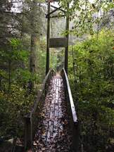
This new piece of the growing Cumberland Trail is almost finished - 4.2 miles. It features a new bridge over McGill Creek and we have been anxious to hike the trail through and admire this feat of construction deep in the woods. Don Deakins has permission to access the trail from Downey Road - there is not yet an official trail head on this end. Once on the trail it was not hard to follow except for 3 extreme blow downs. It "took a little help from a friend" to climb over and around! As you near an amazing waterfall, the creek and its bridge, the trail runs out and there is a distance of 0.2-mile tough hillside bushwhacking. This section of the CT has areas of very large rocks placed to create steps. After a snack break by the creek (we had crossed to the other side via the new bridge) we began the trek back to the cars that had been parked at the Roaring Creek trailhead on Brayton Road. The walking on this half of the trail is much easier underfoot. The blowdowns and bushwhacking were hard but most proud to have safely walked this CT section. Amazed by the trail building work evident on the McGill Creek section were: Barbara Miller, Betsy Parson, Bill Kinnaman, Boe Rudder (wants to organize a chainsaw crew for those blowdowns!), Jennifer Yarbrough, John Budka, Joy Ward, Mac Dean, Renee Grace, Ronnie Williams, Susan Garrett, Suzanne Dorough, Teresa Dean, Wanda McCarter, Wayne Chambers, John Searcy, Bob DeHart, Lonnie Williams, Carol Deakins, Che Carico reporting, Don Deakins leading. |
|
|
Smokies AT Backpack, Newfound Gap north; Saturday-Monday November 3-5, 2018
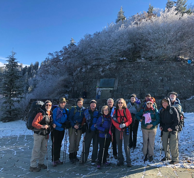
Memories from this "epic" 35 mile hike as twelve hikers began their hike in snow, ice, and surrounded by hoar frost flocked trees at Newfound Gap. In the next three days of hiking and two nights in AT shelters they encountered typical varied trail with ups, downs, and flat sections; roots and rocks; falling leaves; blue skies; cold nights with privies fairly near the shelters; ice cold water running out of the ground at water sources; views from very high places, and the best fall color we had seen this year; sharp foot paths cut through dog hobble and ferns covered with snow; rain on the shelter's tin roof; fire in the shelter fireplace; bowing heads to strong winds on the highest ridges; time change - headlamps required; snoring reasonably quiet in the shelters; a few mice visitors; found and rescued hunting dog who had been separated from his owners since Oct. 26; returned the dog to his owners after a good night's sleep in our shelter and some food ("even that dog would not eat those carrots!"); made new friends with through hikers Big Ben and Fancy Free; Big Ben also slept on the ground in our shelter, out of the rain, but not with the dog; "What time do you get up in a shelter? When you can see!" At Cosby Knob this hardy group broke up into smaller groups for different exit points: Barbara McCollum, Bonnie Smith, Wayne Chambers, down Low Gap II meeting John Rowland to retrieve cars at Newfound Gap. Carolyn Brannon, Joyce Campbell, Rick Glisson, Terri Holcomb, Noel Holcomb exited at Davenport Gap after a side trip to Mt.Cammerer. Ken Smith exited Chestnut Branch Trail. Monty Simmons and Che Carico exited Big Creek after coming down Low Gap I. All finished safely and headed home with the reminder that "Hikers are the most wonderful people!" Statistics from the three-day trek included mileage of 35+, 21 hours of time on the trail, 6,500 ft. in ascent and 10,000 ft. in descent. Ken Smith and Barbara McCollum, leading with Che Carico reporting |
|
|
Indian Rock House to Suck Creek Road; Wednesday October 31, 2018
This section is part of the Cumberland Trail and is 5.6 miles. It has not been hiked in quite a few years because of our reluctance to leave cars on Suck Creek Road due to random break ins. For this day we had a plan!! We drove cars to the trailhead parking above Indian Rock House and began the hike. As the leaves were beginning to fall, there were opportunities to look down at the Tennessee River from high places and with great views. The trail features rock typical of the Cumberland Plateau, caves, rock hopping water crossings, lush ferns, and interesting mushrooms (color and shape). Nearing the end of the hike, Susan Garrett called husband Bob who had been on standby. Answering her call, Bob headed out to pick up the drivers of the shuttle cars, handed out bananas and water, then took drivers to the Indian Rock House trailhead to retrieve the cars. Bob claims to now be the Wednesday Hiker Shuttle Service and we are all so very grateful he helped us experience this part of the CT without the worry of damage to our cars if left on Suck Creek Road! Enjoying the hike and meeting Bob Garrett were: Beverly Ligon, Betsy Darken, Barry Ligon, Bill Kinnaman, Bill LaRoque, Charlie Breeding, Joe Teringer, Jenny Hopkins, John Budka, Edith Behringer, Mac Dean, Ned Giles, Patti Giles, Renee Grace, Ronnie Williams, Susan Garrett, Suzanne Dorough, Teresa Dean, Wanda McCarter, Wayne Chambers, Che Carico reporting, and Susan Garrett leading. |
|
|
Charit Creek Lodge Overnight; Wednesday-Thursday October 24-25, 2018
Most of us first drove to Litton’s Restaurant and Bakery in the Knoxville area for lunch, meeting a few additional participants there. The ambiance was wonderful, as was the food (many of us opted for burgers), and several succumbed to the temptations of the yummy baked goods available. Then we traveled north and west to Big South Fork River and Rec. Area, driving all the way through the park; we then hit the dirt roads to our trailhead, where we met a few more participants, and anxiously wondered about a missing carload of folks. Wednesday’s hike took us down some steep stairs and then under the north arch of Twin Arches, then beneath a stretch of impressive bluffs, before winding down into the valley. Along that stretch we encountered two of the missing and learned that they had taken a “more creative” route; but it was nice to know that everyone was accounted for! We cut it a little bit close as far as being to Charit Creek in time for dinner, but we made it in time to get settled in our cabins and listen to an introductory speech from our host. Dinner by kerosene lamp in the dining room heated by fireplace was delicious and filling. Then we spent the rest of the evening in laughter and song, led by that intrepid duo of Jack and Charlie. After a comfy night’s rest in the cabins, breakfast was just as good as dinner had been, and fueled us for the short but steep climb back up to Twin Arches. Here we walked underneath the south arch, some checked out the “fat man’s squeeze” through the rocks, then we all climbed the stairs to the top of the arches. A few made the short hand-overhand scramble to a great overlook near the south arch, then we all traversed the tops of both arches on our way back to our cars. We learned a lot about the history of the place from our host, and we’d like to get a little history of our own going there, i.e., we’d like to make this an annual trip! Participants were Wanda McCarter, Suzanne Dorough, Sue Christensen, Betsy Parson, Bonnie Smith, Alyx Hogg, Helen Owens, Sonja Parker, Jennifer Yarbrough, Che Carico, Ken Smith, Joyce Campbell, Stephen Turner, Charlie Breeding, Jack Clayton, Jane Trentin, Beverly and Barry Ligon, Vicki and Wayne Chambers (who honeymooned in the “corn crib”), trip organizer Barbara McCollum (thanks!!!), and John Rowland reporting. |
|
Enterprise South; Wednesday October 24, 2018
18 hikers set out to enjoy a beautiful day and headed to Enterprise South Nature Park. We covered 6 plus miles hiking a loop comprised of the Poe Run Path, Dogwood Ridge Trail to Hawks’ Ridge and back via Poe Run Path. Participating were Betsy Darken, Bill Kinnaman, Bill LaRoque, Boe Rudder, John Budka, Joe Teringer, Larry Parks, Linda Keown, Linda Rudder, Patti Giles, Renee Grace, Stormy McGauley, Tom Carter, John Searcy, Diehl Boggs, Merry Boggs, Gail Stokes and Cecile Shenouda. Stormy McGauley reporting.
18 hikers set out to enjoy a beautiful day and headed to Enterprise South Nature Park. We covered 6 plus miles hiking a loop comprised of the Poe Run Path, Dogwood Ridge Trail to Hawks’ Ridge and back via Poe Run Path. Participating were Betsy Darken, Bill Kinnaman, Bill LaRoque, Boe Rudder, John Budka, Joe Teringer, Larry Parks, Linda Keown, Linda Rudder, Patti Giles, Renee Grace, Stormy McGauley, Tom Carter, John Searcy, Diehl Boggs, Merry Boggs, Gail Stokes and Cecile Shenouda. Stormy McGauley reporting.
|
Virginia Creeper Biking; Thursday October 18, 2018
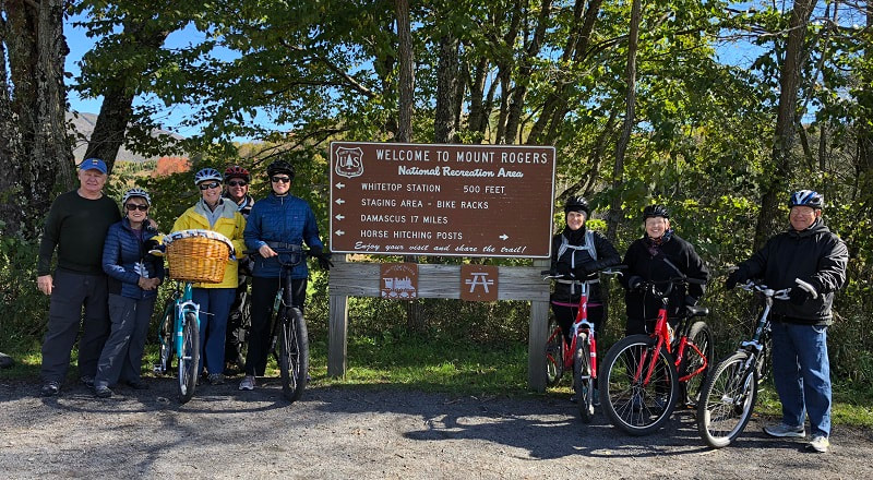
Thousands of visitors each year hike, bike, and horseback ride on the Virginia Creeper Trail. As a former railroad grade, the trail has a long and gentle grade crossing 47 train trestles and bridges from the community of Whitetop to the town of Abingdon. Rushing mountain streams, rural farms, wildflowers, and cool mountain air are just some of the many sights along the trail. Fifteen from the Chattanooga Hiking Club enjoyed biking 17 miles of the trail starting at Whitetop and ending at Sundog Outfitters in Damascus which provided the bicycles, helmets, and shuttle. It was a picture-perfect day with temperatures in the 50’s, and some leaf peeping at higher elevation. This was the first ever club event for the Virginia Creeper, and we hope to make it an annual event. It was a gentle coast for 10 miles starting at Whitetop to the Creeper Trail Café which is world famous for its chocolate cake. After lunch at the café, it was an easy ride into Damascus but did require some pedaling. Anyone who can ride a bicycle would enjoy this trip. Participating were Jerry Wright, Stan and Theresa Reed, Susan Faidley, Phil Ryder, Brenda Nunn, Sue Christensen, Susan Garrett, Jo Beth Kavanaugh, Sue Glascock, Vicki Chambers, and Karin and Scott Deering. Thanks to Wayne Chambers for planning and leading. Barbara McCollum reporting. |
|
Boyd Gap to Thunder Rock, Ocoee; Wednesday October 17, 2018
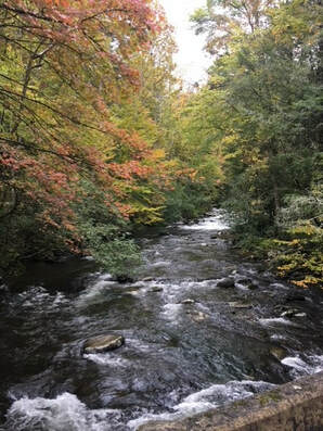
Finally, the sun was shining and the temperature pleasant! Wed hikers hit the trail to enjoy this hike after so many humid days and so many days of rain. For the shuttle, several cars were left at the Thunder Rock campground (Powerhouse # 3) and the rest were left at the large trailhead parking area at Boyd's Gap. From Boyd's Gap the trail heads mostly downhill and toward an intersection with the Old Copper Road where it then follows along beside the rushing waters of the Ocoee to the Whitewater Visitor's Center. Follow signs carefully so as not to miss the trail as it turns left briefly down a paved road and then picks up near and behind a restroom. The stone walls at the visitor's center provided comfortable seating for lunch, bathrooms are on site, and the gift shop is open and welcoming. To complete the hike back to Thunder Rock, cross the bridge and turn right for a clear trail back to the powerhouse and parked cars. Enjoying an unrushed 5-mile hike in the beautiful Ocoee were: Barbara Miller, Barry Ligon, Betsy Parson, Beverly Ligon, Bill Kinnaman, John Budka, Joe Teringer, Patti Giles, Renee Grace, Suzanne Dorough, Bill Needham, Che Carico reporting and John Rowland leading.
Finally, the sun was shining and the temperature pleasant! Wed hikers hit the trail to enjoy this hike after so many humid days and so many days of rain. For the shuttle, several cars were left at the Thunder Rock campground (Powerhouse # 3) and the rest were left at the large trailhead parking area at Boyd's Gap. From Boyd's Gap the trail heads mostly downhill and toward an intersection with the Old Copper Road where it then follows along beside the rushing waters of the Ocoee to the Whitewater Visitor's Center. Follow signs carefully so as not to miss the trail as it turns left briefly down a paved road and then picks up near and behind a restroom. The stone walls at the visitor's center provided comfortable seating for lunch, bathrooms are on site, and the gift shop is open and welcoming. To complete the hike back to Thunder Rock, cross the bridge and turn right for a clear trail back to the powerhouse and parked cars. Enjoying an unrushed 5-mile hike in the beautiful Ocoee were: Barbara Miller, Barry Ligon, Betsy Parson, Beverly Ligon, Bill Kinnaman, John Budka, Joe Teringer, Patti Giles, Renee Grace, Suzanne Dorough, Bill Needham, Che Carico reporting and John Rowland leading.
Benton Mackaye trail maintenance, Hiwassee; Saturday October 13, 2018
We brushed out the entire section, removed downed trees and repaired tread in four locations. Someone has just been through with a chain saw and taken out all but one tree near eastern end. It is pretty big, and I suspect a bigger saw is needed to remove it. It is too big to get around and only 20 inches to crawl under. We did not get the tread repaired where it is most needed. At the shale ledge at the high point on the eastern end. There used to be footholds in the ledge, but time and hikers have broken them off. The tread is only 6 to 10 inches wide on either side, but we ran out of energy at that point. We can fix it but need some direction from you on how BMTA wants it done. This was a Chattanooga Hiking Club volunteer day. Carolyn Brannon, Bill Kinnaman, John Budka, Steve Barnes, and Boe Rudder reporting.
We brushed out the entire section, removed downed trees and repaired tread in four locations. Someone has just been through with a chain saw and taken out all but one tree near eastern end. It is pretty big, and I suspect a bigger saw is needed to remove it. It is too big to get around and only 20 inches to crawl under. We did not get the tread repaired where it is most needed. At the shale ledge at the high point on the eastern end. There used to be footholds in the ledge, but time and hikers have broken them off. The tread is only 6 to 10 inches wide on either side, but we ran out of energy at that point. We can fix it but need some direction from you on how BMTA wants it done. This was a Chattanooga Hiking Club volunteer day. Carolyn Brannon, Bill Kinnaman, John Budka, Steve Barnes, and Boe Rudder reporting.
Balsam Mtn, Smokies; Saturday October 6, 2018
Pin Oak Gap is where you will find the Balsam Mountain trailhead. From here 5 determined hikers began the climb and trek to the AT and a night spent in the Tri Corner Knob shelter. The weather was reasonably cool but humidity a factor. The first 4.3 miles to Laurel Gap shelter is easy to follow and with its ups came some flat sections and some downs as you would expect in the Smokies. The flat stretches were covered as far as the eye could see by the white blooms of Snake Root when hikers passed through there on their way to Gunter Fork in September. Here in October the blooms were faded and dry, but the plants stood tall and lined the trail. From Laurel Gap shelter it was 5.8 miles on to the Tri-Corner Knob shelter. This shelter is said by some to be the most "luxurious" on the AT as it has a privy and the water source is right beside it ! After enjoying the new folks we met in the shelter, and after a night of restless sleep, we headed back the way we came. The exception is that Carolyn and Wayne exited to Balsam Mtn. Road via Beech Gap Trail. It was a bit longer and MUCH steeper downhill on the return. Since we had to keep our eyes cast down on the rocky trail it is a good thing the ferns were still green and there were interesting mushrooms along the way. Blessed to have safely made more memories were: Carolyn Brannon, Wayne Chambers, Betsy Parson, Monty Simmons, and Che Carico reporting.
Pin Oak Gap is where you will find the Balsam Mountain trailhead. From here 5 determined hikers began the climb and trek to the AT and a night spent in the Tri Corner Knob shelter. The weather was reasonably cool but humidity a factor. The first 4.3 miles to Laurel Gap shelter is easy to follow and with its ups came some flat sections and some downs as you would expect in the Smokies. The flat stretches were covered as far as the eye could see by the white blooms of Snake Root when hikers passed through there on their way to Gunter Fork in September. Here in October the blooms were faded and dry, but the plants stood tall and lined the trail. From Laurel Gap shelter it was 5.8 miles on to the Tri-Corner Knob shelter. This shelter is said by some to be the most "luxurious" on the AT as it has a privy and the water source is right beside it ! After enjoying the new folks we met in the shelter, and after a night of restless sleep, we headed back the way we came. The exception is that Carolyn and Wayne exited to Balsam Mtn. Road via Beech Gap Trail. It was a bit longer and MUCH steeper downhill on the return. Since we had to keep our eyes cast down on the rocky trail it is a good thing the ferns were still green and there were interesting mushrooms along the way. Blessed to have safely made more memories were: Carolyn Brannon, Wayne Chambers, Betsy Parson, Monty Simmons, and Che Carico reporting.
Roaring Creek; Wednesday October 3, 2018
16 CHC club members hiked about 6.5 miles from the Roaring Creek trailhead to the Cranmore Cove overlook on Graysville Mtn and back. The weather was great. Not too sunny or muggy. The trail is in pretty good condition except for one new tree down and a section along the ridge that needs an additional marker. The views from the overlook are spectacular when the weather is so clear. This hike is always a good excuse to eat lunch at the Screen Door. Those participating were Bill Kinnaman, Carla Schunck, Charlie Breeding, Edie Behringer, Mac Dean, Renee Grace, Sue Christensen, Susan Garrett, Susan Basch, Suzanne Dorough, Teresa Dean, Wanda McCarter, Joy Ward, Joe Teringer and John Budka. Boe Rudder reporting.
16 CHC club members hiked about 6.5 miles from the Roaring Creek trailhead to the Cranmore Cove overlook on Graysville Mtn and back. The weather was great. Not too sunny or muggy. The trail is in pretty good condition except for one new tree down and a section along the ridge that needs an additional marker. The views from the overlook are spectacular when the weather is so clear. This hike is always a good excuse to eat lunch at the Screen Door. Those participating were Bill Kinnaman, Carla Schunck, Charlie Breeding, Edie Behringer, Mac Dean, Renee Grace, Sue Christensen, Susan Garrett, Susan Basch, Suzanne Dorough, Teresa Dean, Wanda McCarter, Joy Ward, Joe Teringer and John Budka. Boe Rudder reporting.
Lost Creek; Saturday September 22, 2018
After a brief stop at the Ooltewah gathering site, nine hikers made the drive to the Hiwassee River State Canoe Launch parking area. The Lost Creek Trail trailhead is a short but steep walk and is located in the Cherokee National Forest near the confluence of Lost Creek with the Hiwassee. The weather was warm and somewhat humid, but the trail follows Lost Creek which has an abundance of canopy which shades the trail from the sun. Lost Creek was flowing steadily thanks to an abnormally wet summer. The trail was well maintained, and the only obstacles were the two creek crossings and an occasional muddy patch from horse and wild pig traffic. We set a mild pace and the group enjoyed the scenic trek through the woods, along the bluffs and ridgeline to the Lost Creek Campground. As we neared the campground the water was low, and we found a gravel bank which was the perfect place for a rest and a snack. The gurgling creek provided for a cool respite from the heat. This is a good walk for a warm day. It is also spectacular in the fall as the colors are stunning. Those enjoying the 7 plus miles out and back were Teresa Boswell, Kaye and Katie Freeman, John Budka, Trey Causey, Lindy Johnson, Joe Teringer, Boe Rudder and Steve Barnes reporting.
After a brief stop at the Ooltewah gathering site, nine hikers made the drive to the Hiwassee River State Canoe Launch parking area. The Lost Creek Trail trailhead is a short but steep walk and is located in the Cherokee National Forest near the confluence of Lost Creek with the Hiwassee. The weather was warm and somewhat humid, but the trail follows Lost Creek which has an abundance of canopy which shades the trail from the sun. Lost Creek was flowing steadily thanks to an abnormally wet summer. The trail was well maintained, and the only obstacles were the two creek crossings and an occasional muddy patch from horse and wild pig traffic. We set a mild pace and the group enjoyed the scenic trek through the woods, along the bluffs and ridgeline to the Lost Creek Campground. As we neared the campground the water was low, and we found a gravel bank which was the perfect place for a rest and a snack. The gurgling creek provided for a cool respite from the heat. This is a good walk for a warm day. It is also spectacular in the fall as the colors are stunning. Those enjoying the 7 plus miles out and back were Teresa Boswell, Kaye and Katie Freeman, John Budka, Trey Causey, Lindy Johnson, Joe Teringer, Boe Rudder and Steve Barnes reporting.
Buggy Top; Wednesday September 19, 2018
Renee Grace loves this trail and by her request we returned! It was to be a really hot day and we thought a short hike on a cooler (?) Monteagle Mountain would be in order. For those of you who know this trail, it ascends at first, levels off somewhat, then descends to the trail's end at the bluff and steep trail down to the cave entrance. Several new hikers today then followed Renee into the cave entrance. They climbed up and over the rocks and out the Peter's Cave entrance. Headlamps are a must for this part as at times it is so dark you can only get your bearings by the visual of the exit cave opening and the light coming through that entrance. The new hikers loved it and Susan, Renee, and Charlie loved helping them find their way back to those of us who chilled out and got chigger bitten. The trail is not well marked from entrance to entrance. Enjoying new friendships and off to lunch at Mountain Goat Cafe were: Suzanne Dorough, Tom Carter, Betsy Darken, John Budka, Joe Teringer, Charlie Breeding, Che Carico reporting, Susan Garrett and Renee Grace leading.
Renee Grace loves this trail and by her request we returned! It was to be a really hot day and we thought a short hike on a cooler (?) Monteagle Mountain would be in order. For those of you who know this trail, it ascends at first, levels off somewhat, then descends to the trail's end at the bluff and steep trail down to the cave entrance. Several new hikers today then followed Renee into the cave entrance. They climbed up and over the rocks and out the Peter's Cave entrance. Headlamps are a must for this part as at times it is so dark you can only get your bearings by the visual of the exit cave opening and the light coming through that entrance. The new hikers loved it and Susan, Renee, and Charlie loved helping them find their way back to those of us who chilled out and got chigger bitten. The trail is not well marked from entrance to entrance. Enjoying new friendships and off to lunch at Mountain Goat Cafe were: Suzanne Dorough, Tom Carter, Betsy Darken, John Budka, Joe Teringer, Charlie Breeding, Che Carico reporting, Susan Garrett and Renee Grace leading.
CT Rock Creek Gorge Segment; Saturday September 15, 2018
It was a hot but beautiful and clear day when hikers Barbara McCollum, Boe Rudder and Carolyn Brannon welcomed Trey Causey and John Budka on their first hike with the CHC. A car was left on Upper Leggett Road and then the hikers drove to the Retro Hughes parking lot to begin their hike on the Rock Creek segment of the Cumberland Trail. Trey had never used hiking poles and soon learned why they are important. He found sticks along the way to help support him across the rocks. The water was low, but we were still grateful for the 4 bridges over the creek. We enjoyed lunch and beautiful views at the Rock Creek and Leggett Point overlooks and hiked 6.5 miles in total. All agreed it was a great hike. Carolyn Brannon reporting.
It was a hot but beautiful and clear day when hikers Barbara McCollum, Boe Rudder and Carolyn Brannon welcomed Trey Causey and John Budka on their first hike with the CHC. A car was left on Upper Leggett Road and then the hikers drove to the Retro Hughes parking lot to begin their hike on the Rock Creek segment of the Cumberland Trail. Trey had never used hiking poles and soon learned why they are important. He found sticks along the way to help support him across the rocks. The water was low, but we were still grateful for the 4 bridges over the creek. We enjoyed lunch and beautiful views at the Rock Creek and Leggett Point overlooks and hiked 6.5 miles in total. All agreed it was a great hike. Carolyn Brannon reporting.
Richie Trail Maintenance; Wednesday September 12, 2018
The Ritchie Trail may be the most recently built, finished, and opened up trail in our immediate area. A short 2-mile section coming from Davis Pond lacked raking out and stump and root removal. Mariah met us at Davis Pond with tools and she led us to the beginning of the trail section that needed improving. From here we worked toward the Pot Point Loop trail and the intersection of the Ritchie Trail coming up from the Pot Point House parking lot. Mariah said we had achieved her goal for the day, but I just bet she would not have objected if we had worked on to 3 pm rather than knocking off at 1:30! So close, when our group stopped, we could look through the trees and see orange flags down below on the Pot Point Trail - so close, but she did encourage us to stop as the drainage work would be a little more demanding in that last part. Working out with tools today were: Sue Christensen, Bill Kinnaman, Charlie Breeding, Tom Carter, Wayne Chambers, Jenny Hopkins, Joe Teringer, Che Carico reporting.
The Ritchie Trail may be the most recently built, finished, and opened up trail in our immediate area. A short 2-mile section coming from Davis Pond lacked raking out and stump and root removal. Mariah met us at Davis Pond with tools and she led us to the beginning of the trail section that needed improving. From here we worked toward the Pot Point Loop trail and the intersection of the Ritchie Trail coming up from the Pot Point House parking lot. Mariah said we had achieved her goal for the day, but I just bet she would not have objected if we had worked on to 3 pm rather than knocking off at 1:30! So close, when our group stopped, we could look through the trees and see orange flags down below on the Pot Point Trail - so close, but she did encourage us to stop as the drainage work would be a little more demanding in that last part. Working out with tools today were: Sue Christensen, Bill Kinnaman, Charlie Breeding, Tom Carter, Wayne Chambers, Jenny Hopkins, Joe Teringer, Che Carico reporting.
Smokies Balsam Mtn, Gunter Fork, Big Creek; Saturday September 8, 2018
We have heard ominous stories about Gunter Fork and they were proven true! As we started out on the first 4.3 miles on Balsam Mtn. trail we found it to be uphill but not too steep and with some leveling off places as we approached Laurel Gap Shelter. The flowers were amazing and unexpected as it is so far into the season. After a leisurely lunch at Laurel Gap we hiked .9 of a mile to the intersection with Gunter Fork trail. Unsuspecting of what lay ahead and since it was only 4.1 miles to Wet Bottoms, we were jubilant to be making good progress and soon to have completed this trail. We had been warned that the trail was quite narrow in places, loose rock lay underfoot, rutted step downs, vegetation that hid the edges of the trail and its steep drop off, tall briars and stinging nettle. This made for slow progress down a trail that this writer thinks should be closed until maintained and improved! Finally near the end of the trail we encountered several crossings of Gunter Fork, and Big Creek that are often impassable in high water. Today OK to cross with water shoes, poles, and caution. It was a sight for sore eyes to finally see Barbara McCollum across the creek waiting for us. Barbara had run the very long shuttle for us, placing us at Pin Oak Gap then driving around to Big Creek and hiking up the creek to meet us. She had begun to worry! It seemed like a forever trek on out Big Creek but all made it safe and sound as dark approached. Grateful to have completed Gunter Fork, grateful to Barbara for the shuttle, and grateful to Carolyn for driving were: Monty Simmons, Carolyn Brannon, Che Carico reporting, and Barbara McCollum directing and encouraging - "You've got to get this trail before Heintooga Road closes for winter!"
We have heard ominous stories about Gunter Fork and they were proven true! As we started out on the first 4.3 miles on Balsam Mtn. trail we found it to be uphill but not too steep and with some leveling off places as we approached Laurel Gap Shelter. The flowers were amazing and unexpected as it is so far into the season. After a leisurely lunch at Laurel Gap we hiked .9 of a mile to the intersection with Gunter Fork trail. Unsuspecting of what lay ahead and since it was only 4.1 miles to Wet Bottoms, we were jubilant to be making good progress and soon to have completed this trail. We had been warned that the trail was quite narrow in places, loose rock lay underfoot, rutted step downs, vegetation that hid the edges of the trail and its steep drop off, tall briars and stinging nettle. This made for slow progress down a trail that this writer thinks should be closed until maintained and improved! Finally near the end of the trail we encountered several crossings of Gunter Fork, and Big Creek that are often impassable in high water. Today OK to cross with water shoes, poles, and caution. It was a sight for sore eyes to finally see Barbara McCollum across the creek waiting for us. Barbara had run the very long shuttle for us, placing us at Pin Oak Gap then driving around to Big Creek and hiking up the creek to meet us. She had begun to worry! It seemed like a forever trek on out Big Creek but all made it safe and sound as dark approached. Grateful to have completed Gunter Fork, grateful to Barbara for the shuttle, and grateful to Carolyn for driving were: Monty Simmons, Carolyn Brannon, Che Carico reporting, and Barbara McCollum directing and encouraging - "You've got to get this trail before Heintooga Road closes for winter!"
|
Scenic Spur/Goforth Creek; Wednesday September 5, 2018
Nineteen hikers showed for the trip to the Ocoee. Overcast day which helped with the humidity, a little. We took the Scenic Spur trail. Some saw a Copperhead (well ... without the head). We crossed two creeks that we had to rock hop. Elevation climb of almost 800 ft. All of the falls did have normal water flow. About 10 of us went to the third falls, Rainbow. It was somewhat tricky scrambling up and down the boulders, but it was worth the climb. Back at the Clemmer trailhead, three hikers decided to head home. The other 16 headed to Goforth Creek just up the road a piece. The trail is a dirt road most of the way. The creek running beside the trail is beautiful. The meadow at .9 miles (where we were going to have lunch), was too high with wildflowers. Although very beautiful, there wasn't a spot to sit. We headed back to the creek and everyone found a spot to have lunch. Everyone was well behaved (especially Bill K). LOL. Attending: Teresa Dean (reporting), Mac Dean, Charlie Breeding, Luke Spiekermann, Bill LaRoque, Patti Giles, Joy Ward, Betsy Parson, Barbara Miller, Joe Teringer, Trish Appleton, Wanda McCarter, Suzanne Dorough, Beverly Ligon, Barry Ligon, Susan Garrett, Betsy Darken, Renee' Grace, Bill Kinnaman. |
|
Big Soddy Gulf; Wednesday August 29, 2018
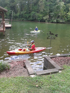
Hot and humid day for this easy trail along Big Soddy Creek, in and out to its end point at the picnic area bridge. The trail has been extended, turning to the left after crossing the bridge and continuing for another half mile. This makes the in and out 3 miles unless you want to turn right and continue on to the Cumberland Trail. Taking this path opens up lots of other sections of the CT. This trek was perfect for the temperature, humidity, threat of rain, and pot luck picnic at the lakeside home of Trish Appleton. Her hospitality was boundless, the breeze as we sat on the lawn by the lake cooling, and the food endless. Trish took several out on the water a short distance (storm clouds were moving in) on her pontoon boat. Debbie and Jack raced to the end of the cove and back in lake kayaks. Only as the last person began to pack up did the rain move in. How blessed were we on this day!! |
|
Biology Trails; Saturday August 18, 2018
Six of us completed an 8-mile hike on the Biology Trails at Southern Adventist University. We managed to dodge the rain predicted for that day, though the humidity was close to 90% from the heavy rains the night before. We had three new hikers joining us today, Rita Pendergast, Amy Griffith and Annette Finley. This was their first hike with the club and they enjoyed getting on the trail. Other hikers included Rick Glisson and Shelly Claiborne. Reporting Tim Chomyn. |
|
Greeter Falls; Saturday August 11, 2018
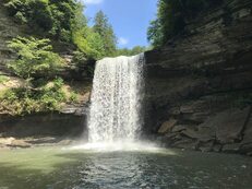
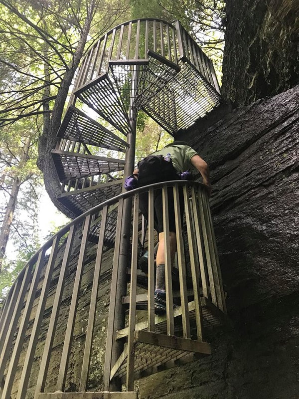
Another great turnout for a less strenuous, local hike to Greeter Falls in the Savage Gulf State Natural Area just outside of Altamont, TN. Savage Gulf is a 15,000-acre area in the South Cumberland State Park full of beautiful hardwood forests, tumbling creeks, sandstone cliffs and incredible waterfalls. The 3.2-mile Greeter Falls Loop offers three waterfalls as well as a historic home place. We first hiked to Boardtree Falls, and to make the hike a little longer, we hiked out to Alum Gap for a nice view of the gorge. Next, it was on to the highlight of the day—the impressive 50-foot Greeter Falls which required descending a spiral staircase and a slippery set of stairs ending in a notched boardwalk. Several hikers carefully descended to the beautiful pool created by the Falls for photographs or to get their feet wet. We also visited the 15-foot upper Greeter Falls which is equally as spectacular. On the return trip to the parking lot, we hoped to swim in the Blue Hole, but we only had two swimmers who enjoyed the cooling effects of Firescald Creek. Milder temperatures and lots of shade made for a very pleasant day. Total mileage was 4 miles with 500 feet in elevation gain. The day ended with a late lunch at one of the club’s favorite restaurants in Monteagle—Papa Ron’s Italian Steakhouse. Helping to celebrate a milestone birthday with another fun day of hiking and fellowship were Steve Barnes, John Rowland, Sue Christensen, Boe Rudder, Teresa Dean, Mac Dean, Betsy Parson, Tim Chomyn, Che Carico, Lindy Johnson, Kathy Steinbruegge, Gayle Monk, and newcomer Marti Smith. Many thanks to Steve Barnes for navigating to the trailhead and to John Rowland for leading the hike. Barbara McCollum, reporting. |
Grundy Forest Day Loop; Wednesday August 8, 2018
This trail is a good choice for a half day hike when heat, humidity, and afternoon summer showers are in the forecast. A dense canopy protected the hikers as they took the counterclockwise direction for hiking to the bridge, spurring off to free-flowing Sycamore Falls, then returning to complete the loop back to the parking lot. The South Cumberland work crews have rerouted the trail to access the Fiery Gizzard. This change is well marked as they have defined the day loop and then the access to the Fiery Gizzard separately. Lots of healthy ferns, unusual mushrooms, and rocks! Remember this trail has lots of exposed roots and rocks and must be traveled with careful foot placement. We did experience a hiker's fall and injury only to find out how quickly the ranger could respond and how professional he was as he took over the situation. Thanks Bill Knapp and crew! In this case we were able to call the ranger station directly with cell service but were prepared to get out the SPOT that our club provides if needed. Glad for a happy ending were: Susan Basch, Barbara Miller, Wanda McCarter, Renee Grace, Sue Christensen, Edith Behringer, Bill Kinnaman, Joe Teringer, Jenny Hopkins, Beverly Ligon, Barry Ligon, Tom Carter, John Rowland, Bill Needham, Charlie Breeding, Larry Parks, Suzanne Dorough, Che Carico reporting and Susan Garrett leading.
This trail is a good choice for a half day hike when heat, humidity, and afternoon summer showers are in the forecast. A dense canopy protected the hikers as they took the counterclockwise direction for hiking to the bridge, spurring off to free-flowing Sycamore Falls, then returning to complete the loop back to the parking lot. The South Cumberland work crews have rerouted the trail to access the Fiery Gizzard. This change is well marked as they have defined the day loop and then the access to the Fiery Gizzard separately. Lots of healthy ferns, unusual mushrooms, and rocks! Remember this trail has lots of exposed roots and rocks and must be traveled with careful foot placement. We did experience a hiker's fall and injury only to find out how quickly the ranger could respond and how professional he was as he took over the situation. Thanks Bill Knapp and crew! In this case we were able to call the ranger station directly with cell service but were prepared to get out the SPOT that our club provides if needed. Glad for a happy ending were: Susan Basch, Barbara Miller, Wanda McCarter, Renee Grace, Sue Christensen, Edith Behringer, Bill Kinnaman, Joe Teringer, Jenny Hopkins, Beverly Ligon, Barry Ligon, Tom Carter, John Rowland, Bill Needham, Charlie Breeding, Larry Parks, Suzanne Dorough, Che Carico reporting and Susan Garrett leading.
|
Gibbs Gardens; Saturday August 4, 2018
The dog days of summer called for something a little different and refreshing. So, we decided to place world-class Gibbs Gardens near Ball Ground, Georgia on the schedule. Based on the turnout and the number of photographs taken, it was considered a “hit." The weather forecast had not been favorable for several days prior, but the sun came out and provided a picture-perfect day. Mr. Jim Gibbs of Gibbs Landscaping (Atlanta, GA) purchased 292 acres in 1980 and spent the next 32 years building the gardens. They were opened to the public in 2012. Three feature gardens—Manor House, Japanese, and Waterlily provided stunning beauty and color at every turn. The gardens were designed for different colors to emerge every three to four weeks and delightful sculptures were strategically placed throughout the gardens including a space dedicated to the Gibbs grandchildren. The Waterlily Gardens featured an exact replica of the bridge in Monet’s Gardens in Giverny, France. In the Japanese Gardens, the group walked over the crooked bridge to rid ourselves of evil spirits. At the Manor House Gardens (private residence of the Gibb’s), we enjoyed a view of Mount Oglethorpe, which used to be the southern terminus of the Appalachian Trail prior to the opening of Amicalola Falls State Park. Also observed during our stroll was National Summit Day and the walk to the Manor House provided a 150-foot summit. A leisurely lunch under the tall trees of the Arbor Terrace Café was a welcome rest stop. After meandering for over three hours through the gardens full of blooming annuals and perennials, several in the group decided to purchase annual passes which hopefully means a return trip for the club. New club members, Annette Finley and Trey Causey, joined veteran members Betsy Parson, Carolyn Brannon, John Rowland, Joyce Campbell, Sonja Parker, Susan Basch and Tom Long. Guests from Rome included Steve and Ginger Smith. As a retired Arborist, Steve was happy to provide tree identification. Happy to share one of her favorite places with the club was Barbara McCollum, reporting. |
|
|
Red Clay State Park; Wednesday August 1, 2018
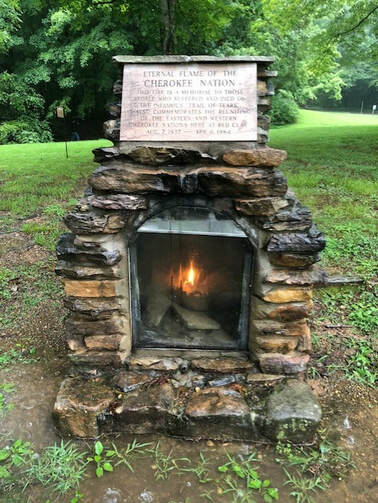
What is it that they say? "Neither rain, nor sleet, nor snow, nor slush" will keep the hikers off the trail? 14 of us had misguided faith the rain would stop soon and went on to check in at the visitor's center at Red Clay. There we appreciated the artifacts preserved about the Cherokee Nation, and the historical presentation about the Trail of Tears. The rain did not stop but, armed with umbrellas, we walked the paved paths of the grounds to see the log homes , a barn and other out buildings built there demonstrating their village way of life. There is a newly built amphitheater on the property and an eternal flame on a hill above the Blue Hole that has been burning since 1984. We did not walk the woods trail because of the "depth" of the water and mud at its beginning. As the rain continued to come steadily down, a few returned to Chattanooga and some drove on into Cleveland to the Renfro sock outlet. Armed with bargains and more socks than a body might need, the next stop was Uncle Larry's on Apison Pike for catfish and vegetables. Certainly not working on their cardio today were: Beverly Ligon, Barry Ligon, Tom Carter, Joe Teringer, Betsy Parson, Sue Christensen, Bill LaRoque, Susan Basch, Vanessa Turner, Barbara Miller, Larry Parks, Teresa Dean, Che Carico reporting, and Mac Dean the reluctant leader!! |
|
Fall Creek Falls Paw Paw trail; Wednesday July 25, 2018
It had been a long time since any of us had hiked in this area, so we stood around for a bit questioning who would be our leader! We finally decided on John in the lead and Mac carefully placed along the line with his GPS to keep us on the loop in the direction we had chosen - counter clockwise. This beautiful woodland trail features 3 spur trails to overlooks in the gorge and of the waterfalls. The one with the best view of Cane Creek falls from a distance was the last spur, going off to the right, before completing the loop back to the "lollipop stick" to exit. At the picnic shelter above the under-construction nature center we regrouped then continued on to find and hike the Gorge Overlook/Woodland trail. The overlook of the gorge and Cane Creek falls was splendid as there was so much water falling over and into the gorge. The short spur brings you down to a bluff with a clear view of the falls. Some pulled out packed lunches and rested here and others headed back to the nature center with plans to go to Cookie Jar and/or to the Screen Door for lunch. Noticing heat and humidity with fairly short distance hiking were: Suzanne Dorough, Wanda McCarter, Patti Giles, Larry Parks, Boe Rudder, Teresa Dean, Mac Dean, Joy Ward, Bill Needham, Charlie Breeding, John Rowland, Renee Grace, Sue Christensen, Susan Basch, Che Carico, reporting. |
|
AT to Charlie’s Bunion, Dry Sluice/Bradley Fork; Saturday July 21, 2018
The unsettled July weather threatened the July 21 Smokies hike but the day turned out to be mostly sunny and dry. The Fork Ridge Trail, the planned hike, had a river crossing and after heavy rain hit overnight, the group decided to switch to the Dry Sluice Trail. After starting the day at Peter's Pancakes in Cherokee, Bonnie Smith, Betsy Parson and Ken Smith headed up to Newfound Gap, hiked north on the AT to Charlies Bunion before heading down Dry Sluice, in and out on Cabin Flats and out Bradley Fork to Smokemont Campground. The total hike was 14.31 miles with 1,690 feet of elevation gain but 4,464 feet of descent. On the way out on Bradley Fork, Betsy and Ken were walking side by side when Bonnie pointed out that they had stepped right in front and right behind a stretched out Black Snake! Neither had seen it until Bonnie pointed it out. Good thing it wasn't an aggressive snake! A special thanks to Rick Glisson for his scouting report on the river crossing on Fork Ridge Trail. Even with the heavy early morning rain, the river crossing was only knee deep, something good to know for when we reschedule this trail. Ken Smith reporting. |
|
|
Hiwassee Float Trip; Wednesday July 18, 2018
The river was running higher than usual on this day of our annual duckie float trip. For this reason, the one-man inflatable craft were less likely to get stuck on rocks with a smoother ride - mostly! Hikers also met with the results of days of rain in that their attempt to hike was met with LOTS of overgrowth, and mud from the overflown river bank. Meeting at Big Bend for the "covered dish" hot dog roast was joyfully received by both veterans and newcomers of this annual event. John had brought his newly acquired canopy which offered shade for picnic table seating. He also took over duties as "Master Chef" as Wayne was out post-op from shoulder surgery and Bill was out due to important doctor's appointment. An impressive feast was laid out having been brought to the river bank in coolers. John "cooked to order" from gentle roasting to blackened hot dogs - beef and vegetarian. Loaded up and back on the river and in cars for traveling home were: Tim Chomyn, Gary and Judy Petty, Charlie Breeding, Tristan Carico, Seth Carico, You-jin Seo, Jane Anne Seal and Joy Ward (veterans for one man duckies now), Barry and Beverly Ligon, Debbie Lambert, Susan Garrett, Renee Grace, Betsy Parson, Susan Basch, Suzanne Dorough, Wanda McCarter, John Rowland, Larry Parks, Edith Behringer, Patti Giles, Boe Rudder, Che Carico reporting. (We enjoy the outfitting care given by Webb Brothers Outfitters and the adventurous ride to put in hanging on in the slat-sided farm truck.) |
|
|
Benton MacKaye Project; Saturday July 14, 2018
The third installment of this project was to be two days of hiking beginning at Beech Gap on the Cherohala Skyway near the Tennessee/North Carolina Border to the Fontana Visitor’s Center in the Smoky Mountains. Day one: Beech Gap to Tapoco Lodge/ Hwy. 129 for 15.1 miles; and day two: Hwy 129 to Fontana Visitor Center for 14.2 miles. After meeting up in Robbinsville, North Carolina on Friday evening, the group decided to have dinner at the Tapoco Lodge and place a car at the ending trailhead to make Saturday’s shuttle easier. We enjoyed a lovely dinner on the terrace of the Tapoco Tavern overlooking the Cheoah River. In retrospect this turned out to be the high point of the trip! Saturday’s hike started at 8:30 a.m. and 66 degrees. After a mile or so on an old forest service road where we enjoyed a multitude of Turk’s Cap Lily, we started climbing a ridgeline to Bob and Stratton Balds, the latter of which was abloom in lavender phlox! After leaving the balds, trail conditions and weather quickly changed. Clouds rolled in which prevented us from enjoying one of the highlights of this section - the Hangover. A lack of trail maintenance for most of the trail and an almost 5,000 ft. descent made for a long and challenging day. Most hikers agreed it was their most difficult day on the trail. A couple of rain showers and 99 percent humidity didn’t help. After climbing over and under through numerous blowdowns, we finally made it to the Tapoco Lodge at 7:15 p.m. Almost 11 hours on the trail. We all decided the air conditioning, varied menu, and nice assortment of cold beverages would help to make our broken bodies feel better. Given the difficulty of Saturday’s trail conditions, we decided as a group to bail on Sunday’s hike. Completing a 14-mile “in and out” hike back to Beech Gap were John Rowland and Susan Basch. Completing Beech Gap to Tapoco Lodge were Tim Chomyn, Bill Needham, Carolyn Brannon, Cathy Love, and Barbara McCollum, reporting. |
|
|
Emery Creek; Wednesday July 11, 2018
Emery Creek is a beautiful trail in the Cohutta Wildlife Management Wilderness. Its greatest challenge is the area of big rocks disturbing the footpath in the first .8 miles and then the first of 8 water crossings. The first crossing can be thigh deep and swift although on this day it was anke/calf deep and more easily navigated. The next 7 crossings are easier and refreshing - we had taken water shoes and once they were on they stayed on for the rest of the hike. The footpath is easy enough to be walked with water shoes rather than boots and the crossings come frequently enough to make taking boots on and off impractical. The trail gently climbs to a junction with a left turn spur to the lower water falls - Emery Creek falls. Bearing right takes you on more steeply uphill to the top of the ridge where you will see a series of four cascades. This is where we turned around, trekked back down to the lower falls, enjoyed packed lunches, then headed back to parked cars and home. Enjoying 5.4 miles of adventure were: Angela Evans, Barbara McCollum, Betsy Parson, Bill Kinnaman, Charlie Breeding, Jenny Hopkins, Larry Parks, Mac Dean, Renee Grace, Suzanne Dorough, Teresa Dean, Wanda McCarter, Tim Chomyn, Joe Teringher, Che Carico reporting, Angela Evans and Che Carico leading. (To avoid an unnecessary road walk to the trailhead, do not stop at first parking area. Continue on up the dirt/gravel road until it swings sharply uphill to the right as the road seems to end. On the left is the parking closest to the beginning of the trail.) |
|
|
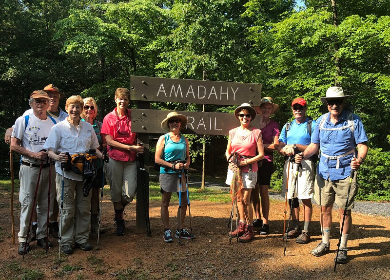
Amadahy Trail, Carter’s Lake; Saturday June 30, 2018
Amadahy is a name of native American origin (most likely Cherokee) and means “forest water”. The very lovely Amadahy Trail is a family-friendly 3.6-mile loop around Carters Lake near Chatsworth, Georgia. Owned by the Army Corps of Engineers, it is Georgia’s deepest reservoir lake. Stately hardwoods and pines along the scenic shoreline help to shade the trail, plus there are no private docks or houses to obstruct views of the lake. The trail is open to hikers, bicycles, and friendly dogs on leashes. It was 72 degrees when we started hiking at 9:45 a.m., but the day grew a little warm and humid before our noon finish. A group of Rome, Georgia hikers made for a great turnout including Wade and Gayle Monk, Rex and Raleigh Hussmann, Bob and Kathy Steinbruegge, and Mary Ann Pawlowski. CHC members included Noel and Terri Holcomb, Tom Long, and Barbara McCollum, reporting. |
|
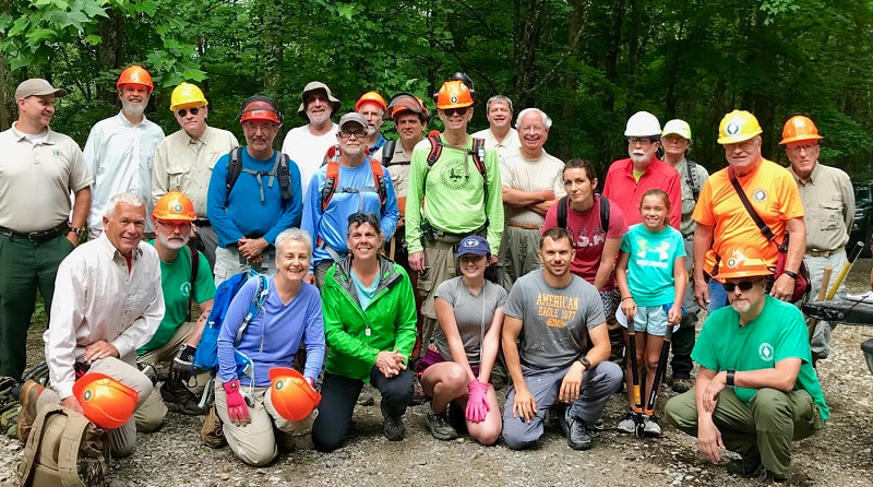
Sycamore Creek BMTA trail maintenance; Saturday June 23, 2018
The Benton MacKaye Trail Association usually does trail maintenance twice a month; one time a TN team will work in TN, and the other time a GA team will work in GA. This time the two combined forces to work on a section in the Tellico Plains area that had been closed for months by circumstances beyond their control. So, some 26 people gathered, were divided into teams, assigned certain areas, given the necessary tools, and off we went on a 6-mile downhill trail clearing mission. There were 2 chainsaw teams; the other 4 teams had string trimmers, brush trimmers with blades, loppers, and hand saws. Perhaps the high point of the day came early on when we cleared a nice cozy little campsite and the spur trail leading to it; had it not been marked by a scout team, you wouldn’t even had known the spur trail was there! We made a tremendous amount of progress considering we were attempting to clear 6 miles, but time eventually ran out on us. And at about that same time we were drenched in a torrential downpour with some rather frightful high winds for a few minutes. We finished our day by trekking out to the lower end of the trail in a drizzling rain. There we could at least refuel ourselves thanks to two wonderful ladies who prepared burgers and hot dogs and all the fixings. Under the heading of culinary discoveries, adding raindrops to the other condiments on your burger really isn’t all that bad! On a day when a couple and their two young girls came all the way from south of Atlanta (inspiring on multiple levels!!!), the CHC was well represented by Ralph Van Pelt, JD Dickinson, Bill Kinnaman, Boe Rudder, and John Rowland reporting. |
|
|
Hyatt Ridge, Enloe Creek, Hughes Ridge, Chasteen Creek; Saturday June 23, 2018
The weather had been of concern all week leading up to the 23rd. How blessed and amazed were these hikers as the clouds parted leaving patches of blue, a cool temperature prevailed for this time of year, and sometimes gentle breezes. When you go to the Smokies your senses are challenged: sound (rushing water and today a startled grouse), sight (views from mountain tops and this day fresh ferns spreading throughout the forest), smell (the fragrance of damp earth and evergreen trees) and touch as the stinging nettles reached out to sting bare legs! Then there is "good sense" as we wondered if we had any when striking off steeply uphill for the first 1.9 miles, then soon steeply again for a 2.3 mile section. Turns out the climbing ultimately ended in an incredibly beautiful gap on Hughes Ridge. Each hiker "pulled up" a log or rock for an extended lunch break. The reward for the uphill trek was the downturn on Chasteen Creek and descent most of the way back to Smokemont. Flowers in bloom were fire pink, umbrella leaf, spider wort, squaw root, sweet cicely, a few unidentified in the moment flowers, rhododendron, and soooo many ferns as yet untouched by the summer heat. There were beautiful waterfalls and cascades on Raven Fork Creek, Enloe Creek and Chasteen Creek - one of these always present alongside. Feeling good and on to supper at NOC were: Monty Simmons, Betsy Parson, Che Carico reporting and Wayne Chambers leading. |
|
Castle Rock Wednesday; June 20, 2018
When you hike with Bob Butters you are likely hiking a new trail! Bob builds, writes about, and leads hikes on new trails as they are opened especially in the South Cumberland Park system. Castle Rock is a familiar destination for climbers. These hikers today had never been to the trail on the top of the mountain above Jasper that leads to a beautiful bluff view of the valley. 30,000 acres on the mountain top are owned and protected by the TRGT. This was a perfect hike for a hot and humid day. It was nice to be looking down from the intriguing promontory that is visible as you look up to the mountain from Jasper. Bob has a theory about a space ship buried up there and will welcome any help finding the right place to dig to access the space ship's door! It was a short trail but there were blackberries to be picked along the way. Joyful for another experience on a new trail were: Larry Parks, Linda Keown, Renee Grace, Bill Kinnaman, Ellie Carico, Emery Carico, Susan Garrett, Sue Christensen, Gail Stokes, Shirley Wright, Barbara Miller, Wayne Chambers, Teresa Dean, Mac Dean, Trish Appleton, Betsy Parson, Debbie Lambert, Patti Giles, Che Carico reporting and Bob Butters leading. |
|
Little Hump/Big Hump, Roan Highlands; Friday June 15, 2018
It was mid-June, so dreams of Little Hump/Big Hump were dancing in the heads of those who had been there before and have become addicted to the area. And as usual, we enticed a few first-timers to join us. We assembled in Johnson City Thursday evening, and most of us enjoyed dinner at what has become a favorite of ours, Cootie Brown’s; there Vicki Chambers provided the highlight of the evening by momentarily rendering Wayne speechless – a moment to remember! On Friday an out-and-back hike from the Red Barn shelter was the original plan, but in order to accommodate everyone we added an option for a longer through hike from Carver Gap to 19E, then at the last minute put in a third option to go from the Red Barn to 19E. This necessitated a fairly lengthy and complex car shuttle, but we pulled it off without a hitch. The weather was great and stayed that way all day, unusual for this trip. The rhododendrons at Carver’s Gap (and at Rhododendron Gardens the day before) were not yet up to peak, but lovely none the less. And they were complimented by some nice flame azaleas around Carver’s Gap, plus we saw several of the rare Gray’s Lilies around Big Hump. The long hikers enjoyed watching a deer up close and personal on their lunch break. We all enjoyed the majestic sight of Big Hump as we prepared to climb it, and we all were rewarded with magnificent views once we reached the top. Bonnie Smith, Cathy Love, Ken Smith, Rick Glisson, and Tim Chomyn, all first-timers, did the long hike. First-timer Betsy Parson and veteran Wayne Chambers went from Red Barn to 19E. The torch is being passed to Barbara McCollum as the leader of these expeditions; she and I did the out-and-back from the Red Barn. And I’m still grateful to Susan Faidley, who introduced me to this wonderland back in 2000-aught… - never mind!; John Rowland reporting. |
|
|
Benton MacKaye Project; Saturday June 2, 2018
Five brave souls completed the Benton MacKaye Trail’s “Heart of Darkness” on Saturday, June 2, 2018: Bonnie Smith, Cathy Love, Barbara McCollum, Charlie Breeding, and Boe Rudder. This section in the Club’s Benton MacKaye series began at Sandy Gap and ended at the Pheasant Fields Fish Hatchery on Tellico River Road (14.5 miles). It is called “Heart of Darkness” due to its remoteness and relative lack of maintenance. The group encountered close to 5,700 feet of elevation change, waist-deep briars and undergrowth, blowdowns, rainstorms, numerous water crossings, and a 2 hour shuttle set-up. The last 2 miles of the trail is the section maintained by club member, Ralph Van Pelt, who used to work it with Betty Petty. The group found this section to be in great shape with freshly-painted trail blazes, and it was the most enjoyable part of the day. Terri Holcomb and Helen Owens arrived Saturday night to share the car camp at McNabb Creek Group campground and enjoyed hiking the Bald River Falls trail on Sunday. Reported by Cathy Love. |
|
Stringer’s Ridge; Saturday May 26, 2018
The unofficial start of summer (Memorial Day weekend) was heralded by our group of hikers at Stringer’s Ridge Park in Chattanooga on May 26. The park, a 92-acre urban wilderness, is enjoyed by hikers, trail runners, and bikers alike, and it indeed seemed “away from it all” on this quiet Saturday. Moderate temperature and overcast skies were appreciated as we wound around and up and down the Blue Loop consisting of the Hill City, Double-J, and Gig City trails. We also took a quick trip up the Cherokee Trail to look out over the city. There was a sampling of wildflowers along the way, and we were surprised and delighted by roses abundantly blooming near the foundation of an old derelict building on the property. Our group consisted of Boe Rudder, Susan Basch, Tim Chomyn and his guests John, Paula, and Eden Muina, Dolores Ladd, Joe Teringer, and new member Leslie Vaccaro and her daughter Alexandra, with Edie Behringer leading. |
Chilhowee Mountain; Wednesday May 23, 2018
Chilhowee is an amazing natural area with a beach and swimming lake, bathrooms with running water, grills and picnic tables, campsites, and well marked hiking trails tracing its beauty. This complex of trails has become a favorite of Chattanooga hikers as the trail system offers varying sequences all of which cannot possibly be covered in one day. The choice for this day was the Benton Falls trail for a short distance to the first Naked Widow trail head, a challenging uphill trek to a major field and a right turn through the grasses to pick up the footpath and continue on the Slick Rock Hancock Loop, on around to a left turn onto the Slick Rock Laurel Loop, left onto a short section of the Clemmer Trail, finally arriving at the Benton Falls trail. This area had experienced a major burn quite a few years ago - either controlled or naturally started - which left it quite bare and blackened. Today there were only signs of healing as the rhododendrons, ferns, and magnificent mountain laurel were fully restored along the foot path that now narrowly cuts through the vegetation. We did see one flame azalea. Tim commented the water in the falls was the most he has ever seen in this waterfall! Lunch was enjoyed beside the rushing waters that then spilled over the bluff. Beating the rain and safely home were: Tim Chomyn, Sue Christensen, Cecile Shenouda, Bill Kinnaman, Patti Giles, Larry Parks, Charlie Breeding, Linda Keown, Wendy Gunn, Renee Grace, Che Carico reporting, Mac and Teresa Dean leading.
Chilhowee is an amazing natural area with a beach and swimming lake, bathrooms with running water, grills and picnic tables, campsites, and well marked hiking trails tracing its beauty. This complex of trails has become a favorite of Chattanooga hikers as the trail system offers varying sequences all of which cannot possibly be covered in one day. The choice for this day was the Benton Falls trail for a short distance to the first Naked Widow trail head, a challenging uphill trek to a major field and a right turn through the grasses to pick up the footpath and continue on the Slick Rock Hancock Loop, on around to a left turn onto the Slick Rock Laurel Loop, left onto a short section of the Clemmer Trail, finally arriving at the Benton Falls trail. This area had experienced a major burn quite a few years ago - either controlled or naturally started - which left it quite bare and blackened. Today there were only signs of healing as the rhododendrons, ferns, and magnificent mountain laurel were fully restored along the foot path that now narrowly cuts through the vegetation. We did see one flame azalea. Tim commented the water in the falls was the most he has ever seen in this waterfall! Lunch was enjoyed beside the rushing waters that then spilled over the bluff. Beating the rain and safely home were: Tim Chomyn, Sue Christensen, Cecile Shenouda, Bill Kinnaman, Patti Giles, Larry Parks, Charlie Breeding, Linda Keown, Wendy Gunn, Renee Grace, Che Carico reporting, Mac and Teresa Dean leading.
Savage Gulf Day Loop; Wednesday May 16, 2018
It was a good day for this 5 mile hike as not too far to drive. Thunderstorms were in the forecast for the afternoon. The featured flower search for today was the abundant and beautiful Mountain Laurel. We were not disappointed! An unexpected surprise was the patch of Lady Slippers off to the left soon after beginning the hike. Ferns were splendid and the waterfall roared with lots of water filling a large pool below the falls. Giant rocks surrounding the pool made for a good perch to enjoy the sounds of the falling water and feel the coolness of the surrounding woods. Off for afternoon errands or lunch at our favorite Cookie Jar were: Wayne Chambers, Bill Kinnaman, Bob Rahn, Cecile Shenouda, Charlie Breeding, Larry Parks, Renee Grace, Sue Christensen, Suzanne Dorough, Wanda McCarter, Joy Ward, Joe Teringer, Che Carico reporting and Debbie Lambert leading.
It was a good day for this 5 mile hike as not too far to drive. Thunderstorms were in the forecast for the afternoon. The featured flower search for today was the abundant and beautiful Mountain Laurel. We were not disappointed! An unexpected surprise was the patch of Lady Slippers off to the left soon after beginning the hike. Ferns were splendid and the waterfall roared with lots of water filling a large pool below the falls. Giant rocks surrounding the pool made for a good perch to enjoy the sounds of the falling water and feel the coolness of the surrounding woods. Off for afternoon errands or lunch at our favorite Cookie Jar were: Wayne Chambers, Bill Kinnaman, Bob Rahn, Cecile Shenouda, Charlie Breeding, Larry Parks, Renee Grace, Sue Christensen, Suzanne Dorough, Wanda McCarter, Joy Ward, Joe Teringer, Che Carico reporting and Debbie Lambert leading.
|
Unicoi Mtn, Coker Creek Falls; Wednesday May 2, 2018
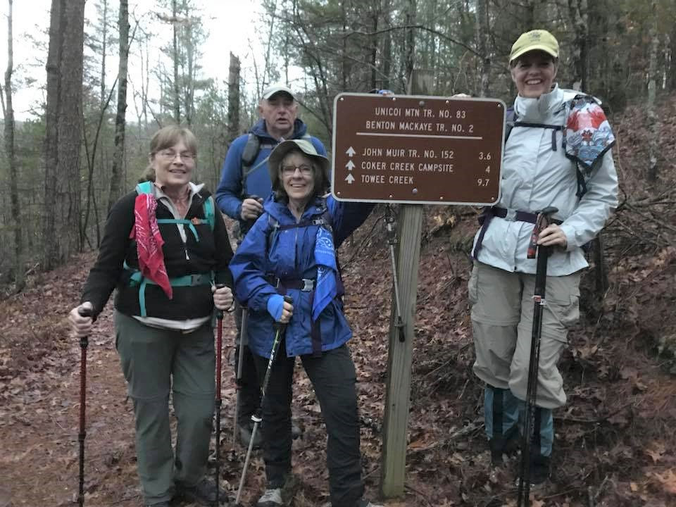
It had been 10 years since I followed Gary Smith on this route. He took the lead again on this moderate to strenuous path up and along a ridge, through pine forest and hardwood, and past another wonderland of wildflowers. We even saw a pink lady slipper and a "field" of blooming stone crop spreading as far as we could see as we approached Coker Creek. Jennifer nearly missed stepping on a very large copperhead (yes Wayne we have a picture), and a long black snake awaited our arrival near the bridge over to the campsites and lunch spot beside the rushing water. After lunch we started uphill and had lots of this for the next 3 miles to the falls destination and the trail head where we had left cars. This was our first really hot hike this year and most could have used more water. Some, however, took the time at the falls to shed boots and soak feet. All made it safely out and home later than after most hikes. It is a long drive to the Hwy 68 trail head, then placing cars on the other end made for an 11am beginning to this 7.2 mile hike. A beautiful trail and another adventure enjoyed by: Kathy Seymour, Larry Parks, Charlie Breeding, Renee Grace, Jennifer Yarbrough. Patti Giles, Suzanne Dorough, Bill Kinnaman, Barbara McCollum, Mary Ann Langevin , Tim Chomyn, Betsy Parson, Susan Garrett, Bob Rahn, Stormy McGauley, Wanda McCarter, Bill LaRoque, Bill Needham, Che Carico reporting, Gary Smith leading. |
Denny’s Cove; Wednesday April 25, 2018
Chattanooga hikers have been anticipating the opening of the Denny's Cove trail in the South Cumberland State Park. On this day we were led there by valued trail advocate, journalist, and naturalist Bob Butters. The road into the trail head parking area is on the mountain above Jasper and one gravel road before you get to the road into Foster Falls. There is a kiosk with a map to this small but beautiful wilderness spot. Plan for a 3 mile hike that will be rather slow as rocks make careful foot placement a must. Rugged as it is, the waterfall at the end is magnificent! And it seems the Scarlet Tanagers love this area as we saw many of them. There are ferns, flowers, and directional signs to the climbing walls. Southeastern climbers (including John Dorough) contributed to the building of this trail making it hiker friendly and giving access to extreme climbing walls. On the way in (or out) there is a fork in the trail that leads a short distance up onto a bluff where you can look off toward Fiery Gizzard. Tired but happy to have the privilege for hiking this trail were: Patti Giles, Mac Dean, Teresa Dean, Susan Garrett, Renee Grace, Jenny Hopkins, Edie Behringer, Bill Kinnaman, Larry Parks, Cecile Shenouda, Tom Carter, Jennifer Yarbrough, Debbie Lambert, Joe Teringer, Susan Basch, Stormy McGauley, Charlie Breeding, Boe Rudder, Joy Ward, Che Carico reporting, Bob Butters leading.
Chattanooga hikers have been anticipating the opening of the Denny's Cove trail in the South Cumberland State Park. On this day we were led there by valued trail advocate, journalist, and naturalist Bob Butters. The road into the trail head parking area is on the mountain above Jasper and one gravel road before you get to the road into Foster Falls. There is a kiosk with a map to this small but beautiful wilderness spot. Plan for a 3 mile hike that will be rather slow as rocks make careful foot placement a must. Rugged as it is, the waterfall at the end is magnificent! And it seems the Scarlet Tanagers love this area as we saw many of them. There are ferns, flowers, and directional signs to the climbing walls. Southeastern climbers (including John Dorough) contributed to the building of this trail making it hiker friendly and giving access to extreme climbing walls. On the way in (or out) there is a fork in the trail that leads a short distance up onto a bluff where you can look off toward Fiery Gizzard. Tired but happy to have the privilege for hiking this trail were: Patti Giles, Mac Dean, Teresa Dean, Susan Garrett, Renee Grace, Jenny Hopkins, Edie Behringer, Bill Kinnaman, Larry Parks, Cecile Shenouda, Tom Carter, Jennifer Yarbrough, Debbie Lambert, Joe Teringer, Susan Basch, Stormy McGauley, Charlie Breeding, Boe Rudder, Joy Ward, Che Carico reporting, Bob Butters leading.
|
Big Creek, Camel Gap to AT, to Low Gap, down to Cosby campground; Saturday April 21, 2018
After rescheduling this hike 3 times due to weather, Chattanooga hikers had a day fit for this 15.8-mile sequence of trails in the Smokies put together by Wayne Chambers. The sky was blue with a low temp that soon began to warm up to 67 degrees by midday at the Camel Gap/AT junction. The wildflowers were the best we had ever seen! There were not just isolated flowers along the way. There were "fields" of flowers stretching into the woods as far as the eye could see! Sometimes the footpath cut through the mounds of White Fringed Phacelia as if through a snow bank. In abundance was Phlox, Trout Lily, Bishop's Cap, Wild Geranium, Star Chickweed, Anemone, Spring Beauty, Bluets, Stone Crop in bloom, Blue Bead Lily, White Trillium, Sweet WhiteTrillium, Dutchman's Britches, Dwarf Iris, just to name a few! Even a Showy Orchis sighting! The route we took started off with a gentle elevation gain for about 7 miles before Camel Gap took a steeper slant pulling uphill to its junction with the AT. Then another very steep half mile up before the trail began to descend. Once turning onto Low Gap, the trail became even steeper downhill. Rushing waters and more beautiful flowers were ever present. There was an alternate sequence: Low Gap out of Cosby up to AT, down to Big Creek, reunite with other hikers at Camel Gap, then on to finish with them; Betsy, Bonnie, and Rick took that route to expedite the car shuttle. The shuttle back to get cars left at Big Creek is long but at Big Creek you are right beside US 40 and the route back to Newport. Ruby Tuesday served our dinner before the drive back home (dinner Friday night was at Cracker Barrel). Comparing notes about the day and naming the flowers seen were: Bill Needham, Betsy Parson, Bonnie Smith, Rick Glisson, Joyce Campbell, Carolyn Brannon, Boe Rudder, John Rowland, Monty Simmons, Che Carico reporting, and Ken Smith leading. |
|
|
Estelle Mine trail to Crockford-Pigeon WMA; Wednesday April 18, 2018
The trek began at the Estelle Mine trail head on highway 193 after placing cars at the other end in the Pocket parking lot. The Pocket is at the end of Pocket Road after turning off of Hogjowl Road. Each time I go the trail blazes are somewhat better, but you have to look for these directional arrows placed far apart. Enter the trail near the end of the drive around oval in the big field. Strike off up the hill eventually coming to a gravel road; turn right and stay on this watching for the small triangular signs with dark brown arrows. At a somewhat confusing junction keep in the middle of the road and continue right and downhill. Eventually, after the road flattens out, you will find a sign on the edge of the woods pointing left and onto a footpath. The official trail blaze color for the trail is orange. Fairly easy to now follow this footpath all the way to the Pocket. There are 4 tunnels along the way - quite passable if you duck your head upon entering and with a flashlight or headlamp to watch for snakes and uneven rocks! The Shirley Miller wildflower trail features a boardwalk and flowers of all varieties. You can continue on up to the waterfall from the end of the boardwalk, in and out hike, then return and complete the boardwalk loop. Benches provide comfortable rest stops along a stream - a good lunch spot, too. Made calm by the serenity of this area were: Suzanne Dorough, Wanda McCarter, Debbie Lambert, Stormy McGauley, Angela Evans, Teresa Dean, Mac Dean, Luke Spiekermann, Larry Parks, Boe Rudder, Bill Kinnaman,Tom Carter, Rebecca Beckman, Charlie Breeding, Barbara Miller, Cecile Shenouda, Jenny Hopkins, Betsy Parson, Renee Grace, Che Carico reporting and Susan Garrett leading. |
|
Coker Creek Falls; Saturday April 14, 2018
The hike required a shuttle from BMT Hwy 68 trailhead to Coker Creek Falls trailhead parking lot. We started the hike at Hwy 68 BMT trailhead. This section is 3.8 miles of ridge top and downhill hiking. The trail is in good condition and had more wildflowers than I expected. At the intersection with the John Muir trail we hiked 0.3 miles across the Coker Creek bridge. We then hiked north on Coker Creek Falls trail 3.0 miles to the parking lot. There were a few blowdowns we had to navigate but not too difficult. This trail was absolutely covered in wildflowers. I have never seen so many nodding trilliums in one area. The Bloodroot had already bloomed but the Stonecrop, Dwarf Iris, an occasional spice bush and Wood Anemone were all at peak. There was Solomon’s Seal, Chickweed and Jack-in-the-Pulpit along the trail. A lot of Halberd-leaved Violets, May-apples, Fire Pinks and other unidentifiable plants. Also saw the purple & yellow tubular honeysuckle but don’t know its name. We needed someone who knows wildflowers. It was a great day for a hike. Temperature was mild, and it was partly sunny to sunny for most of the hike. The rains did not start until we were headed back. Participants were: Steve Barnes, Ronnie Williams, Marc Bernatti, and Boe Rudder, leading. |
Shakerag Hollow; Wednesday April 11, 2018
This section of the Perimeter Trail is a must in the month of April as it is famous for its variety of flowers and the site of weekly tours led by Monteagle naturalists. About a 50 minute ride from Brown's Ferry, the trail head and parking is just before the stone gates to Sewanee. Our plan was to hike down into the gulch and climb out to Greensview, then hike the bluff back making approximately a 4.3 mile hike. At the junction to Piney Point I described that spur and noted it had been many years since I had hiked to the Point. None of those out today had. It was Wanda who said "let's do it!" and everyone else agreed. This added 1.8 miles to our original plan but was beautiful and well worth it not so much for flowers but for the view, big cave like rocks and clear water streams. The Hollow was bloomed out with White Trillium, Larkspur, Phacelia, a few Dutchmen's Britches still fresh, one reported Jack, Celandine Poppies galore, Star Chickweed, and Anemone just to name a few. Some carried lunches, some hiked through and headed home, and some headed to our favorite Papa Ron's. Buoyed by the beauty of the day were: Bill Kinnaman, Boe Rudder, Cecile Shenouda. Charlie Breeding, Edith Behringer, Larry Parks, Luke Spiekermann, Nancy Hoover, Renee Grace, Suzanne Dorough, Wanda McCarter, Barbara Miller, John Dever, and Che Carico, reporting.
This section of the Perimeter Trail is a must in the month of April as it is famous for its variety of flowers and the site of weekly tours led by Monteagle naturalists. About a 50 minute ride from Brown's Ferry, the trail head and parking is just before the stone gates to Sewanee. Our plan was to hike down into the gulch and climb out to Greensview, then hike the bluff back making approximately a 4.3 mile hike. At the junction to Piney Point I described that spur and noted it had been many years since I had hiked to the Point. None of those out today had. It was Wanda who said "let's do it!" and everyone else agreed. This added 1.8 miles to our original plan but was beautiful and well worth it not so much for flowers but for the view, big cave like rocks and clear water streams. The Hollow was bloomed out with White Trillium, Larkspur, Phacelia, a few Dutchmen's Britches still fresh, one reported Jack, Celandine Poppies galore, Star Chickweed, and Anemone just to name a few. Some carried lunches, some hiked through and headed home, and some headed to our favorite Papa Ron's. Buoyed by the beauty of the day were: Bill Kinnaman, Boe Rudder, Cecile Shenouda. Charlie Breeding, Edith Behringer, Larry Parks, Luke Spiekermann, Nancy Hoover, Renee Grace, Suzanne Dorough, Wanda McCarter, Barbara Miller, John Dever, and Che Carico, reporting.
Laurel-Snow/Buzzard Point Pocket Wilderness; Wednesday April 4, 2018
Great wildflowers on this trail! However, with the bridge still out over Laurel Creek, only the bravest should try to rock hop or scoot across the fallen trees at the site of the missing bridge. Today's hikers made choices accordingly. Some turned around at the bridge site (soon to be replaced) having seen some wildflowers and others went on across and took the left fork onto the Snow Falls trail. This section was covered with white Trillium and lots of Phlox. Arriving at the top of the mountain a left turn on the service road takes you to Buzzard Point (our stop for lunch) and a right turn on the service road takes you to Snow Falls. As the Cumberland Trail nears completion through this area, the trails will be marked differently and the trail we are most familiar with will be considered a spur trail. There are strips of orange tape marking the new CT connector that has been roughed out. This trail is a good one for differing goals for the day - in and out allows selecting your choice of distance and the rushing water in Laurel and Richland Creeks is a blessing for all. Enjoying the sunshine then off for home, Screen Door, or Monkey Town Brewing Company were: Betsy Parson, Bill Kinnaman, Boe Rudder, Susan Garrett, Suzanne Dorough, Tom Long, Wanda McCarter, Wayne Chambers, Larry Parks Sr., Larry Parks Jr., Susan Parks, Edith Behringer, Kathy Seymour, Cecile Shenouda, Renee Grace, Jean Dickinson, Rhonda Parks, Debbie Lambert leading and Che Carico reporting.
Great wildflowers on this trail! However, with the bridge still out over Laurel Creek, only the bravest should try to rock hop or scoot across the fallen trees at the site of the missing bridge. Today's hikers made choices accordingly. Some turned around at the bridge site (soon to be replaced) having seen some wildflowers and others went on across and took the left fork onto the Snow Falls trail. This section was covered with white Trillium and lots of Phlox. Arriving at the top of the mountain a left turn on the service road takes you to Buzzard Point (our stop for lunch) and a right turn on the service road takes you to Snow Falls. As the Cumberland Trail nears completion through this area, the trails will be marked differently and the trail we are most familiar with will be considered a spur trail. There are strips of orange tape marking the new CT connector that has been roughed out. This trail is a good one for differing goals for the day - in and out allows selecting your choice of distance and the rushing water in Laurel and Richland Creeks is a blessing for all. Enjoying the sunshine then off for home, Screen Door, or Monkey Town Brewing Company were: Betsy Parson, Bill Kinnaman, Boe Rudder, Susan Garrett, Suzanne Dorough, Tom Long, Wanda McCarter, Wayne Chambers, Larry Parks Sr., Larry Parks Jr., Susan Parks, Edith Behringer, Kathy Seymour, Cecile Shenouda, Renee Grace, Jean Dickinson, Rhonda Parks, Debbie Lambert leading and Che Carico reporting.
|
Walls of Jericho; Wednesday March 28, 2018
This wonderful trail system was private land and long closed to public hiking. When it was opened the Chattanooga Hiking Club just had to check it out. Due to John Rowland's leadership, one time our annual trek took another fork in the trail and instead of going down toward Hurricane Creek and then the falls via the Alabama side trail, we tried the Tennessee side and hit it just right to find the most amazing bloom of Virginia Bluebells we had ever encountered. The Tennessee trail brings you through the forest and the "as far as the eye can see" blooming Bluebells and Dutchman's Britches as the trail then intersects with the Alabama trail, becomes one, and continues on to Hurricane Creek on the way to the Walls. The Tennessee trail is rougher underfoot so we have learned to go down and back on the Alabama trail diverting a very short distance at the intersection to get the full view of the flowers. It seems this has become an annual excursion in the latter part of March. Lots of other flowers to be seen: Fire Pink, Twin Leaf, Trout Lily, Blood Root, Star Chickweed, Phlox, Jack in the Pulpit, to name a few. Many who have hiked this trail have said never again as the steady uphill 3 miles comes at the end. Found many of them back out there on this day - challenged to see the beautiful flowers through the eyes of the newcomers. Be wary of hiking to the Walls of Jericho with rain in the forecast as Turkey Creek (which you must cross) easily floods and you can get trapped on the "wrong" side. Challenged and rewarded: Jenny Hopkins, Rachel Bryant, Teresa Dean, Mac Dean, Bill Kinnaman, Jean Dickinson, Renee Grace, Joy Ward, Tom Long, Larry Park, Patti Giles, Charlie Breeding, Debbie Lambert, Kathy Seymour, Lynn McGee, Renee Grace, Susan Garrett, Suzanne Dorough, Wanda McCarter, Wayne Chambers, Che Carico reporting, John Rowland leading. |
Moonshine Trails; Wednesday March 21, 2018
It was a blustery 32 degrees with snow flurries when we gathered at the core property of Lula Lake Land Trust. The land manager, Patrick Kelly, gave us a brief history of Lula Lake and the recent completion of the Moonshine Trails which is part of the long connector trail between Chattanooga and Cloudland Canyon State Park. We walked across the road to hit the trail head (located directly across from the entrance gate, but no parking is allowed along Highway 157). We meandered along a 5.0 mile loop on trails named Firewater and Bathtub Gin, with several creek crossings (mostly via foot bridges) and passing swaths of mountain laurel, hemlocks, and large boulders. Arriving back at the core property, everyone agreed it was still too cold and windy to add the hike to view Lula Lake and Lula Falls for lunch. Enjoying this new area: Bill Kinnaman, Boe Rudder, Larry Parks, Linda Keown, Mac Dean, Patti Giles, Renee Grace, Richard Park, Susan Garrett, Teresa Dean, Tom Carter, Monty Simmons, Rebecca Beckham, Jenny Hopkins reporting, and Jenny Hopkins and Susan Basch leading.
It was a blustery 32 degrees with snow flurries when we gathered at the core property of Lula Lake Land Trust. The land manager, Patrick Kelly, gave us a brief history of Lula Lake and the recent completion of the Moonshine Trails which is part of the long connector trail between Chattanooga and Cloudland Canyon State Park. We walked across the road to hit the trail head (located directly across from the entrance gate, but no parking is allowed along Highway 157). We meandered along a 5.0 mile loop on trails named Firewater and Bathtub Gin, with several creek crossings (mostly via foot bridges) and passing swaths of mountain laurel, hemlocks, and large boulders. Arriving back at the core property, everyone agreed it was still too cold and windy to add the hike to view Lula Lake and Lula Falls for lunch. Enjoying this new area: Bill Kinnaman, Boe Rudder, Larry Parks, Linda Keown, Mac Dean, Patti Giles, Renee Grace, Richard Park, Susan Garrett, Teresa Dean, Tom Carter, Monty Simmons, Rebecca Beckham, Jenny Hopkins reporting, and Jenny Hopkins and Susan Basch leading.
|
Waterfall Tour led by Don Deakins; Wednesday March 14, 2018
Hikers met Don Deakins at the Sequoyah Crossing Shopping Center then headed off toward Spring City on a very blustery day. The sun was shining, however, so spirits were high. The first trail was to the Stinging Fork Creek and falls. This trail is @2 miles long but rather difficult in places due to big rocks and a final steep descent into the gorge and falls. Well worth it - just take your time! Then on up the highway to Piney Falls State Natural Area. Here Don led us to three waterfalls, each one taller and more powerful than the last. Again, the terrain is rough, but the area is incredibly beautiful. The distance here also @2 miles. Turns out it was warm enough, in spots where the sun shone through on rock faces, to eat packed lunches. Safely home and proud of Tennessee's linear state park, the Cumberland Trail, were: Charlie Breeding, Edith Behringer, Wayne Chambers, Joy Ward, Susan Garrett, Bill Kinnaman, Bob Rahn, Renee Grace, Barry Ligon, Carol Deakins, John Rowland, Mac Dean, Teresa Dean, Susan Basch, Tim Chomyn, Che Carico reporting, and Don Deakins leading. |
Roaring Creek to McGill Creek; Wednesday March 7, 2018
Nine hikers were met at the trail head by two, cute local dogs with (“let’s take these folks to McGill Creek for a free lunch“) on their mind and that’s what they did. The hike out was under cloudy skies with a brisk wind. Good views off to the south to see the forest and the clear-cuts. Saw tire tracks where they brought the bridge and abutment materials down a jeep road that we had brushed out in the past for that purpose. Lunched at the new bridge site. The deck wasn’t installed yet, so we couldn’t cross but knew from previous hike from Leggett Road to the bridge that the trail was already complete and waiting to be hiked. This section of the Cumberland Trail has some of the most beautiful trail construction. Starting back, one of the hikers was in distress and needed help. Debbie Lambert led the group back to the cars and returned to be a nurse to the hiker, meanwhile, cars went to a road crossing on the trail to pick up the hiker. Everyone was accounted for and thankful that it all worked out. Enjoying the event were Mary Ann Langevin, Edith Behringer, Deloris Ladd, Carla Shunck, Debbie Lambert, Bob Rahn, Boe Rudder, Tom Long, and Bill Kinnaman reporting.
Nine hikers were met at the trail head by two, cute local dogs with (“let’s take these folks to McGill Creek for a free lunch“) on their mind and that’s what they did. The hike out was under cloudy skies with a brisk wind. Good views off to the south to see the forest and the clear-cuts. Saw tire tracks where they brought the bridge and abutment materials down a jeep road that we had brushed out in the past for that purpose. Lunched at the new bridge site. The deck wasn’t installed yet, so we couldn’t cross but knew from previous hike from Leggett Road to the bridge that the trail was already complete and waiting to be hiked. This section of the Cumberland Trail has some of the most beautiful trail construction. Starting back, one of the hikers was in distress and needed help. Debbie Lambert led the group back to the cars and returned to be a nurse to the hiker, meanwhile, cars went to a road crossing on the trail to pick up the hiker. Everyone was accounted for and thankful that it all worked out. Enjoying the event were Mary Ann Langevin, Edith Behringer, Deloris Ladd, Carla Shunck, Debbie Lambert, Bob Rahn, Boe Rudder, Tom Long, and Bill Kinnaman reporting.
|
Len Foote Hike Inn; Wednesday-Thursday March 7-8, 2018
This trip to Amicalola State Park and the hike to the Len Foote Lodge has become so popular that this year the lodge was booked and filled by Chattanooga Hiking Club members. It has grown each year to this year's max. Wayne Chambers discovered several years ago that there is often a reduced rate during the months of January and February. Allowed this discount the first week of March, 38 hikers headed up the trail from the ranger station. Hot chocolate, coffee, cookies, and clean sheets greeted each person upon arrival. You must make your own bunk bed, but this is a small price to pay for the excellent food, wood burning stove fires, shelves of library books, puzzles, towels, indoor plumbing and hot showers at this mountain retreat. Everyone gathered for dinner at 6, listened after the meal to a wonderful talk about owl identification, then headed to the common room for more conversation, guitar and banjo playing, and rousing singing. It was hard to prepare for lights out at 10 with the strains of Kansas City, Lucille, and Mercedes Benz running around in our heads! Breakfast of eggs, sausage, and grits also included biscuits and gravy. Fortified with such a meal and a hospitable send off by the staff, the descent of the mountain was made either by the Inn Trail, or the Approach Trail. A quick stop in Ellijay at Darvin Poole's barbeque restaurant, then on home with great memories. Thanks Wayne for organizing another memorable trek to the Len Foote Lodge! |
|
Virgin Falls; Saturday March 3, 2018
It was a picture-perfect day for a hike to one of the most beautiful waterfalls in the state of Tennessee. With all the recent rain, the abundance of water heightened our anticipation as well as raised concern about a cable creek crossing about a mile into the trail. An alternate trail to bypass the creek crossing was discovered which also took us to an outstanding overlook, Martha’s Pretty Point. After enjoying the vista, we climbed our way down into the gorge to connect with the main trail to Virgin Falls and found wildflowers in bloom - hepatica, trout lily, and budding trillium. After a stop and a few photos at Big Laurel Falls, it was on to the highlight of the day - Virgin Falls, which was spectacular. The falls were roaring and water spewed over ledges. A misty fine spray from the falls and a couple of rainbows added to our enjoyment. Lunch included a view of the falls and all Virgin Falls newbies hiked the spur trail to the top of the falls to see the cave where it actually begins. The hike out was arduous, but the cable creek crossing was easier than expected as the water levels were down by the afternoon. A quick drive to Welch Point ended the day’s hike with a stunning view of the gorge and the overflowing Caney Fork River. A much-anticipated stop at The Cookie Jar in Dunlap provided the necessary calorie replenishment along with some tasty, decadent desserts coconut crème pie, carrot cake, and chocolate cake! Many thanks to John Rowland for his pre-hike scouting and communication with the park ranger to ensure a successful day. Enjoying an almost 11-mile day on the trail were: Anne Moore, Carolyn Brannon, Janet Hale, John Rowland, Joyce Campbell, Lora McBride, Rick Glisson, Ron Williams, Tim Chomyn, Shelly Claiborne, and Barbara McCollum, reporting. |
|
Fiery Gizzard; Saturday February 24, 2018
Most of the week we were afraid we were going to get seriously wet if we did this hike. But all we got was a little spritzing, hardly enough to justify a rain jacket, especially since the unusually mild temp and the humidity made for some warm hiking. But on the down side, we saw absolutely zero icicles, which I had hoped for when the hike was scheduled. But on the up side, we saw more water than I can recall ever seeing in the creeks, cascades, and Sycamore Falls. And another up side for most of us was lunch at Papa Ron’s in Monteagle – always a treat. Enjoying a morning in lovely water-splashed Fiery Gizzard were Kathy Seymour, Joy Ward, Betsy Parson, Tim Chomyn, Shelly Claiborne, Edith Behringer, and three welcome newcomers – Linda Williams, Charlene Townley, and Ronnie Williams. John Rowland reporting.
Most of the week we were afraid we were going to get seriously wet if we did this hike. But all we got was a little spritzing, hardly enough to justify a rain jacket, especially since the unusually mild temp and the humidity made for some warm hiking. But on the down side, we saw absolutely zero icicles, which I had hoped for when the hike was scheduled. But on the up side, we saw more water than I can recall ever seeing in the creeks, cascades, and Sycamore Falls. And another up side for most of us was lunch at Papa Ron’s in Monteagle – always a treat. Enjoying a morning in lovely water-splashed Fiery Gizzard were Kathy Seymour, Joy Ward, Betsy Parson, Tim Chomyn, Shelly Claiborne, Edith Behringer, and three welcome newcomers – Linda Williams, Charlene Townley, and Ronnie Williams. John Rowland reporting.
|
Benton MacKaye Trail; Friday-Sunday February 9-11, 2018
Ten hikers were not deterred by the rainy forecast for the first installment of the club’s Benton MacKaye Trail project. We met up in Tellico Plains on Friday evening for dinner at the Tellicafe and an overnight stay at the very nice Lodge at Tellico. The lodge’s Community Room provided a nice spot for after-dinner games and a “snack swap” from a smorgasbord of snacks brought by each hiker. Saturday’s weather forecast had slightly improved overnight, but still called for a 100 percent chance of rain starting around 2:00 p.m. Trailheads had been scouted and a key swap was determined to be the best option for Saturday’s 14-mile section from Reliance to Highway 68. Hiking northbound from the Childers Creek trailhead on the Hiwassee River also known as the John Muir Trail No. 152 were Tim Chomyn, Cathy Love, Terri Holcomb, Helen Owens, and Bonnie Smith. Hiking southbound from Highway 68 were Carolyn Brannon, Joyce Campbell, Betsy Parson, Charlie Breeding, and Barbara McCollum. Hikers had been warned of a potentially dangerous crossing of Loss Creek about a mile south of the Coker Creek Bridge. As luck would have it, a large tree had fallen over the creek providing the option to “butt scoot” avoiding the time-consuming removal of boots, gaiters, and putting on water shoes. One of the northbound hikers just plowed right through the stream even though there was still 4 more miles of uphill hiking. Both groups met up for lunch at a nice campsite along the Hiwassee River and shared stories of the morning’s adventures. Sprinkles started about 2:00 p.m. and the heavy rain started at 3:00 p.m. Both groups were off the trail by 4:00 p.m. and headed back to Tellico Plains for a stop at the Subway with plans to meet back at the Community Room for dinner and dessert. As predicted, rain fell all night long on Saturday. Given the saturation of the ground, swelling creeks and rivers, the group easily came to a decision to postpone Sunday’s hike with hopes to hike during the June event. Special thanks to Charlie Breeding for scouting the trailheads and to Cathy Love for masterminding this project and for the planning and coordinating of this weekend. Barbara McCollum, reporting. |
Booker T Washington State Park; Wednesday January 31, 2018
This park has a nice system of trails featuring views of the lake. It is composed of a set of 3 loops - an outer loop and 2 shorter inner loops. The park also has fishing piers, camping facilities, bathrooms, trails for trail biking or paved roads for street biking, and an Olympic sized pool with lifeguards. Choices were made - some hiked the outer loop (3.9 miles) and others added one of the two inner loops. The trails are nicely marked. Maps on the kiosk will outline each. The two inner loops (1.2 miles and 2.2 miles) come back to the outer loop making adding more miles easy. The lunch destination was Sweenies Barbeque on highway 58. Enjoying this day in the sunshine were: Barbara Miller, Betsy Parson, Bill Kinnaman, Bill LaRoque, Bob Rahn, Cecile Shenouda, Charlie Breeding, Jenny Hopkins, Linda Keown, Mac Dean, Teresa Dean, Rachel Dean, Renee Grace, Stormy McGauley, Susan Basch, Suzanne Dorough, Tom Carter, Tom Long, Wanda McCarter, Joy Ward, Teresa Taylor. Carla Schunck, Larry Parks, Edith Behringer, Che Carico, and Wayne Chambers leading.
This park has a nice system of trails featuring views of the lake. It is composed of a set of 3 loops - an outer loop and 2 shorter inner loops. The park also has fishing piers, camping facilities, bathrooms, trails for trail biking or paved roads for street biking, and an Olympic sized pool with lifeguards. Choices were made - some hiked the outer loop (3.9 miles) and others added one of the two inner loops. The trails are nicely marked. Maps on the kiosk will outline each. The two inner loops (1.2 miles and 2.2 miles) come back to the outer loop making adding more miles easy. The lunch destination was Sweenies Barbeque on highway 58. Enjoying this day in the sunshine were: Barbara Miller, Betsy Parson, Bill Kinnaman, Bill LaRoque, Bob Rahn, Cecile Shenouda, Charlie Breeding, Jenny Hopkins, Linda Keown, Mac Dean, Teresa Dean, Rachel Dean, Renee Grace, Stormy McGauley, Susan Basch, Suzanne Dorough, Tom Carter, Tom Long, Wanda McCarter, Joy Ward, Teresa Taylor. Carla Schunck, Larry Parks, Edith Behringer, Che Carico, and Wayne Chambers leading.
Twenty-Mile to AT, Twenty-Mile Loop, Ridge Trail; Saturday January 27, 2018
An eager bunch left the Food City in Ooltewah at 6:30 headed to the Smokies. The trail started out deceptively flat but soon began the steady uphill trek to the intersection with the AT. It was so windy there that after touching the sign everyone dropped back down the trail for the lunch break. The return trip began rather quickly as the temperature, though not too cold, and wind had a very chilling effect. Twenty Mile Loop and a straight return on Twenty Mile trail were the choices for the return trip. Glad to get warm and head for dinner in Vonore at Pizzeria Venti were: Charlie Breeding, Betsy Parson, Bonnie Smith, Carolyn Brannon, Rick Glisson, Monty Simmons, Tim Chomyn, Anne Moore, and Wayne Chambers leading.
Quote of the day: "Boy I sure am glad to get here!" after trekking uphill to the AT junction and touching the sign. Charlie Breeding
|
Five Points; Wednesday January 24, 2018
It was a brisk 28 degrees when we set off at Five Points, part of the extensive Cloudland Canyon system. The sky was a cloudless blue, and we warmed up quickly. We meandered through a labyrinth of well-maintained trails, hiking a 5.5 mile loop on trails named North Hogsback, Shale Flats, Caprock, Torino Hill, Cross Cut, and Bankhead. Torino Hill is aptly named, as the remnants of an old Torino rests along the trail. Quite an odd sight in the middle of nowhere! We finished in time for lunch, with several folk going to Purple Daisy before heading home. Enjoying the beautiful woods were: Bob Rahn, Wanda McCarter, Richard Park, Bill Kinnaman, Patti Giles, Charlie Breeding, Larry Parks, Suzanne Dorough, Stormy McGauley, Debbie Lambert, Teresa Dean, Mac Dean, Betsy Parson, Wayne Chambers, Barbara Miller, Joy Ward, Susan Garrett, Rachel Bryant, Lisa and Lynn Taylor, Bill LaRoque, Che Carico, Susan Basch and Jenny Hopkins leading and Jenny Hopkins reporting. |
|
Lookout Wild Film Festival; Saturday January 20, 2018
For six years the Lookout Wild Film Festival has brought the best outdoor adventure and conservation films from around the world to Chattanooga for one incredible weekend. The club decided to take advantage of this event by attending the Saturday afternoon matinee as a group. Nine club members attended the 3 ½-hour matinee held at the Walker Theatre of the Memorial Auditorium. Eighteen films were shown ranging from the shortest at 3 minutes and 24 seconds to the longest at 45 minutes. Film topics included caving near Fort Payne, Alabama, the vanishing lowlands rainforests of Borneo, the economically distressed coal fields of West Virginia, to the couple who quit their jobs and have been traveling for two years in a VW bus from Alaska to Patagonia. Participants were asked to vote for their favorite film. Since several club members had recently hiked in the Grand Tetons, the film “A Walk in the Park” about a Teton triathlete who biked 23 miles, swam 1.3 miles and hiked 3 miles at 6,000 straight up and then turned around and did in reverse was voted our favorite. At the end of the matinee, the group enjoyed dinner at nearby Jefferson’s with some club members returning for the evening event. Attending were: Carolyn Brannon, Joyce Campbell, Bill Needham, Betsy Parson, Debbie Lambert, Tim and Elaine Chomyn, and Greg and Barbara McCollum, reporting. |
|
Cumberland Trail, Soddy Creek; Saturday January 13, 2018
Sometimes it’s better to be lucky than smart. The original plan was for a 12.1-mile thru hike of the Soddy Creek Gorge North section of the Cumberland Trail. Because there was no parking at the southern trailhead, a shuttle had been prearranged for hikers to be dropped off at the Sluder Lane/Hotwater Road access and hike north to Heiss Mountain Road where cars had been left. A greater turnout than expected despite the frigid temperatures necessitated that three hikers (Rick, Boe, and Tom) begin southbound at Heiss Mountain Road as an “in and out” to meet the four thru hikers (Betsy, Barbara, Joyce, and Cathy) at the suspension bridge over Big Soddy Creek. About 5 miles into the hike, the three men encountered a dangerous icy section of the trail with wrong step or slip resulting in a 30 to 40-foot fall into Big Soddy Creek. Boe decided to turnaround while Rick and Tom safely navigated the section to meetup with the ladies and warn them about this stretch of trail. The rendezvous at the 100-foot long impressive suspension bridge was accomplished and it didn’t take much for the men to convince the ladies to turn around and head back to Hotwater Rd. Fortunately, there was cell coverage in the gorge and the hike leader was able to contact Boe for pickup and transport back to cars left at Heiss Mountain Road. The good news is that everyone was safe, Rick and Tom completed the 12.1 miles and Boe saved the day by turning around and transporting the stranded hikers to their cars. A special thanks to Don Deakins for providing shuttle services, to Rick and Tom for being some gallant, and to all hikers (Boe Rudder, Rick Glisson, Tom Baker, Joyce Campbell, Betsy Parson, and Cathy Love) for being such good sports when the hike didn’t go as originally planned. Barbara McCollum, reporting. |
|
Cloudland Canyon West Rim Loop; Wednesday January 10, 2018
After nearly two weeks of sub-freezing temps, and with the prospect of seeing a frozen waterfall, a large group of hikers was lured to Cloudland Canyon State Park, led by Susan Basch and Jenny Hopkins. After 36 hours of warming, however, the previously frozen Cherokee Falls was quickly thawing out. Beautiful nonetheless! After a quick jaunt down to the falls, the group climbed back up and proceeded to hike the 5-mile West Rim Loop. It was a warm 50+ degree day, and the views were spectacular. Nearing the end of the loop, the sound of large chunks of falling ice could be heard crashing into the canyon. Lunch was eaten at picnic tables near the parking lot. Betsy Parson generously shared her birthday cake, a decadent strawberry layer cake. Today's hikers were: Barry Ligon, Beverly Ligon, Bill Kinnaman, Bob Rahn, Charlie Breeding, Debbie Lambert, Gail Stokes, John Rowland, Larry Parks, Linda Keown, Patti Giles, Renee Grace, Richard Park, Sue Christensen, Susan Garrett, Suzanne Dorough, Teresa Dean, Mac Dean, Wanda McCarter, Betsy Parson, Rachel Dean, Edith Behringer, Carla Schrunk, Jennifer Yarbrough, Monty Simmons, Betsy Parson, Che Carico, Tristan Carico, Joy Ward, Susan Basch, and Jenny Hopkins, reporting. |
|
Gahuti Trail, Fort Mountain; Saturday January 6, 2018
It was a cold day to hike the Gahuti Trail on top of Ft Mountain. We started out at 19 degrees with a windchill of 13 degrees. Tom Baker and Betsy Darken braved the cold. The loop hike was 8.1 miles with 1,800 feet elevation gain. Our pace was 2.4 mph. Ice was on all the falls which added to the beauty of our winter hike. Tim Chomyn reporting. |
|
CT Prentice Cooper; Monday January 1, 2018
What a way to start the New Year – willingly getting out of nice warm cars and striking out through the woods when it was 10 degrees out there! But nine of us did it, and generally somewhat cheerfully. It really wasn’t too bad; the sun was out most of the time, and frigid breezes were few and far between. We came upon a tent under the bluffs at Indian Rock House, and decided we should investigate for possible frozen bodies, but the two occupants were apparently alive and well. After we briefly admired the view from Snooper’s Rock, the stiffening breeze encouraged us to get on out to the shuttle cars, where Tim treated us to some great semi-frozen banana pudding. But the prospect of doing the longer option over on the Mullens Cove side was a bit too daunting, especially with the danger of icy footing in spots, so we shut it down and headed for home. I once saw an entry in a journal at one of the Smokies shelters that said, “There are only five of us now; we had to eat the other two.” Thankful that it didn’t turn out that way today were Sue Chistensen, Joyce Campbell, Bill Kinnaman, Tim Choymn, Boe Rudder, Jennifer Yarbrough, Wayne Chambers, and co-leader Barbara McCollum, John Rowland leading and reporting. |
|

