Reports from the Field, 2017 --- Index
(click on any one to jump to detail)
(click on any one to jump to detail)
Pot Point House Christmas Lunch - Wednesday December 13, 2017
Georgia Pinhoti Section 25 - Saturday December 2, 2017
Cloudland Connector - Wednesday November 29, 2017
Audubon Trail Maintenance - Friday November 17, 2017
Riverwalk, St. Elmo - Wednesday November 15, 2017
Clingman’s Dome/AT/Goshen Prong/Little River to Elkmont, plus Husky Gap - Saturday November 11, 2017
Pot Point Loop, Prentice Cooper - Wednesday November 8, 2017
Laurel/Snow Pocket Wilderness, Buzzard Point - Wednesday November 1, 2017
Daddy’s Creek - Wednesday October 25, 2017
Red Top Mountain State Park, GA - Wednesday October 18, 2017
Clingman’s Dome, Welch Ridge, Jonas Creek, Forney Creek, to Road to Nowhere - Friday October 13, 2017
Skyuka Trail, Nature Center, Red Wolf Exhibit - Wednesday October 11, 2017
Historic Mining Section of the CT - Wednesday October 4, 2017
Hazel Creek, Bone Valley, Welch Ridge, Cold Springs Gap, High Rocks, and Ollie’s Cove - Friday-Sunday September 30-October 1, 2017
Richie Gulf - Wednesday September 27, 2017
Shackleford Ridge Park, Rainbow Lake, Edward’s Point Loop - Wednesday September 20, 2017
Raccoon Mountain - Wednesday September 6, 2017
Little Cedar Mountain - Wednesday August 30, 2017
Chattanooga Nature Center, Betty’s Memorial - Saturday August 26, 2017
Fall Creek Falls, Gilbert Gaul trail - Wednesday August 23, 2017
Mill Creek CT section - Wednesday August 16, 2017
Laurel Falls - Wednesday August 9, 2017
Canyon Ridge hike and lunch - Wednesday August 2, 2017
Mt Sterling, Mt Sterling Ridge, Swallow Fork, Big Creek, Baxter Creek - Friday July 28, 2017
Bay Point trail, Harrison Bay St Park - Wednesday July 26, 2017
Hiwassee float trip and picnic - Wednesday July 19, 2017
Gahuti at Fort Mountain - Saturday July 15, 2017
Shackleford Ridge Park - Wednesday July 12, 2017
Berry College - Saturday July 8, 2017
Big Soddy Creek Gulf - Wednesday July 5, 2017
Little Hump, Big Hump on the AT in the Roan Highlands - Thursday June 29, 2017
Roaring Creek Trail to Brush Creek, and lunch at Trish Appleton’s home - Wednesday June 28, 2017
Buggy Top/Carter Cave - Wednesday June 21, 2017
Falling Water Falls and McCoy Farm - Wednesday June 14, 2017
Possum Creek Trail, Imodium Falls - Saturday June 10, 2017
Chilhowee Mountain: Azalea, Red Leaf, Slick Rock trails, and Benton Falls - Wednesday June 7, 2017
Hiwassee River area work day - Saturday June 3, 2017
Eagle Creek, Spence Field, Jenkins Ridge backpack - Thursday-Saturday June 1-3, 2017
Ochs Gateway to Skyuka Springs to Kiddie Trail trailhead - Wednesday May 31, 2017
Foster Falls - Wednesday May 17, 2017
Smokies, several trails around Cherokee - Friday-Saturday May 12-13, 2017
Cumberland Trail, Boston Branch - Wednesday May 10, 2017
Black Mountain - Wednesday May 3, 2017
Horsepound Falls Wildflower Hike - Saturday April 29, 2017
Shake Rag Hollow and Natural Bridge - Wednesday April 26, 2017
Smokies Cataloochee area - Friday-Sunday April 21-23, 2017
Lula Lake work day and hike - Wednesday April 19, 2017
Frozen Head State Park - Wednesday April 12, 2017
Wolf Creek - Saturday April 1, 2017
Smokies Forney Ridge, Springhouse Branch, Noland Creek - Saturday April 1, 2017
Walls of Jericho - Wednesday March 29, 2017
Piney River - Wednesday March 22, 2017
Smokies Big Creek - Friday March 17, 2017
Fiery Gizzard Loop - Wednesday March 15, 2017
Pine Mountain Car Camp - Friday-Sunday March 10-12, 2017
Clear Creek, Rim Rock, Benton Falls, and Clemmer trails - Wednesday March 8, 2017
Rich Mtn Loop - Saturday March 4, 2017
Len Foote Hike Inn - Wednesday-Thursday February 22-23, 2017
Cumberland Trail McGill Creek - Wednesday February 22, 2017
Lookout Mountain - Saturday February 18, 2017
Cloudland Connector - Saturday February 11, 2017
Jakes Creek/Miry Ridge - Saturday February 4, 2017
BMT/Unicoi Mtn Trail/John Muir Trail - Wednesday February 1, 2017
Keown Falls - Saturday January 28, 2017
Pine Log Creek - Wednesday January 25, 2017
Sitton Gulch - Wednesday January 18, 2017
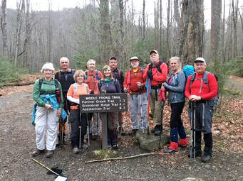
Middle Prong/Greenbrier Ridge - Saturday January 14, 2017
Tower Road, Ransom Hollow, Snooper’s Rock, Indian Rock House - Wednesday January 4, 2017
Reports from the Field, 2017
|
Pot Point House Christmas Lunch; Wednesday December 13, 2017
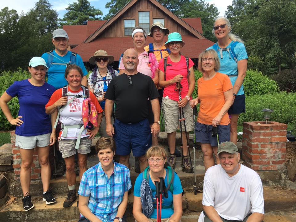
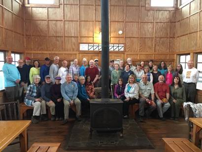
Stormy's job is to worry about getting our ever increasing number of hikers (some are + one) into the Pot Point House for our Christmas and year of hiking celebration, especially if weather is bad and we cannot spill out onto the deck. Once again, her worrying warded off the expected cold as the sun shone brightly down on the deck and sure enough a couple tables were set outdoors. Louis, Pete, Monty, John, Teresa, Mac, Susan, Debbie, Renee, Sue, and Charlie came early, and others trickled in to join the Trust helpers in setting up the tables, placing chairs, covering with table cloths, and adding little lanterns and greenery for decoration. Monty and John outdid themselves with room and deck decorations and the ever-growing Charlie Brown Christmas Tree. The hike on the Pot Point Loop trail was led by Rick Huffines. This year there was not a dedicated work effort - just light trash pickup - as we had worked on the Ritchie trail the week before. As others arrived after the hike began, the kitchen master Karen Rahn began to direct dishes to refrigerator, the oven, or to the tables. Appetizers were set out and some nibbling began! When all hikers had returned the "whistle was blown" by Teresa and or Susan and all was quiet as Che greeted everyone, Stormy introduced our guests from the Trust, and Rick Huffines shared a few remarks about the value of volunteers to our trail systems and upkeep for the Trust properties. After a blessing for the food was requested by Bob Rahn the feasting began and feast it was. Bowls were scraped clean - not much in the way of leftovers. I can still imagine the laughter that day and the praise to Monty for the woven macrame bracelets - one for everyone who attended. I won't list everyone who came but the Trust guests were: Sarah Quattrochi, Mariah Prescott, Rick Huffines, Hugh Berz, and Elliot Bullock. A small but intense group, Boe, John, and Barbara put their heads together while the others were hiking, and planned a schedule of hikes for Saturdays for the next 6 months. Check the website or newsletter for upcoming outings. Happy Trails and Happy New Year to all!! Che Carico, reporting. |
|
|
Georgia Pinhoti Section 25; Saturday December 2, 2017
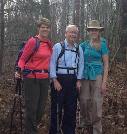
Three hikers met at the Dalton McDonald’s for breakfast and to put the car shuttle in place on Dug Gap Road. We then drove south to Snake Creek Gap where we began our 15.8-mile day hike of Section 12 which is very popular with mountain bikers and hikers. It is commonly referred to as “The Snake” as there are lots of ups and downs and the trail twists around several times. Even though we were hiking northbound, we checked our compass at one point to confirm we were walking southbound. That didn’t last long, and we continued on high atop a ridge with great views of the northwest Georgia mountains as well as I-75 to the east. We encountered several mountain bikers who willingly took our group photo. Hikers were promised that we would be off the trail before dark. As we neared Dug Gap Road, we could see numerous communications towers and we knew the second car was close. A full moon was beginning to rise in the East which helped us see our way to the car and ensure that we didn’t have to retrieve our headlamps. Enjoying a beautiful late Fall day on the trail were John Rowland, Terri Holcomb, and Barbara McCollum leading. |
|
Cloudland Connector; Wednesday November 29, 2017
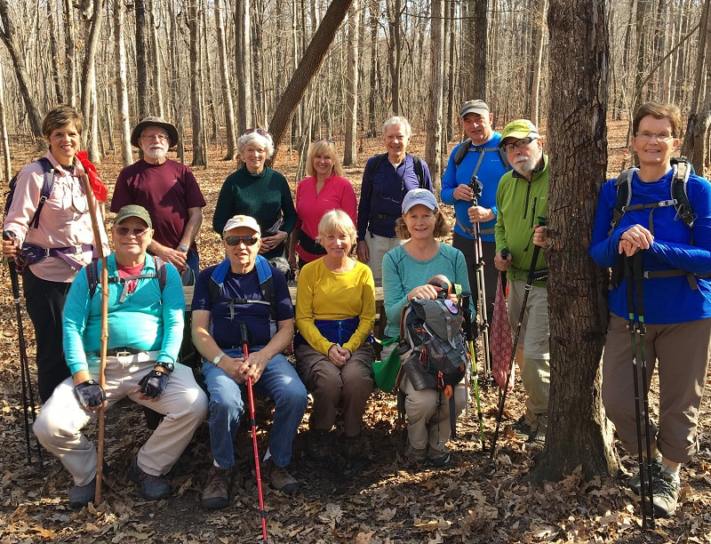
A large group of hikers set off from the Ascalon Trailhead in Cloudland Canyon, hiking the 1.5 mile Can’t Hardly Trail, then joining the Cloudland Connector Trail for another 3.5 miles before lunch. We returned 5 miles to the trailhead via the Cloudland Connector Trail, for a total of approximately 10 miles. It was a gorgeous day, and everyone had a great time. More hikes in this area to be scheduled! The hikers today were Barbara McCollum, Barbara Miller, Bill Kinnaman, Bob Rahn, Boe Rudder, Charlie Breeding, Edith Behringer, Che Carico, Hank Koeningsmark, Nancy Dell Koeningsmark, Luke Spiekermann, Renee Grace, Richard Park, Susan Garrett, Suzanne Dorough, Tom Long, Wanda McCarter, Jennifer Yarbrough, Delores Ladd, Steve Turner, Monty Simmons, Susan Basch reporting, Susan Basch and Jenny Hopkins leading. |
|
Audubon Trail Maintenance; Friday November 17, 2017
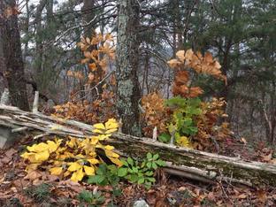
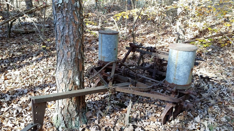
Audubon Trail - 1.8 miles one way (off of Leggett Road) Participants: Bill Kinnaman, Renee Grace, and JD. Bill and I picked Renee up at her house and the three of us drove down to the Audubon Trail Head which is not even a mile from Renee's house. It is a tiny parking area and we made sure to park where we couldn't get blocked in by another car, which isn't a big concern really. This hidden gem of a trail doesn't receive much foot traffic. Renee has spent many hours locating the original trail, marking & maintaining it with blue marking tie tape. Like a mother with a child, Renee has taken this orphaned trail under her protective wing and is doing what she can to preserve it for the rest of us to enjoy. At one time the Audubon Trail was going to be part of the Cumberland Trail System, but was abandoned. As you hike along you can see splashes of white paint on the trees here and there. It does occasionally receive attention from strangers. One such “trail angel” is Andrew James Gennett. In 2008 his Eagle Scout Project was to 'construct a portion of the trail' in the bottom of the hollow, not too far from the cabin. Andrew is from BSA Troop 166 – Mountain District of the Cherokee Council. As we worked our way down the rocky ridge area (about a 1500' drop to the bottom), Renee and Bill spent their time sawing and clearing down trees blocking the trail. I used my time to clear the heavy leaf accumulation off the rocky steps in our descent into the bottom of the hollow and to document our day with pictures. We set out on our journey at 9:15 am and returned to the car, tired but happy, about 3:00 pm. During our day we experienced the beauty of fall colors, marveled at the antique “seeder” rusting out along the trail and being barraged by hunters shooting multiple rounds of ammo lasting ¾ of an hour. We were near the cabin at this time and by the end of our lunch break the guns had grown silent. We waited a bit before we felt safe enough to return to the car via the trail but only after we made sure we had our red bandannas attached to our pack shoulder strap & flapping in the breeze, Bill wearing his bright green reflective vest & me with my bright green cap. Renee was wearing brown colors; we put her between the two of us. Jeanne E. Dickinson reporting |
Riverwalk - St. Elmo; Wednesday November 15, 2017
Celebrated the coming of Thanksgiving today as a huge group of hikers met at the St. Elmo end of the Riverwalk. We found this end to be really polished - an improvement since we first walked here after the initial opening of this section. Landscaping has "taken hold", the old factory buildings look like they have been freshened up, and new and interesting modern art sculptures line the walk. The river was splendid! Instructions were given to hike at your own speed and as far as you wanted - just return to trail end by 11:30. From this point we headed to Mount Vernon where the staff had set the back room for us and were completely "company ready" with delicious food. Bob Rahn asked the blessing for the food and our time together. Conversations never ceased! Laughter prevailed! A highlight of the day was John Rowland taking off down the Riverwalk on his beloved scooter! Easily accommodated by the Mount Vernon were: Edith Behringer, Susan Basch, Suzanne Dorough, Susan Garrett, Bob Garrett, Joy Ward, Cecile Shenouda, Wayne Chambers, Barbara McColllum, Betsy Parson, Charlie Breeding, Tom Carter, Sue Christensen, Jennie Chandler, Teresa Dean, Mac Dean, Rachel Dean , Renee Grace, Vicki Chambers, Boe Rudder, Bill LaRoque, Bob Rahn, Gail Stokes, Jenny Hopkins, Joyce Campbell, Larry Parks, Patti Giles, Richard Park, Nancy Dell Konigsmark, Hank Konigsmark, and Che Carico reporting.
Celebrated the coming of Thanksgiving today as a huge group of hikers met at the St. Elmo end of the Riverwalk. We found this end to be really polished - an improvement since we first walked here after the initial opening of this section. Landscaping has "taken hold", the old factory buildings look like they have been freshened up, and new and interesting modern art sculptures line the walk. The river was splendid! Instructions were given to hike at your own speed and as far as you wanted - just return to trail end by 11:30. From this point we headed to Mount Vernon where the staff had set the back room for us and were completely "company ready" with delicious food. Bob Rahn asked the blessing for the food and our time together. Conversations never ceased! Laughter prevailed! A highlight of the day was John Rowland taking off down the Riverwalk on his beloved scooter! Easily accommodated by the Mount Vernon were: Edith Behringer, Susan Basch, Suzanne Dorough, Susan Garrett, Bob Garrett, Joy Ward, Cecile Shenouda, Wayne Chambers, Barbara McColllum, Betsy Parson, Charlie Breeding, Tom Carter, Sue Christensen, Jennie Chandler, Teresa Dean, Mac Dean, Rachel Dean , Renee Grace, Vicki Chambers, Boe Rudder, Bill LaRoque, Bob Rahn, Gail Stokes, Jenny Hopkins, Joyce Campbell, Larry Parks, Patti Giles, Richard Park, Nancy Dell Konigsmark, Hank Konigsmark, and Che Carico reporting.
Clingman’s Dome/AT/Goshen Prong/Little River to Elkmont, plus Husky Gap; Saturday November 11, 2017
A perfect day for a Smokies Hike! Clear skies (after the lowlying clouds cleared out), high upper 60s, no rain!! The section of AT from Clingman's Dome to the Goshen Prong junction is so very beautiful with "forever" views, fallen trees covered with vibrant green moss, and that Christmas fragrance of healthy hemlocks. This part of the trail is reasonably flat but the downturn on Goshen Prong was steep and had steep step downs between boulders. So careful footing until the trail began to level off and approach campsite 23. Lots of logs here around a fire ring providing plenty of seating for packed lunches. Then came the challenge of crossing the first of two stream crossings - this one rock hopped with "a little help from a friend". Shortly, however, we came to the second crossing. "Boots off" and wading was the only way to cross safely. From here on out the trail was mostly flat with a bridge just before getting to the Little River Road trail. The group that split off onto the Huskey Gap trail headed gently up, over a ridge, and on out to Newfound Gap Road as the brilliance of the setting sun brought the stunning fall color. The others completed the hike ending in Elkmont - cars had been left at both trail heads. Headlamps were needed as Monty and Che came out after dark. Just before dark caught them they saw a bear coming up the trail toward them. Hearing Che's "hollering" and seeing the flashing headlamp lights in the dusk, the bear soon turned off the trail and disappeared! Both groups together again we headed to a fine dinner at Subway in Townsend. Rejoicing in today's display of God's artwork were: Carolyn Brannon, Betsy Parson, Bonnie Smith, Rick Glisson, Shelly Claiborne, Monty Simmons, Che Carico reporting, Wayne Chambers leading.
A perfect day for a Smokies Hike! Clear skies (after the lowlying clouds cleared out), high upper 60s, no rain!! The section of AT from Clingman's Dome to the Goshen Prong junction is so very beautiful with "forever" views, fallen trees covered with vibrant green moss, and that Christmas fragrance of healthy hemlocks. This part of the trail is reasonably flat but the downturn on Goshen Prong was steep and had steep step downs between boulders. So careful footing until the trail began to level off and approach campsite 23. Lots of logs here around a fire ring providing plenty of seating for packed lunches. Then came the challenge of crossing the first of two stream crossings - this one rock hopped with "a little help from a friend". Shortly, however, we came to the second crossing. "Boots off" and wading was the only way to cross safely. From here on out the trail was mostly flat with a bridge just before getting to the Little River Road trail. The group that split off onto the Huskey Gap trail headed gently up, over a ridge, and on out to Newfound Gap Road as the brilliance of the setting sun brought the stunning fall color. The others completed the hike ending in Elkmont - cars had been left at both trail heads. Headlamps were needed as Monty and Che came out after dark. Just before dark caught them they saw a bear coming up the trail toward them. Hearing Che's "hollering" and seeing the flashing headlamp lights in the dusk, the bear soon turned off the trail and disappeared! Both groups together again we headed to a fine dinner at Subway in Townsend. Rejoicing in today's display of God's artwork were: Carolyn Brannon, Betsy Parson, Bonnie Smith, Rick Glisson, Shelly Claiborne, Monty Simmons, Che Carico reporting, Wayne Chambers leading.
Pot Point Loop - Prentice Cooper; Wednesday November 8, 2017
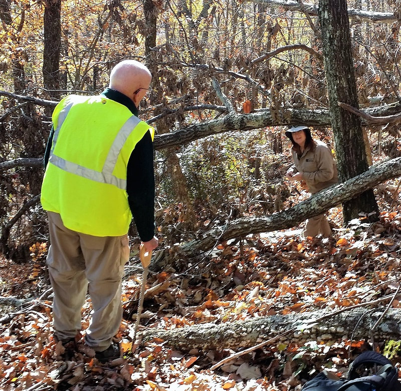
Always happy to "give back" with trail work, today the hikers became trail blazers. Organized by Steve Barnes the work began on the Pot Point Loop where it is bisected by Tower Road. One group went toward Mullins Cove and the other group took off toward the Natural Bridge and Snooper's Rock end of the trail. Each group had two volunteers with white paint (CT is blazed with white blazes) and each group had 5 volunteers carrying lopers and clippers for cutting back intruding vegetation along the trail. Bill Kinnaman carried a saw and cut what he could, leaving behind the large blow downs for the park employees. Mac noted the waypoints for the blow downs on his side using his MotionX GPS hoping to help the park crew locate them more quickly. The plan was to hike in and work for 1 1/2 hours then turn and start back. Steve was quite pleased with the effort and success of the day! As the entire loop is 9 miles, the work will be done in sections. It was cloudy and chilly but hungry hikers stopped at the park pavilion on the way out long enough to eat lunch. A little laughter, also, as the conversation included tales of unusual names some of which should not be published here! Promising Steve to return another day were: Bill Kinnaman, Larry Parks, Edith Behringer, Susan Basch, Suzanne Dorough, Wanda McCarter, Wayne Chambers, Renee Grace, Jennifer Yarbrough, Teresa Dean, Che Carico reporting, and Mac Dean and Steve Barnes leading.
Always happy to "give back" with trail work, today the hikers became trail blazers. Organized by Steve Barnes the work began on the Pot Point Loop where it is bisected by Tower Road. One group went toward Mullins Cove and the other group took off toward the Natural Bridge and Snooper's Rock end of the trail. Each group had two volunteers with white paint (CT is blazed with white blazes) and each group had 5 volunteers carrying lopers and clippers for cutting back intruding vegetation along the trail. Bill Kinnaman carried a saw and cut what he could, leaving behind the large blow downs for the park employees. Mac noted the waypoints for the blow downs on his side using his MotionX GPS hoping to help the park crew locate them more quickly. The plan was to hike in and work for 1 1/2 hours then turn and start back. Steve was quite pleased with the effort and success of the day! As the entire loop is 9 miles, the work will be done in sections. It was cloudy and chilly but hungry hikers stopped at the park pavilion on the way out long enough to eat lunch. A little laughter, also, as the conversation included tales of unusual names some of which should not be published here! Promising Steve to return another day were: Bill Kinnaman, Larry Parks, Edith Behringer, Susan Basch, Suzanne Dorough, Wanda McCarter, Wayne Chambers, Renee Grace, Jennifer Yarbrough, Teresa Dean, Che Carico reporting, and Mac Dean and Steve Barnes leading.
|
Laurel/Snow Pocket Wilderness - Buzzard Point; Wednesday November 1, 2017
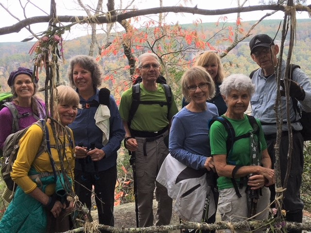
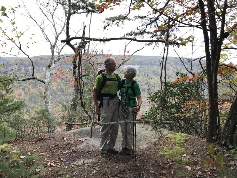
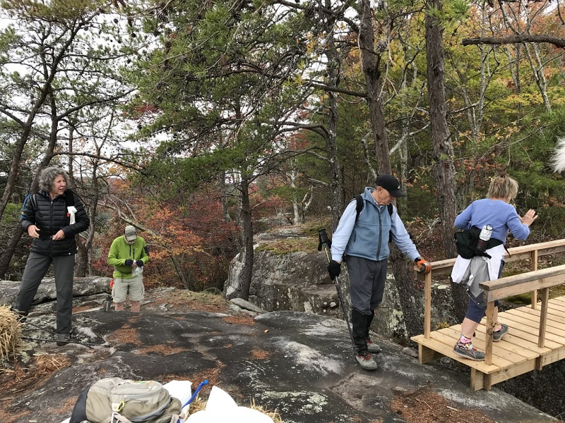
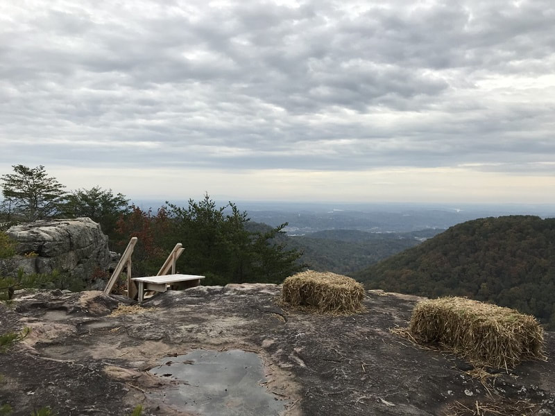
Water was rushing in Richland creek as we started out on the main trail leading to lots of concern about getting across the creek at the site where the bridge is out. Sure enough the crossing (Laurel Creek) had to be made with great care via a log. Reaching the trail intersection, we turned left and headed off on the Snow Falls trail. After coming around a huge boulder, right before the 150' bridge that crosses Richland Creek, the fall foliage was a beautiful picturesque scene of red, orange and yellow. A short stop allowed for taking a few pictures on the bridge. The trail continued along beside Richland Creek until it turned up the mountain with a elevation change of 900 ft. The climb paid off! Once we reached the top, there were remnants of a wedding that had taken place on the bluff before reaching Buzzard Point. They had made a window frame out of twigs and flowers (picture attached). Of course, we all had to take advantage of the beautiful work they left behind by posing in front of it. Continuing on to Buzzard point, we noticed they had also built a bridge, steps leading down to the outer point and also left behind bales of hay for seating. We appreciated the use of the bales of hay to take our break and have lunch. Boe, Joyce, and Hank started back before the remaining 8 hikers. We took our time on the descent. We were also wondering what happened to the other group. Mac could see Sue on the MotionXGPS and noticed she was back at the parking lot. What a nice feature of Motion X to be able to spot hikers you cannot see! Hoping all were safe: Wanda McCarter, Hank Konigsmark, Jenny Hopkins, Boe Rudder, Jennifer Yarbrough, Beverly Ligon, Barry Ligon, Joyce Campbell, Susan Basch, Edith Behringer, Larry Parks, Suzanne Dorough, Teresa Dean reporting and Mac Dean leading. A "rogue" group of hikers had noticed and explored a pink flagged trail that split off from the main trail at the top of the downturn from the bluff to the trail below. This new trail ran parallel with the familiar trail below and came back out onto the main trail above the mine shaft opening. A CT employee in the parking lot explained that this trail is the extension of the CT and will connect eventually with the trail being built coming toward Laurel/Snow pocket wilderness from Graysville Mountain. The current trail will be a "spur" from the CT. New signs have been installed along Richland and a nice bench. There you will find a history of the area including its original ownership and later designation as a state natural area. Enjoying a shorter hike and exploration were: Bill Kinnaman, Sue Christensen, Cecile Shenouda, Che Carico reporting, and Jean Dickinson leading. (This group of hikers also was able to spot the ones at Buzzard Point with Sue's MotionX app.) |
|
Daddy’s Creek; Wednesday October 25, 2017
This new section of the CT is so fine! There is an end to end hike from the southern terminus on Hebbertsburg Road to the northern terminus on East Keyes Road. Distance 7.4 miles. An option is there for a 3 mile hike which begins on Hebbertsburg Road and spurs off to exit at the yellow gate. The trail is beautiful with ferns, running water, rock bluff views of Daddy’s Creek from above, trail wide and easy underfoot. There are a few rather short uphill treks on the first part of the trail, one steep step down over large rocks, then @2 miles of gentle uphill near the end of the trail. When admiring the trail, Don Deakins said the best is yet to come as new trail will be built on either end of this section. A trail crew is currently in the Catoosa Wildlife Management area working south toward the current end point of Daddy’s Creek on E Keyes Road - a distance of 4 miles. Next spring the Break Away program will work on connecting Black Mountain with Ozone Falls. Later a trail will be built connecting Ozone Falls to the Hebbertsburg Road end of Daddy’s Creek. Remarking that the 80 minute drive is worth it were: Susan Garrett, Suzanne Dorough, Wanda McCarter, Charlie Breeding, Bill Kinnaman, Bob Rahn, Jean Dickinson, Teresa Dean, Mac Dean, Edith Behringer, Susan Basch, Renee Grace, Sue Christensen, Jennifer Yarbrough, Nancy Lewis, Joy Ward, Lonnie Rogers, Che Carico reporting, Judy Varner and Don Deakins, leaders and avid CT trail builders. |
|
Red Top Mountain State Park, GA; Wednesday October 18, 2017
The Wednesday hikers ventured a bit south to hike at Red Top Mountain State Park just outside of Cartersville, Georgia. Named for the soil’s rich red color caused by high iron-ore content, Red Top Mountain was once an important mining area. Today’s trail was the Homestead Loop which started at the park’s visitors center and made its way to the shores of Lake Allatoona. The trail is well maintained and easy under foot. Both hardwoods and pines make up most of the forest which is home to deer and wild turkey. We actually saw a couple of deer scamper in the woods while on our way to the lake. The elevation of 930 ft. was scattered over several short climbs. Most of the climbing was before lunch which was enjoyed on a beautiful peninsula of the lake. After lunch, we hoped to find the chimney remains which helped to name the trail, but unfortunately, the remains were well-camouflaged and we kept hiking until we reached the junction of the Sweet Gum Trail. We decided to take this trail back to the Visitor’s Center for a different view and completed the day at 5.5 miles. Enjoying an absolutely perfect Fall day on the trail were: Jenny Hopkins (who brought delicious homemade oatmeal cookies), Patti Giles, Susan Garrett, Edith Behringer, Wanda McCarter, Suzanne Dorough, Larry Parks, Sue Christensen, Linda Keown, Tom Long (who organized the Chattanooga car pool) and Barbara McCollum leading. |
|
Clingman’s Dome, Welch Ridge, Jonas Creek, Forney Creek, to Road to Nowhere; Friday October 13, 2017
Bypass trail to AT from Clingman's Dome, AT to Welch Ridge trail, Jonas Creek trail, portion of Forney Creek, White Oak Branch, Lakeshore Drive. Two hikers took the Springhouse Branch trail and exited via Noland Creek. Moist forest, incredible views of mountains as far as the eye can see, cooling breeze on this potentially hot summer day, a wonderland of fallen trees coated with vibrant green moss, rushing creeks along almost every step, and the fragrance of Christmas trees - that is what Chattanooga hikers found and enjoyed and why they pursue trails and marking a Smokies map! This hike began at the Clingman's Dome parking lot with the bypass trail up to the AT; it continued on the AT to the junction with the Welch Ridge trail; passed up the junction with Hazel Creek where we had lunched two weeks ago; and stopped for lunch at the junction with Jonas Creek. Here we found Rick Glisson and Tim Chomyn who were hiking this 17.2 miles uphill! Their reason was for training purposes and as a result facilitated a key swap car shuttle. John Rowland also helped with the shuttle by taking some of the hikers up to Clingman's and then returning (via Peter's Pancakes) to the Road to Nowhere. He started up the trail toward the hikers coming down. We all met up at the junction with the Forney Creek trail. John turned around here and hiked out with us enduring the seemingly unending uphill trek on White Oak Branch to Lakeshore Drive, hiking with headlamps through the tunnel on the Road to Nowhere, and ending where our cars were parked. Tired but satisfied with miles and safe keeping were: Wayne Chambers, Sandy Barlett (comes from Ohio to do this), Monty Simmons, Boe Rudder, Ken Smith (from S. Carolina), John Rowland, Tim Chomyn, Rick Glisson, Betsy Parson and Bonnie Smith (included Spring House Branch), Tom Sewell, Tom Long (helped with car placement, hiked for a short while on this part of the AT then off to get another AT section), Che Carico reporting, Barbara McCollum and Wayne Chambers leading. |
|
Skyuka Trail, Nature Center, Red Wolf Exhibit; Wednesday October 11, 2017
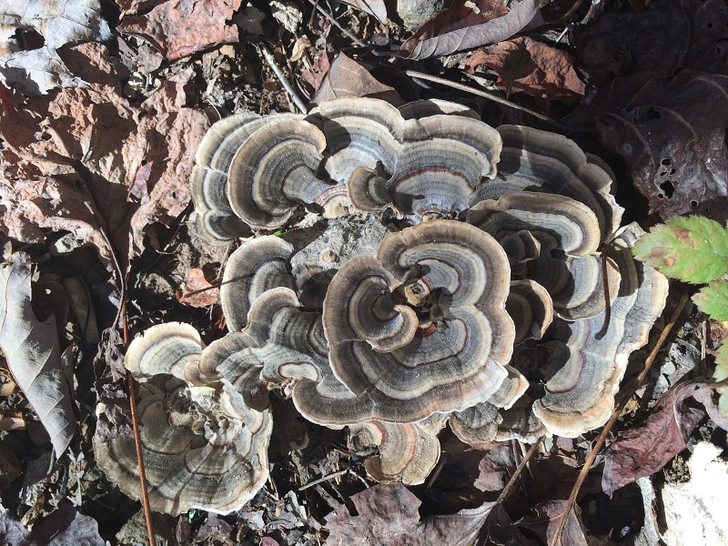
The Skyuka trail head is on highway 318. There is a limited amount of parking near the sign pointing the way to Skyuka Springs. Down on highway 72 is a larger parking area which will then require a short careful walk up to the trail head. Today we left most cars at the parking area across from the trail head for the Kiddie trail and then transported hikers to the area on the corner of 72 and 318. The trail starts out uphill for a short distance, levels off, then climbs gently to another plateau where you will find the intersection to the Kiddie trail coming up from the right. We continued on until we came upon the intersection where we could reflect and admire the memorial tribute to Betty Petty, an avid Chattanooga hiker and leader who was tragically killed in an auto accident. From Betty's memorial we traveled to the right and slightly downhill and headed for the Nature Center. After stepping out onto the dirt road we turned left and continued by looping away from and then back toward the main Nature Center area. The boardwalk took us to the Tree House (structure designed by Bill Kinnaman) and then on to the wolf and bird protective area. What luck that it was feeding time! We were treated to a very informative lecture by Tish Gaillmard about the red wolves, their potential extinction, their current numbers, and efforts to promote the species. Tish has a passion for protecting the wolves and generously shared her passion with us! The forest was decorated with purple asters, goldenrod, and unusual mushrooms. Still blessed by no encounters with snakes or yellow jackets on this still hot and humid day were: Patti Giles, Sue Christensen, Wayne Chambers, Bill Kinnaman, Susan Basch, Edie Behringer, Gail Stokes, Susan Garrett, and Che Carico reporting.
The Skyuka trail head is on highway 318. There is a limited amount of parking near the sign pointing the way to Skyuka Springs. Down on highway 72 is a larger parking area which will then require a short careful walk up to the trail head. Today we left most cars at the parking area across from the trail head for the Kiddie trail and then transported hikers to the area on the corner of 72 and 318. The trail starts out uphill for a short distance, levels off, then climbs gently to another plateau where you will find the intersection to the Kiddie trail coming up from the right. We continued on until we came upon the intersection where we could reflect and admire the memorial tribute to Betty Petty, an avid Chattanooga hiker and leader who was tragically killed in an auto accident. From Betty's memorial we traveled to the right and slightly downhill and headed for the Nature Center. After stepping out onto the dirt road we turned left and continued by looping away from and then back toward the main Nature Center area. The boardwalk took us to the Tree House (structure designed by Bill Kinnaman) and then on to the wolf and bird protective area. What luck that it was feeding time! We were treated to a very informative lecture by Tish Gaillmard about the red wolves, their potential extinction, their current numbers, and efforts to promote the species. Tish has a passion for protecting the wolves and generously shared her passion with us! The forest was decorated with purple asters, goldenrod, and unusual mushrooms. Still blessed by no encounters with snakes or yellow jackets on this still hot and humid day were: Patti Giles, Sue Christensen, Wayne Chambers, Bill Kinnaman, Susan Basch, Edie Behringer, Gail Stokes, Susan Garrett, and Che Carico reporting.
|
Historic Mining Section of the CT, Wednesday October 4, 2017
Find lots of history by googling the historic mining in Soddy Daisy, TN. Our hike today followed the trail from Sluder Lane/ Hotwater Road to the Mowbray Pike trailhead on Hotwater Road. The distance for this section is 5 miles rated moderate to strenuous. Lots of evidence of long past coal mining including signs marking sites of mines with family names. The trail section is typical of the CT with sharp downhills, equally sharp uphills, rocks and roots underfoot, huge exposed rock rising above, ferns, fall blooming wildflowers, views of the Tennessee River today partially obscured by low brush, and cool forested paths stretching forward in places. Parking at both ends has been greatly improved, so plenty of space for the car shuttle. Follow the well-marked white blazed CT using a spur with blue blazes marking the exit to the Sluder Lane parking area. Proud to claim the CT as a linear state park in Tennessee and appreciative of the work to build it were: Joy Ward, Suzanne Dorough, Sue Christensen, Edith Behringer, Gail Stokes, Wayne Chambers, Jennifer Yarbrough, Renee Grace, Jean Dickinson, Wanda McCarter, Luke Spiekerman, Bill Kinnaman, Teresa Dean, Rachel Bryant, Mac Dean, John Rowland, Barbara Miller, Tom Carter, Susan Garrett, Wendy Gunn, Sharon Hogan, Bob Rahn, Betsy Parson, Linda Keown, Ed Park, Bill LaRoque, Patti Giles, and Che Carico, reporting. |
|
Hazel Creek, Bone Valley, Welch Ridge, Cold Springs Gap, High Rocks, and Ollie’s Cove; Friday-Sunday September 30-October 1, 2017
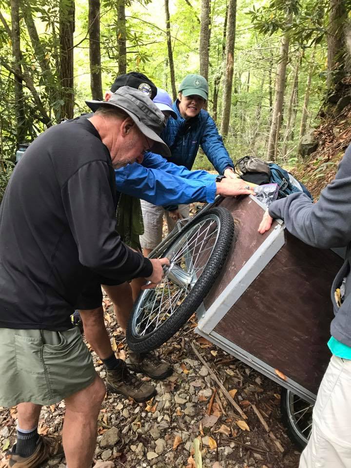
The weather became our best friend for this weekend of hiking and camping. The temps for daytime were high 70s and high 40s (a bit chilly) at night with absolutely NO rain! Campsite 82 on Hazel Creek was the destination on the first day. The distance hiked was 12.4 miles which included the spur to Bone Valley and back. Carts are available to fishermen who hike into the many campsites along Hazel Creek for multiple days of fishing and who need more gear than they can carry. We rented one of these and piled our gear into it, then took turns pulling or pushing it along the trail. For the first 4.5 miles this seemed like a good idea. However, now rather tired and having stopped to change a wheel, the last 2.3 miles had more uphill than previously encountered. Rather than give in we forged on until our scout, Carolyn, came back to report the campsite was within sight! It is called the Calhoun and is wrapped around by Hazel Creek. Supper, a roaring fire, and bed time! Daily total 12.4 miles. Then on day 2 after breakfast and with day packs loaded, the hike began by continuing up Hazel Creek and at least 16 creek crossings! At the last crossing we filled our water bottles and prepared for the almost straight uphill 2 mile section to finally top out (after 10 switchbacks) at the junction with Welch Ridge. This was a good stop for rest and lunch. Downhill all the way from here? Not so much as there were rather strenuous uphill sections on Welch Ridge including the spur to High Rocks (well worth it!). Then there was Cold Springs Gap trail - gullied, lots of rocks, and sometimes wet with normal runoff. There were 5 boots off water crossings on this trail. Dark did catch us so the last 2 1/2 hours were spent with flashlights and headlamps. We stepped back onto Hazel Creek trail gratefully having no mishaps except one falling into the creek at the last crossing. It was easy underfoot from here but continuously uphill that last 1.75 miles in the shine of the moon. Exhausted and quick to bed! Daily total 17.7 miles. Day 3 was strike camp day and an 8.4 mile hike/pull/push cart back to Lakeshore. The good news is that it was a bit easier with the pitch being mostly downhill. Three "horses" took off after a period of sharing the load - Terri, Barbara, and Carolyn "headed to the barn" so they get the most credit for the gear portage out. At the Lakeshore trail junction with Hazel Creek we left the cart and gear with Steve Claxton who took it on down to the lake and the pontoon boat. He had agreed to bring the boat and gear around to shore at Ollie Cove giving us a chance to also "get this trail" too. Steve safely delivered us back across the lake, surrounded by beautiful mountains, to our parked cars and the beginning of our drive home by way of Monte Alban Mexican in Andrews. Daily total 9.1 miles. Blessed by safekeeping, perfect weather, personal success, great leadership, and new memories stored away were: Carolyn Brannon, Monty Simmons, Terri Holcomb, Bonnie Smith, Che Carico reporting, Barbara McCollum and Wayne Chambers leading. |
|
|
Richie Gulf, Wednesday September 27, 2017
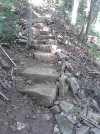
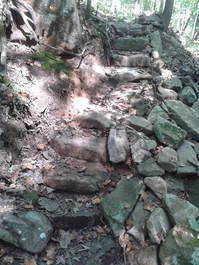
This "work in progress" Ritchie Gulf trail is in the Prentice Cooper state forest but originates near the Pot Point House on Mullins Cove Road in the upper parking lot. The Wednesday hikers have watched it progress from a barely scratched out hard to follow trail to one almost polished up for recreational hiking. Many volunteers have helped bring this trail along including Chattanooga Hiking Club members out for trail work on several occasions, the trail runners, and today we found an SECC group hard at work building magnificent steps out of magnificent stones! The leader for us today was Mariah Prescott from the TN River Gorge Trust. The greatest distance hiked was 2.5 miles in and out to where the trail ties into the Pot Point loop trail above and beyond Blowing Wind Falls. She has now proposed a work day for us in the near future as we have seen the improvements already made. Planning to come back soon were: Susan Garrett, Stormy McGauley, Boe Rudder, Suzanne Dorough, Bob Rahn, Edith Behringer, Bill Kinnaman, JD Dickinson, Barbara Miller, John Rowland, Charlie Breeding, Linda Keown, Patti Giles, Susan Basch, Betsy Parson, Larry Park, Che Carico reporting, and Mariah Prescott leading. |
|
Shackleford Ridge Park, Rainbow Lake, Edward’s Point Loop, Wednesday September 20, 2017
The Parks Board has placed a new kiosk and trail map sign on the hill beside the visitors' bleachers at the SMMHS football field. It is placed at the beginning of a spur trail (Orange) that connects with the Yellow/Orange trail and for a short distance the Blue trail. The Orange/Yellow trail continues as one until the Orange splits left down a washout and the Yellow continues straight. Fairly soon the Orange trail makes a subtle left heading toward Middle Creek. Watch for the trail to then turn off right before getting to the creek. From here it follows the creek under huge rock bluffs and over rough terrain. Along this section you will run into the CB swinging bridge where you can cross and hike on out to the Rainbow Lake entrance on Ohio Avenue. Keeping straight following Orange the trail forks uphill and soon becomes the Cumberland Trail (White blazes) as it heads to the bluff and eventually Edward's Point. There is a beautiful view of the Tennessee River Gorge and today the area was rather free of litter sometimes left behind by 4 wheeler visitors. We sat for a reasonable time for lunch and then in groups turned uphill, found the yellow blazes, and continued on to complete our loop. We left Edward's Point and the Cumberland Trail (White blazes) behind us as from here it remains on the bluff to Mushroom Rock and beyond. Our loop began and ended at the ample parking lot at the stadium bleachers. Challenged a bit by the heat and humidity were: Bob Rahn, Edith Behringer, Larry Parks, Mac Dean, Renee Grace, Stormy McGauley, Susan Garrett, Suzanne Dorough, Tom Long, Teresa Dean, Wanda McCarter, Wayne Chambers, Wendy Gunn, Boe Rudder, Charlie Breeding, and Che Carico reporting. |
|
Raccoon Mountain, Wednesday September 6, 2017
The system of trails built primarily by SORBA with bikers in mind is multi-use, clearly marked, and well maintained. You will enjoy the beautiful forest around you, the clear blue lake on the top, the views of the Tennessee River gorge, views of the city, and the hospitable and informative visitor's center. Noticeable also is the silence in these woodlands except for the river side - may hear passing motor boats and barges! There are 50 miles of trails on the top of the mountain and maps that show you how to hike them all or sections. Today's hike began by leaving cars at the visitor's center then driving around to Laurel Point to begin. From the parking area we hiked down to intercept the River Gorge trail, turned right and continued until it came to the Megawatt trail where we turned left, caught the short 6 Flags loop along the way, and ended back at the visitor's center. There were a few decisions to make as the trails are not all named or marked. Good sense will keep you on track as you keep the dam on your right and the river on your left (when hiking clockwise from Laurel Point). Mac and Sue were following their Motion XGPS tracker apps which were very helpful for making our way. We picked up the cars and went back to Laurel Point (this drive is one way) to get the ones left there including Mac's truck which we had loaded up in order to make this shuttle without driving around the lake more than once! Off to home, eating packed lunch, or off to the Cafe and Toast for Thai food were: Joy Ward, Sue Christensen, Patti Giles, Linda Keown, Bill Kinnaman, Edie Behringer, Susan Basch, Bob Rahn, Tom Long, Stormy McGauley, Larry Parks, Wanda McCarter, Mac Dean, Teresa Dean, Susan Garrett, Rachel Bryant, Jennifer Yarbrough, and Che Carico reporting. |
Little Cedar Mountain, Wednesday August 30, 2017
You can find this trail just off 24 W at exit 158. Take the exit, turn left, and soon you will see a sign to the trail head on the right pointing to a left hand turn. This trail is an example of dedication and continuing hard work. It had been neglected until Bob Butters began his revitalization project. After brushing out the original trail and adding mileage, he created a figure 8 trail that can total 4.1 miles and is splendid with wild flowers in the spring. It has ups and downs, views of the river, and a pond with frogs and cattails. This day we noticed the new and improved trail signs that made our experience even better. If Tim, Rick, Teresa, John, or Bill had been on this hike we would have pictures of the armadillos that came curiously out of the woods toward us! They have a den near the major overlook as reported by Bob Butters. These folks take such good pictures, always at the ready. One armadillo came within a foot of me but no picture as I was sure he planned to bite me and I scared him away! In good spirits as we out hiked the approaching Hurricane Harvey rain, we headed back to Haletown and the Lookout Winery for great pizza enjoyed outdoors on their covered deck and with a view of the river. Heading home just as the rains came were: Cecile Shenouda, Linda Busby, Sue Christensen, Bob Rahn, Monty Simmons, Suzanne Dorough, Wanda McCarter, Susan Garrett, Edie Behringer, Renee Grace, Bill Kinnaman, Teresa Dean, Mac Dean, Stormy McGauley, Wendy Gunn, Jenny Hopkins, and Che Carico reporting.
You can find this trail just off 24 W at exit 158. Take the exit, turn left, and soon you will see a sign to the trail head on the right pointing to a left hand turn. This trail is an example of dedication and continuing hard work. It had been neglected until Bob Butters began his revitalization project. After brushing out the original trail and adding mileage, he created a figure 8 trail that can total 4.1 miles and is splendid with wild flowers in the spring. It has ups and downs, views of the river, and a pond with frogs and cattails. This day we noticed the new and improved trail signs that made our experience even better. If Tim, Rick, Teresa, John, or Bill had been on this hike we would have pictures of the armadillos that came curiously out of the woods toward us! They have a den near the major overlook as reported by Bob Butters. These folks take such good pictures, always at the ready. One armadillo came within a foot of me but no picture as I was sure he planned to bite me and I scared him away! In good spirits as we out hiked the approaching Hurricane Harvey rain, we headed back to Haletown and the Lookout Winery for great pizza enjoyed outdoors on their covered deck and with a view of the river. Heading home just as the rains came were: Cecile Shenouda, Linda Busby, Sue Christensen, Bob Rahn, Monty Simmons, Suzanne Dorough, Wanda McCarter, Susan Garrett, Edie Behringer, Renee Grace, Bill Kinnaman, Teresa Dean, Mac Dean, Stormy McGauley, Wendy Gunn, Jenny Hopkins, and Che Carico reporting.
Chattanooga Nature Center, Betty’s Memorial; Saturday August 26, 2017
Enjoying a relatively mild day for August, we followed the loop road through Reflection Riding, checking out the many signs that identified different types of trees (most of which we didn’t know…). At the far end of the road, we turned back on the trail system that criss-crosses the lower slopes of Lookout Mountain, following it to the junction where Betty’s bench and marker are found. We sat on the bench for a while (that’s what it’s for!), talking about our dear friend. We also made note of the fact that the bench needs a good refinishing; that’s something that we hope to take care of this fall. Joining me were Barbara McCollum and Tom Long; John Rowland reporting.
Enjoying a relatively mild day for August, we followed the loop road through Reflection Riding, checking out the many signs that identified different types of trees (most of which we didn’t know…). At the far end of the road, we turned back on the trail system that criss-crosses the lower slopes of Lookout Mountain, following it to the junction where Betty’s bench and marker are found. We sat on the bench for a while (that’s what it’s for!), talking about our dear friend. We also made note of the fact that the bench needs a good refinishing; that’s something that we hope to take care of this fall. Joining me were Barbara McCollum and Tom Long; John Rowland reporting.
Fall Creek Falls, Gilbert Gaul trail; Wednesday August 23, 2017
Fall Creek Falls is another beautiful Tennessee State Park encompassing 26,000 acres! It has amenities to include a lake for paddling and fishing, hotel accommodations, hiking trails, biking trails, and a restaurant serving delicious Southern cuisine. There is a maze of short trails, a longer perimeter trail, a back country trail, a trail to the bottom of Cane Creek Falls, and one that is fairly new - the Gilbert Gaul trail. With a distance of 4.45 miles and a rating of moderate it wanders through a beautiful forest, takes you by the Gilbert Gaul homestead, and includes a view of the lake. Today our hikers walked this easily followed loop trail, and finished in time for lunch at the park restaurant - the Gaul Restaurant. You can order from a menu or choose from an incredible layout of foods in the buffet line which includes banana pudding! Dominating the conversation in the crowded restaurant were: Boe Rudder, Susan Basch, Susan Garrett, Stormy McGauley, Barbara Miller, Wayne Chambers, Bill Kinnaman, Renee Grace, Edie Behringer, Barbara McCollum, Tom Long, Sue Christensen, Tim Chomyn, and Che Carico, reporting. Visit our beautiful Tennessee State Parks!
Fall Creek Falls is another beautiful Tennessee State Park encompassing 26,000 acres! It has amenities to include a lake for paddling and fishing, hotel accommodations, hiking trails, biking trails, and a restaurant serving delicious Southern cuisine. There is a maze of short trails, a longer perimeter trail, a back country trail, a trail to the bottom of Cane Creek Falls, and one that is fairly new - the Gilbert Gaul trail. With a distance of 4.45 miles and a rating of moderate it wanders through a beautiful forest, takes you by the Gilbert Gaul homestead, and includes a view of the lake. Today our hikers walked this easily followed loop trail, and finished in time for lunch at the park restaurant - the Gaul Restaurant. You can order from a menu or choose from an incredible layout of foods in the buffet line which includes banana pudding! Dominating the conversation in the crowded restaurant were: Boe Rudder, Susan Basch, Susan Garrett, Stormy McGauley, Barbara Miller, Wayne Chambers, Bill Kinnaman, Renee Grace, Edie Behringer, Barbara McCollum, Tom Long, Sue Christensen, Tim Chomyn, and Che Carico, reporting. Visit our beautiful Tennessee State Parks!
Mill Creek CT section, Wednesday August 16, 2017
Chattanooga Hiking Club members have lent a hand on at least 3 occasions to help prepare and build sections of this trail. Proud they were to hike the trail (now groomed, well marked, and easy to follow all the way to the creek) and enjoy seeing the fruits of their efforts along with the efforts of other volunteers and CT employees. This 2.4 mile section rated moderate to strenuous begins just past the gate at the parking lot for the Roaring Fork and Graysville Mountain trails on Brayton Road. Look for the slightly grown up path and white CT blazes to the left. Shortly after getting on the trail it will take you out onto the road where you must walk across the road bridge to then reenter the forest on the path to the right. From here it is an often uphill climb through beautiful forest with frequent vistas. The trail crosses Brayton Road and resumes another 1+ mile to a dead end with McGill Creek. You can prowl a little more up and down this side of the creek. The Southern Trail Crew is working from the Downey View trail head off of Leggett Road toward McGill Creek which must be crossed by a bridge not yet in place. The CTC June newsletter mentions the McGill Creek waterfall spur and the picture is beautiful! We had been warned about yellow jackets but had no mass encounters or stings! Hot and humid today so gratefully we were not far for a return to the Screen Door and delicious food! Enjoying this pretty addition to the CT in spite of the heat were: Boe Rudder, Suzanne Dorough, Wanda McCarter, Jennifer Yarbrough, Sue Christensen, Patti Giles, Renee Grace, Betsy Parson, Trish Appleton, Edie Behringer, Susan Basch, Teresa Dean, Mac Dean, Bill Needham, Larry Parks, Stormy McGauley, Wayne Chambers, and Che Carico reporting.
Chattanooga Hiking Club members have lent a hand on at least 3 occasions to help prepare and build sections of this trail. Proud they were to hike the trail (now groomed, well marked, and easy to follow all the way to the creek) and enjoy seeing the fruits of their efforts along with the efforts of other volunteers and CT employees. This 2.4 mile section rated moderate to strenuous begins just past the gate at the parking lot for the Roaring Fork and Graysville Mountain trails on Brayton Road. Look for the slightly grown up path and white CT blazes to the left. Shortly after getting on the trail it will take you out onto the road where you must walk across the road bridge to then reenter the forest on the path to the right. From here it is an often uphill climb through beautiful forest with frequent vistas. The trail crosses Brayton Road and resumes another 1+ mile to a dead end with McGill Creek. You can prowl a little more up and down this side of the creek. The Southern Trail Crew is working from the Downey View trail head off of Leggett Road toward McGill Creek which must be crossed by a bridge not yet in place. The CTC June newsletter mentions the McGill Creek waterfall spur and the picture is beautiful! We had been warned about yellow jackets but had no mass encounters or stings! Hot and humid today so gratefully we were not far for a return to the Screen Door and delicious food! Enjoying this pretty addition to the CT in spite of the heat were: Boe Rudder, Suzanne Dorough, Wanda McCarter, Jennifer Yarbrough, Sue Christensen, Patti Giles, Renee Grace, Betsy Parson, Trish Appleton, Edie Behringer, Susan Basch, Teresa Dean, Mac Dean, Bill Needham, Larry Parks, Stormy McGauley, Wayne Chambers, and Che Carico reporting.
Laurel Falls Wednesday, August 9, 2017
Hot summer day and morning only hike in order. Laurel Falls trail was the destination and quite a few turned out in spite of storms in forecast for the afternoon and the pretty intense humidity. The bridge over Richland Creek has not yet been replaced but rock hopping was easy as very little water in the creek. There was enough water in the waterfall to make a noise but surely not as full forced as we have seen in the past. This is a pretty trail alongside Richland Creek with challenges of crawling through a short cave, rocks and roots underfoot, and a short lived steep switchback section. Spotted a few summer wildflowers and ferns plentiful. We were saddened to find many places where hikers have hiked off trail taking shortcuts on the switchbacks. It would be easy to get confused and this causes trail erosion! In good spirits and ready for the next part of the day - lunch at the Screen Door in Dayton - were: Boe Rudder, Patti Giles, Susan Garrett, Eileen Del Piano, Sue Christensen, Betsy Parson, Jenny Hopkins, Teresa Dean, Mac Dean, Rachel Bryant, Cecile Shenouda, Bob Rahn, Bill Kinnaman, Jean Dickinson, Stormy McGauley, Edith Behringer, Susan Basch, Wanda McCarter, Savannah Steele, Suzanne Dorough, and Che Carico, reporting.
Hot summer day and morning only hike in order. Laurel Falls trail was the destination and quite a few turned out in spite of storms in forecast for the afternoon and the pretty intense humidity. The bridge over Richland Creek has not yet been replaced but rock hopping was easy as very little water in the creek. There was enough water in the waterfall to make a noise but surely not as full forced as we have seen in the past. This is a pretty trail alongside Richland Creek with challenges of crawling through a short cave, rocks and roots underfoot, and a short lived steep switchback section. Spotted a few summer wildflowers and ferns plentiful. We were saddened to find many places where hikers have hiked off trail taking shortcuts on the switchbacks. It would be easy to get confused and this causes trail erosion! In good spirits and ready for the next part of the day - lunch at the Screen Door in Dayton - were: Boe Rudder, Patti Giles, Susan Garrett, Eileen Del Piano, Sue Christensen, Betsy Parson, Jenny Hopkins, Teresa Dean, Mac Dean, Rachel Bryant, Cecile Shenouda, Bob Rahn, Bill Kinnaman, Jean Dickinson, Stormy McGauley, Edith Behringer, Susan Basch, Wanda McCarter, Savannah Steele, Suzanne Dorough, and Che Carico, reporting.
Canyon Ridge hike and lunch, Wednesday August 2, 2017
Jenny Hopkins invited all to come to her home in Canyon Ridge and hike a trail within that property. We stopped upon arrival and put perishable foods in her refrigerator then geared up for the 4 mile walk that began down the street from her house. Many commented on how "wilderness like" the trail was in this gated residential community. We did cross a few golf course greens, but for the most part enjoyed ups and downs, huge rock formations, unusual mushrooms, splendid ferns, incredible bluff views, and a few of those later in the summer wildflowers blooming in the dense woods. Upon finishing the hike and back at Jenny's we gathered up the food and drove down to the community clubhouse for one of our famous covered dish lunches. The entree was pork from the Purple Daisy supplied by Jenny and the sides were beyond compare! Seems no matter how many times we have one of these meals the foods brought are different from the last one and so very delicious. We enjoyed the meal seated at long tables and looking down on (I think south!) a beautiful valley. Enjoying a vigorous walk and gracious hospitality today were: Susan Basch, Bob Rahn, Richard Park, Patti Giles, Boe Rudder, Linda Keown, Sue Christensen, Monty Simmons, Betsy Parson, Susan Garrett, Tracy and Luke Spiekermann, Cecile Shenouda, Bill LaRoque, Larry Parks, Che Carico reporting, and Jenny Hopkins leading.
PS Two of our hikers were celebrating birthdays - Richard Park (August 1) and Bill LaRoque (August 2). I think they were delighted to hear us sing the Happy Birthday song to them on the bluff of Lookout Mountain and with a great lunch soon to follow!
Mt Sterling, Mt Sterling Ridge, Swallow Fork, Big Creek, Baxter Creek; Friday July 28, 2017
It was a day of choices! Leaving town at 6:30 the hikers drove to Newport McDonald's for a quick breakfast, then on to the horse trailer parking lot at Big Creek. There we met Sandy Barlett from Ohio and Betsy and Bonnie who had been camping at Cosby and hiking in that area since Wednesday. Leaving cars at Big Creek we drove on up the mountain road to the Mt. Sterling pull-off parking and began the hike. After 2.3 miles of unrelenting uphill we came to the junction with Mt. Sterling Ridge. Some continued .5 miles on up the trail to the Mt. Sterling tower. John and Bonnie hiked to the tower then continued down the Baxter Creek trail - reportedly John's favorite trail in the Smokies. The others returned to the junction with Mt. Sterling Ridge, hiked 1.4 miles, took a lunch break and then turned down Swallow Fork. At the junction with Big Creek they turned right and followed the trail and creek back to the Big Creek parking area. The woods were filled with lush ferns, unusual mushrooms, later blooming wildflowers, and rushing water in the creek and at Mouse Creek falls. Out safely and headed to McDonald's for quick supper were: Jenny Hopkins, Rick Glisson, Sue Christensen, Betsy Parson, Bonnie Smith, Sandy Barlett, Tim Chomyn, Monty Simmons, Che Carico reporting (still dealing with pack weight + gear distribution = back muscle spasm = slowed and impaired hiking), with Wayne Chambers and John Rowland leading.
It was a day of choices! Leaving town at 6:30 the hikers drove to Newport McDonald's for a quick breakfast, then on to the horse trailer parking lot at Big Creek. There we met Sandy Barlett from Ohio and Betsy and Bonnie who had been camping at Cosby and hiking in that area since Wednesday. Leaving cars at Big Creek we drove on up the mountain road to the Mt. Sterling pull-off parking and began the hike. After 2.3 miles of unrelenting uphill we came to the junction with Mt. Sterling Ridge. Some continued .5 miles on up the trail to the Mt. Sterling tower. John and Bonnie hiked to the tower then continued down the Baxter Creek trail - reportedly John's favorite trail in the Smokies. The others returned to the junction with Mt. Sterling Ridge, hiked 1.4 miles, took a lunch break and then turned down Swallow Fork. At the junction with Big Creek they turned right and followed the trail and creek back to the Big Creek parking area. The woods were filled with lush ferns, unusual mushrooms, later blooming wildflowers, and rushing water in the creek and at Mouse Creek falls. Out safely and headed to McDonald's for quick supper were: Jenny Hopkins, Rick Glisson, Sue Christensen, Betsy Parson, Bonnie Smith, Sandy Barlett, Tim Chomyn, Monty Simmons, Che Carico reporting (still dealing with pack weight + gear distribution = back muscle spasm = slowed and impaired hiking), with Wayne Chambers and John Rowland leading.
|
Bay Point trail, Harrison Bay St Park, Wednesday July 26, 2017
This trail begins above the Marina at Harrison Bay and is a loop trail rarely leaving the banks of Chickamauga Lake. It is a mostly flat walk, few ups and downs, easy underfoot, and has nice benches along the way to pause, look at the lake, and take a little rest. John led the hikers as he is the most familiar with the random off trails that could lead you astray. He kept us on the proper path for the full enjoyment of the lake. Lunch for most was at the marina cafe and it was delicious. The menu is varied and does have foods for special nutritional needs. Tables are set next to large windows from which you can see the many fish and turtles swimming below. Really enjoying this summer day were: Larry Parks, Wanda McCarter, Patti Giles, Sue Christensen, Susan Basch, Teresa Dean, Mac Dean, Rachel Bryant, Edie Behringer, Cecile Shenouda, Boe Rudder, Stormy McGauley, Ned Giles, Melba Smothers, Suzanne Dorough, Che Carico reporting and John Rowland leading. |
Hiwassee float trip and picnic, Wednesday July 19, 2017
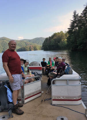
When the temp goes above 90 and rarely is there a cloud in the sky, the best place to be is floating in a duckie on the Hiwassee with lots of friends! 16 rafters were put on the river by Webb Brothers Outfitters. 6 hikers stopped with the picnic supplies at Big Bend, claimed the tables with cloths and "readied camp", then took off down river on the trail that runs back toward Benton and along the river. Right on time the floaters began to arrive @ 12:45 and helped empty the coolers which held perishables like pasta salads, deviled eggs, fresh sliced tomatoes, potato salad, fruit and watermelon, humus, chili, chocolate amaretto brownies and zuchinni bread. Master chef Bill brought the fire to just the right temp for grilling and the feasting began. Tom Long had hung a couple of hammocks and offered "free trials". It was a really good float for the rafters who pulled into takeout raving about the beauty of the river and the grand run. They were also quite appreciative of the preparation for lunch by the hikers. Back home with great memories of another good float trip on the Hiwassee were: Bill Kinnaman, Tom Weldon, Cecile Shenouda, Joyce Campbell, Jim and Linda Keown, Sue Christensen, John Dever, Stephanie Evans, Shirley Wright, Susan Garrett, Patti Giles, Suzanne Dorough, Susan Basch, Edith Behringer, Dean Hutson, Barbara McCollum, Tom Long, Angela Evans, Mary Ann Pawlowski, Renee Grace, Larry Parks, Tim Chomyn, and Che Carico reporting.
When the temp goes above 90 and rarely is there a cloud in the sky, the best place to be is floating in a duckie on the Hiwassee with lots of friends! 16 rafters were put on the river by Webb Brothers Outfitters. 6 hikers stopped with the picnic supplies at Big Bend, claimed the tables with cloths and "readied camp", then took off down river on the trail that runs back toward Benton and along the river. Right on time the floaters began to arrive @ 12:45 and helped empty the coolers which held perishables like pasta salads, deviled eggs, fresh sliced tomatoes, potato salad, fruit and watermelon, humus, chili, chocolate amaretto brownies and zuchinni bread. Master chef Bill brought the fire to just the right temp for grilling and the feasting began. Tom Long had hung a couple of hammocks and offered "free trials". It was a really good float for the rafters who pulled into takeout raving about the beauty of the river and the grand run. They were also quite appreciative of the preparation for lunch by the hikers. Back home with great memories of another good float trip on the Hiwassee were: Bill Kinnaman, Tom Weldon, Cecile Shenouda, Joyce Campbell, Jim and Linda Keown, Sue Christensen, John Dever, Stephanie Evans, Shirley Wright, Susan Garrett, Patti Giles, Suzanne Dorough, Susan Basch, Edith Behringer, Dean Hutson, Barbara McCollum, Tom Long, Angela Evans, Mary Ann Pawlowski, Renee Grace, Larry Parks, Tim Chomyn, and Che Carico reporting.
|
Gahuti at Fort Mountain, Saturday July 15, 2017
After carefully checking weather predictions for July 15th, even with the threat of afternoon thunderstorms looming, we decided to go ahead with the hike. We met Saturday morning at 7:30am to carpool to the Gahuti Trail. We were on the trail by 8:30am. We started the trail at the entrance to Fort Mountain State Park and walked up to the Gahuti Trail parking lot then around. This is counter clock wise to the usual way we hike. The temperature was in the low 80’s but a little humid. The trail was slippery from Friday’s rain. Several hikers slipped during this section, but nothing major. We ate lunch at the waterfall. I have never seen the waterfall this beautiful. Thanks to all the rain this summer. Luckily, we made it back to our cars right before the rain started! Great day and thanks to everyone for making this a great hike! Hikers that attended: Rick Glisson, Tim Choymn, Joyce Campbell, Boe Rudder, Merry and Diehl Boggs. |
|
Shackleford Ridge Park, Wednesday July 12, 2017
Thank you Sam Powell and Bill Fronk for the system of trails you created at Shackleford Ridge Park on Signal Mountain! You can find maps for the trails online and today we followed the map beginning at Noland School on the blue trail. It was cool enough in the forest on this summer day as we circled around to the spur trail to Mushroom Rock. Most of the hikers did take this 1.1 mile trail to the rock and back to then to resume on the blue trail. After crossing the swinging bridge, we made a left hand turn. When the yellow trail forked off this trail, we took the right fork and soon crossed over the covered bridge. Picking up the blue trail again, it was a short walk back to the cars. Many improvements are in evidence: lots of benches and bridges along the trail and newly built steps from the parking lot at the soccer fields down to the trail. Enjoying this morning only hike and on to Southern Star for lunch were: Patti Giles, Wayne Chambers, Boe Rudder, Suzanne Dorough, Linda Keown, Bill LaRouque, Cecile Shenouda, Bob Rahn, Jenny Hopper, Susan Basch, Renee Grace, Bailey Phillips, Hallie Fuller, Weston Carico, Ellie Carico, Emery Carico, Bill Kinnaman, Hank Konigsmark, Sue Christensen, Teresa Dean, Tom Weldon, Mac Dean, Edith Behringer, Jenny Hopkins, and Che Carico reporting. |
|
Berry College, Saturday July 8, 2017
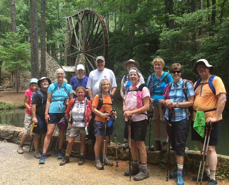
Thirteen hikers enjoyed the trails as well as historic sites and structures of Berry College near Rome, Georgia. Two options were offered for the climb to the highlight of Lavender Mountain--the House O’ Dreams, the mountaintop retreat built in 1922 for the founder of the college, Martha Berry. Those who chose the more difficult route were not disappointed. Who knew a climb to 900 feet above sea level could leave you breathless? All hikers met up at the summit to enjoy the lush gardens, beautiful vistas, and the nice facilities nicknamed the “Outhouse O’ Dreams”. After a snack break and a tour of the home, it was on to the mountain reservoir where all enjoyed having lunch besides the shores of the lake made possible by donations to the school from Henry Ford. The hike concluded at the Old Mill which is one of the most photographed spots on Berry’s 26,000 acres. After-hike refreshments at Jandy’s Yogurt helped to cool off everyone before the return trip to Chattanooga. Hikers included Diehl and Merry Boggs, Devin (a friend of the Boggs), Tim Chomyn, Shelly Claiborne, Edith Behringer, Susan Basch, Betsy Parson, Joyce Campbell, Steve Barnes, Lawana Pitts, and Greg and Barbara McCollum, leading. |
Big Soddy Creek Gulf, Wednesday July 5, 2017
Weather had been iffy, but finally there appeared a window of opportunity in the radar and the hike was definitely on. Fifteen hikers set out from Big Soddy Creek Gulf off Back Valley Road, a recreation area owned by the City of Soddy-Daisy and enjoyed by many locals. The first leg of the hike was on the wide gravel path along Big Soddy Creek now full of water and tumbling over rocks after all the recent rain. Reaching Board Camp Creek, we followed it for a pleasant stretch, then found a few downed small trees to climb over before reaching the Cumberland Trail portion of the hike. The CT was much overgrown from recent rains, a few slippery rocks here and there kept one’s attention, and the humidity of the warm morning soaked in. Along the CT we saw vividly colored mushrooms and a spotted fawn on the move. We paused for a bit at Big Soddy Creek Bridge, the 100 ft suspension bridge completed in 2015, and then moved eagerly back to our starting point to enjoy lunch at a picnic table along Big Soddy Creek. (We had missed Che during the hike, and there was disappointment at the lack of chocolate also!) Despite all the recent rain which had enhanced the waterfall cascading along the Big Soddy Creek path, the characteristic greens and turquoises of the pools along Big Soddy and Board Camp Creeks were as beautiful as ever. No one decided to jump in for a swim however. As the last of the group were getting into their cars at the parking lot, a cool breeze blew in with dark clouds. Rain and thunderstorms moved in over the surrounding areas not long after we were on our way. Glad to have had a chance to hike during a break in the rainy weather were Susan Basch, Suzanne Dorough, Patti Giles, Bob Rahn, Wanda McCarter. Linda Keown, Susan Garrett, Kathy Seymour, Sue Christensen, Wendy Gunn, Lori Holland, Stormy McGauley, Shirley Wright, with Edith Behringer and Renee Grace leading.
Weather had been iffy, but finally there appeared a window of opportunity in the radar and the hike was definitely on. Fifteen hikers set out from Big Soddy Creek Gulf off Back Valley Road, a recreation area owned by the City of Soddy-Daisy and enjoyed by many locals. The first leg of the hike was on the wide gravel path along Big Soddy Creek now full of water and tumbling over rocks after all the recent rain. Reaching Board Camp Creek, we followed it for a pleasant stretch, then found a few downed small trees to climb over before reaching the Cumberland Trail portion of the hike. The CT was much overgrown from recent rains, a few slippery rocks here and there kept one’s attention, and the humidity of the warm morning soaked in. Along the CT we saw vividly colored mushrooms and a spotted fawn on the move. We paused for a bit at Big Soddy Creek Bridge, the 100 ft suspension bridge completed in 2015, and then moved eagerly back to our starting point to enjoy lunch at a picnic table along Big Soddy Creek. (We had missed Che during the hike, and there was disappointment at the lack of chocolate also!) Despite all the recent rain which had enhanced the waterfall cascading along the Big Soddy Creek path, the characteristic greens and turquoises of the pools along Big Soddy and Board Camp Creeks were as beautiful as ever. No one decided to jump in for a swim however. As the last of the group were getting into their cars at the parking lot, a cool breeze blew in with dark clouds. Rain and thunderstorms moved in over the surrounding areas not long after we were on our way. Glad to have had a chance to hike during a break in the rainy weather were Susan Basch, Suzanne Dorough, Patti Giles, Bob Rahn, Wanda McCarter. Linda Keown, Susan Garrett, Kathy Seymour, Sue Christensen, Wendy Gunn, Lori Holland, Stormy McGauley, Shirley Wright, with Edith Behringer and Renee Grace leading.
|
Little Hump, Big Hump on the AT in the Roan Highlands, Thursday June 29, 2017
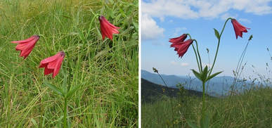
We originally planned this expedition a week earlier, but a threat of thunderstorms caused us to cancel. But a few were doggedly determined to mark this one off their list, and the leader was in the mood for another visit, so we changed our motel reservations and went a week later. After a great dinner at Cootie Brown’s in Johnson City and a good night’s motel sleep, we wound our way along the convoluted drive to the still relatively obscure trailhead to begin our hike at the Overmountain Shelter, aka the Red Barn. There we met several backpackers, mostly from Indiana - one of them took a group picture for us; before the day was over we wondered who stayed home to mind the store in Indiana! Right off the bat we got a good taste of high country grassy bald hiking, climbing steeply with nary a switchback in sight; but we stopped a few times to look back at the Red Barn as it seemed to shrink down to the size of a postage stamp, and that encouraged us to think that we really were making progress. After some ridgeline hiking in the woods, we then reached Little Hump, our second grassy bald, and were soon at its highest point. There were great views in most directions, but the most impressive view was Big Hump looming ahead to the north. After descending through the woods, we came out into the clearing just above Bradley Gap at the base of Big Hump, where we could see the trail (still no switchbacks!) as it meandered toward the horizon. In the early part of the climb our spirits were boosted by a beautiful stem of Gray’s Lily, which grows only in the high country of that region. We resolutely plugged along, trying to ignore a couple of false summits, and again looking behind us to gauge our progress, until we finally did reach the top of Big Hump, with its magnificent 360-degree views. The grassy bald continues on northward, seemingly forever. After lunch and some lingering to soak up the experience, we returned the way we had come, enjoying the fact that it was mostly downhill now. A sighting of a little fawn in the woods just off the trail pretty much put the cap on a great hike. When the Red Barn came into view far below us, I decided to name that stretch “Our Victory Lap”! And then we celebrated with another dinner at Cootie Brown’s on the way home. Thanks to Merry and Diehl Boggs and Kathy Seymour for nudging me to lead it, and for nudging me several more times when I needed it along the trail; John Rowland reporting. |
|
Roaring Creek Trail to Brush Creek, and lunch at Trish Appleton’s home, Wednesday June 28, 2017
The Chattanooga Hiking Club is blessed by opportunities to hike and reunite with former hikers in a social setting. Such was this day as we planned a short hike along Roaring Creek. Bypassing the upturn to Graysville Mountain and the continuing stretching of the Cumberland Trail, the hikers continued creek side to Brush Creek. You can ford Brush Creek and get a view of a lovely waterfall, but not today. The long line of hikers turned here and headed back to go hungrily to the home of Trish Appleton and the covered dish lunch planned. Great trees provided shade and a breeze came off the lake making a cool site for folding chairs, great food, and catching up. Especially welcomed was Val Hargis who packed up in a 5th Wheel with husband Carl 3 years ago to roam the US! So glad she was in Chattanooga for this reunion time on the lake with old hiking friends. Boe Rudder had begun his hike several hours earlier and went up the mountain to the first overlook on top of the mountain and back, rejoining Rough Creek in time to encourage the hikers now coming up the Rough Creek trail. Joyful for a great day, a great picnic site, and the great hospitality of Trish were: Alicia, Emery, Ellie and Weston Carico (Che's family), Mac Dean, Teresa Dean, Edith Behringer, Bill LaRoque, Susan Garrett, Stormy McGauley, Renee Grace, Susan Basch, Patti Giles, Shirley Wright, Tim (brownie man!!) Chomyn, Boe Rudder, Donald and Madelaine Box, Suzanne Dorough, Sue Christensen, Melba Smothers, Charlie Breeding, Doug Graydon (back on the trail!), Linda Keown, Val (5th Wheel) Hargis, and Che Carico reporting.
The Chattanooga Hiking Club is blessed by opportunities to hike and reunite with former hikers in a social setting. Such was this day as we planned a short hike along Roaring Creek. Bypassing the upturn to Graysville Mountain and the continuing stretching of the Cumberland Trail, the hikers continued creek side to Brush Creek. You can ford Brush Creek and get a view of a lovely waterfall, but not today. The long line of hikers turned here and headed back to go hungrily to the home of Trish Appleton and the covered dish lunch planned. Great trees provided shade and a breeze came off the lake making a cool site for folding chairs, great food, and catching up. Especially welcomed was Val Hargis who packed up in a 5th Wheel with husband Carl 3 years ago to roam the US! So glad she was in Chattanooga for this reunion time on the lake with old hiking friends. Boe Rudder had begun his hike several hours earlier and went up the mountain to the first overlook on top of the mountain and back, rejoining Rough Creek in time to encourage the hikers now coming up the Rough Creek trail. Joyful for a great day, a great picnic site, and the great hospitality of Trish were: Alicia, Emery, Ellie and Weston Carico (Che's family), Mac Dean, Teresa Dean, Edith Behringer, Bill LaRoque, Susan Garrett, Stormy McGauley, Renee Grace, Susan Basch, Patti Giles, Shirley Wright, Tim (brownie man!!) Chomyn, Boe Rudder, Donald and Madelaine Box, Suzanne Dorough, Sue Christensen, Melba Smothers, Charlie Breeding, Doug Graydon (back on the trail!), Linda Keown, Val (5th Wheel) Hargis, and Che Carico reporting.
|
Buggy Top/Carter Cave, Wednesday June 21, 2017
Twelve hikers started out on this reported to be 2 miles in and 2 miles out trail near Sewanee. At the end, most agreed the longest 4 miles they had ever hiked! Upon hiking down to the Buggy Top (Carter Cave) entrance it was decided all (armed with flashlights) would enter the cave entrance, rock hop rather swift and somewhat deep water, and begin the accent up and through this section to the almost imperceptible light shining from above. Doing this added to the mileage. It was harder than remembered because it seemed lots of rocks had shifted and finding a clear path was difficult. The new to this experience hikers either said it was their FAVORITE trail and experience or glad they had done it but never again! One corn snake was found and played with by Renee and one rattlesnake was discovered on a ledge and carefully avoided. New plants spotted today were Witch Hazel and Wild Petunia. Another white flower is as not yet identified. Lots of fern fields today and a pretty trail with areas of difficult rock underfoot. As usual as you walked into the presence of Buggy Top it felt like an air conditioner had been turned on! On to lunch at Shenanigan's and then the outfitter store. Rain began to pour as these happy hikers started home: Renee Grace, Wayne Chambers, Bob Rahn, Cecile Shenouda, Susan Garrett, Linda Keown, Sue Christensen, Tom Carter, Boe Rudder, Stormy McGauley, Susan Basch and Che Carico reporting. |
|
Falling Water Falls and McCoy Farm, Wednesday June 14, 2017
So, it is summer now and finally the humidity is a factor as well as the higher temps. This led to the choice of a morning only hike and yet 25 hikers came out to trek it!! The maps online get better all the time, so you can find a pretty clear route to Mabbit Springs and then on to the falls. Louis was in the lead and peacefully sitting on a rock near the top of the falls by the time the end of the line got there! He and Susan led a portion of the group down and across the creek bed above the falls, up the other side, and on out the short distance to another trail head on Forest Park Drive. Wayne and Susan had fond memories of hiking into the falls from this side as children. All hiked out safely then splintered into different groups - some home, some to cool restaurant lunch, but most drove the short distance to the McCoy Farm at the top of the W Road. This old homestead has been entrusted to the Town of Walden and has been reclaimed by hardworking citizens bringing it to family recreation status. Sam Powell engineered the swinging bridge that crosses over a wetlands he so desperately wanted to protect, the Lions Club is rebuilding the blacksmith's shop and someone was working there today, Larry Mick was putting fresh paint on the pump house, and the gardens created by Master Gardeners were beautiful! This is only a "tich" of the volunteer efforts given to create this lovely venue. You can find the history of this property and family online. The McCoy Farm is open dawn to dusk and free for use by all; the property can also be rented for special events. Enjoying a nice hike and lunch somewhere were: Wayne Chambers, Susan Garrett, Debbie Lambert, Edie Behringer, Susan Basch, Freda Richie, Patti Giles, Cecile Shenouda, Linda McKeown, Charlie Breeding, Bob Rahn, Sue Christensen, Suzanne Dorough, Jenny Chandler, Teresa Dean, Mac Dean, Louis Spencer, Anne Dean, Rachel Bryant, Diehl Boggs, Merry Boggs, Connie Young, Renee Grace, Stormy McGauley, and Che Carico, reporting. |
|
Possum Creek Trail, Imodium Falls, Saturday June 10, 2017
A group of five hikers conquered the Janet M Hale Trail (aka Possum Creek Trail). Weather was perfect. The trail was 10.2 miles and we completed it in 4 ½ hours including a lunch break. We did not set out to hike quickly, but we were all lost in conversations and forgot the pace of our hiking. This hike is a car shuttle hike. I believe this hike is as beautiful as many of the Smoky Mountain hikes. The landscape changes at least five times during the hike. We crossed several bridges, one water crossing, a pine tree section, rocky section, and Imodium Falls. We did come across a large black snake. On the way back to pick up a car at the start of the trail, we came across a large black bear on the side of the road. We are all glad to be in our car. I am always amazed that this trail is in our backyard. Hikers today were: Joyce Campbell, Steven Miller, and Rick Glisson, and Diehl and Merry Boggs, reporting. |
Chilhowee Mountain: Azalea, Red Leaf, Slick Rock trails, and Benton Falls, Wednesday June 7, 2017
Since the flame azaleas were so brilliant on Jenkins Ridge trail, we went in search of them on Chilhowee Mountain. Only a few were spotted, mountain laurel was fading, while a few rhododendrons were fresh. The route we took was different from previous hikes in this beautiful park and campground. It also left lots of room for choosing your own distance. Some chose to include the Slick Rock trail, others hiked on down to the falls then out, and at least one hiked out and around the lovely lake. Water was running fast in all creeks and it was observed that the falls had more water than ever seen before. The air was so clear that the overlooks were amazing at the pull offs on the way up and on the way down the mountain. The joy of leading hikes comes from the new hikers and their joy. Such was today as in this familiar area we still had new hikers! Inspired by Renee and her yoga routine on the big rock at the top of Benton Falls were: Bill Needham, Sue Christensen, Kathy Seymour, Wayne Chambers, Suzanne Dorough, Edie Behringer, Susan Basch, Bob Rahn, Patti Giles, Sandy Fenton (appearing fully restored after her auto accident), Shirley Wright, and Che Carico reporting.
Since the flame azaleas were so brilliant on Jenkins Ridge trail, we went in search of them on Chilhowee Mountain. Only a few were spotted, mountain laurel was fading, while a few rhododendrons were fresh. The route we took was different from previous hikes in this beautiful park and campground. It also left lots of room for choosing your own distance. Some chose to include the Slick Rock trail, others hiked on down to the falls then out, and at least one hiked out and around the lovely lake. Water was running fast in all creeks and it was observed that the falls had more water than ever seen before. The air was so clear that the overlooks were amazing at the pull offs on the way up and on the way down the mountain. The joy of leading hikes comes from the new hikers and their joy. Such was today as in this familiar area we still had new hikers! Inspired by Renee and her yoga routine on the big rock at the top of Benton Falls were: Bill Needham, Sue Christensen, Kathy Seymour, Wayne Chambers, Suzanne Dorough, Edie Behringer, Susan Basch, Bob Rahn, Patti Giles, Sandy Fenton (appearing fully restored after her auto accident), Shirley Wright, and Che Carico reporting.
Hiwassee River area work day, Saturday June 3, 2017
The CHC and a number of other regional clubs participated in the National Trails Day event sponsored by the Ocoee/Hiwassee Ranger District. More than 20 maintainers participated in the effort on a warm but pleasant day. The work focused on brushing out the Fisherman’s trail on the southern bank of the Hiwassee River. The trail was overgrown but there was plenty of shade as well as the refreshing sound of the stream flowing nearby. The USFS did a fine job of planning and the team completed cutting and clearing nearly a mile and a half of trail. After the work was finished the Rangers provided a deluxe cookout at the Quinn Springs Recreation Area. CHC participants included Bill Kinnaman, J.D. Dickinson, Ralph Van Pelt and Steve Barnes, reporting.
The CHC and a number of other regional clubs participated in the National Trails Day event sponsored by the Ocoee/Hiwassee Ranger District. More than 20 maintainers participated in the effort on a warm but pleasant day. The work focused on brushing out the Fisherman’s trail on the southern bank of the Hiwassee River. The trail was overgrown but there was plenty of shade as well as the refreshing sound of the stream flowing nearby. The USFS did a fine job of planning and the team completed cutting and clearing nearly a mile and a half of trail. After the work was finished the Rangers provided a deluxe cookout at the Quinn Springs Recreation Area. CHC participants included Bill Kinnaman, J.D. Dickinson, Ralph Van Pelt and Steve Barnes, reporting.
|
Eagle Creek, Spence Field, Jenkins Ridge backpack, Thursday-Saturday June 1-3, 2017
The weather a week before this hike experience was gloomy with rain and thunderstorms for sure in the forecast. The two days of hiking, however, turned out to be cool enough for summer days and rain free! Steve Claxton met us at Cable Cove for transport across the lake to the Eagle Creek trailhead. Eagle Creek started out fairly level but with 18 swift and calf-to- knee depth crossings in the first 4.9 miles. So, lots of energy spent staying upright and dry in the crossings. Lunch was refreshing at campsite 97 in an island setting with lots of logs for seating. Then the remaining 4 miles began unrelenting uphill! The stronger hikers seemed not to mind and reached the water source for Spence Field at least an hour and a half before this first-time backpacker! What a joy to finally reach this point, 0.1 miles from my sleeping quarters! Packs were emptied, "beds made", dinner served, and a fire built. We all settled in after enjoying the fire for a while, listening to tall tales, and toasts and singing. Next day after breakfast and breaking camp this line of 11 hikers started the short uphill access to the AT and then Jenkins Ridge which was "downhill all the way". Right! Downhill along narrow trail overgrown with tall blackberry vines (two hikers slipped off the trail several feet because so narrow and could not see where to plant next step), steep uphill short distance, steep downhill, short uphill quite steep again, a brief leveling then a long downhill (so steep you had to plant your poles out front to put on your brakes) which finally bottomed out. As all regrouped at the junction with Hazel Creek trail, many stretched out on picnic tables and all said, "toughest two trails ever hiked back to back", and, "I'll never do that Stinking Jenkins trail again!" (But an unexpected blessing for Stinking Jenkins were the rhododendrons blooming on the bald as the trail began and the brilliant flame azaleas along the trail. The bald reminded us of Gregory Bald.) From here we still had 4 roadbed miles to go to reach the site of our ride back across Fontana Lake to Cable Cove. New backpackers and experienced ones included: John Hyler, Rick Glisson, Barbara McCollum, Betsy Parson, Bonnie Smith, Monty Simmons, Carolyn Brannon, Cathy Love, Terri Holcomb, Che Carico reporting and Wayne Chambers leading. Thanks to Monty Simmons for carrying my pack AND his at least 4 miles when I developed a muscle spasm on the downhill of Jenkins Ridge and could not stand upright to hike out. Then, as my pack weight had been distributed to hikers waiting at campsite 84, they rounded up a cart and Wayne and Terri pulled me down the 4 miles of Hazel Creek roadbed to the edge of the lake! Carolyn diagnosed my hard-as-a-rock lower left back muscle spasm, Terri and Cathy shared water and electrolytes, and the others expressed great concern for the situation all the while carrying parts of my gear in order to relieve Monty of the full burden. Never will I forget and never can I thank them enough! Che |
|
Ochs Gateway to Skyuka Springs to Kiddie Trail trailhead, Wednesday May 31, 2017
It was a good day to take this route previously suggested by Charlotte McNabb. Coming from the Gateway, instead of turning right and heading toward Sunset Rock, we turned left and proceeded gently downhill to Skyuka Springs - well marked to the Springs at the end of the Lower Truck trail and a better sign now indicating the Skyuka Springs trail back to highway. Summer flowers included spider wort, lots of ferns, coreopsis, and ever faithful bluets. The Springs had more water than noted on previous hikes passing by. A brief snack rest here then onto the Lower Truck trail to trek on out. A group stopped and lingered at lunch at the gazebo where a brown thrasher nervously tried to deliver food to her babies in a nest box hanging there. Others went on with the mission of retrieving cars from Ochs Gateway and lunch at the Purple Daisy. The Gazebo lunch group did also take time to circle around to the wildlife preserve. The endangered and protected Red Wolves were up and roaming to the delight of those who had not visited this compound before. It was a good day enjoyed by: Barry Ligon, Beverly Ligon, Bob Rahn, Linda Keown, Merry Boggs and Diehl Boggs who extended their hike by starting up the Kiddie Trail and meeting us at the springs, Patti Giles, Susan Garrett, Suzanne Dorough, Teres Dean, Wanda McCarter, Wayne Chambers, Wendy Gunn, Susan Basch, Barbara Miller, Boe Rudder, and Che Carico reporting.
It was a good day to take this route previously suggested by Charlotte McNabb. Coming from the Gateway, instead of turning right and heading toward Sunset Rock, we turned left and proceeded gently downhill to Skyuka Springs - well marked to the Springs at the end of the Lower Truck trail and a better sign now indicating the Skyuka Springs trail back to highway. Summer flowers included spider wort, lots of ferns, coreopsis, and ever faithful bluets. The Springs had more water than noted on previous hikes passing by. A brief snack rest here then onto the Lower Truck trail to trek on out. A group stopped and lingered at lunch at the gazebo where a brown thrasher nervously tried to deliver food to her babies in a nest box hanging there. Others went on with the mission of retrieving cars from Ochs Gateway and lunch at the Purple Daisy. The Gazebo lunch group did also take time to circle around to the wildlife preserve. The endangered and protected Red Wolves were up and roaming to the delight of those who had not visited this compound before. It was a good day enjoyed by: Barry Ligon, Beverly Ligon, Bob Rahn, Linda Keown, Merry Boggs and Diehl Boggs who extended their hike by starting up the Kiddie Trail and meeting us at the springs, Patti Giles, Susan Garrett, Suzanne Dorough, Teres Dean, Wanda McCarter, Wayne Chambers, Wendy Gunn, Susan Basch, Barbara Miller, Boe Rudder, and Che Carico reporting.
|
Foster Falls, Wednesday May 17, 2017
The trail chosen for today's hike was the new Denny Cove trail on the mountain near Foster Falls. Thanks to Bob Butters we were warned that the trail is currently still closed during the week - open now only on weekends. The road leading to this trail is only a mile from the Foster Falls State Park and that became plan B. We had already planned to go there after the Denny Cove hike to have a picnic birthday lunch to celebrate Ray Myers 85th and friends old and new! This area offered options for everyone - some hiked the entire Climber's Loop, circling back along the rim while others took the first exit of the Climber's Loop and circled back to the trail head along the rim. Everyone made the trip down to the water falls which were running with lots of water. There were reports of wildflowers blooming along the trail, ferns, and no snakes (one snakeskin) were reported. Remember if you go, the trail will be rough with rocks and roots down in the Climber's Loop with easier walking along the rim. The falls are splendid and worth the trip down. The tables were laden with great food! New hikers were pleased to meet Ray and he was pleased to see how easy it was to become friends with the new hikers. Lots of long time hungry hikers also enjoyed watching Ray blow out the one candle on his cake! Planning to come again when the new trail is open during the week: Ray Myers, Donald Box, Madelaine Box, Jenny Hopkins, Susan Garrett, Stormy McGauley, Karen Rahn, Bob Rahn, Linda Keown, Sue Christensen, Renee Grace, Larry Parks, Shirley Wright, Tom Carter, Betsy Parson, Gary Petty, Bill Kinnaman, Jean Dickinson, Bill LaRoque, Edith Behringer, Patti Giles, Trish Appleton, Mary Ann Langevin, and Che Carico reporting. |
|
Cumberland Trail, Boston Branch, Wednesday May 10, 2017
15 hikers started out on the Upper Hogskin Loop toward Boston Branch Overlook and an intersection with Stevenson Branch Trail. The trail goes through an old coal mining area. We passed through the remains of a coal tipple and past the start of a mine. Just beyond that was a major challenge. A large swarm of yellow jackets was guarding the trail. Fortunately, there was a way around them up against the cliff wall. We continued on to the Boston Branch Overlook with its spectacular views. The stairs and ramp just past the overlook have been rebuilt and are much better than before. Climbing the stairs brought us to an old roadbed. We followed that for about a mile. In the section where the abandoned mining equipment was stacked Charlie got a nice surprise from a bunch of snakes. He quickly moved back to the trail. We continued on to where the trail crossed a large branch. A tree had fallen across the cable guides and most did not attempt to cross. A small group (Stormy, Bill and Susan) explored the proposed new section that will connect with Montlake. The distance to that point is about 3.2 miles. We ate lunch there near a small waterfall. The return trip was uneventful other than Stormy walking me into the ground. We took the Lower Hogskin Loop on the return trip. It was a beautiful day for a hike but was the first really hot day of the season. Hikers were Betsy Parson, Bill LaRoque, Bill Needham, Bob Rahn, Carla Schunk, Charlie Breeding, Edith Behringer, Linda Keown, Mary Ann Langevin, Stormy McGauley, Susan Garrett, Suzanne Dorough, Allen Dance, Wanda McCarter, and Boe Rudder reporting. |
Black Mountain, Wednesday May 3, 2017
A web comment about this section of the Cumberland Trail is that "it is a beast!" Maybe so with some uneven ground and quite an uphill haul from Windless Cave to the top, but the trip is well worth it! The flowers are always splendid and the new access trail to Windless Cave is beautifully laid out and easy to follow. By following the white blazes, you will find yourself starting the uphill trek, passing through huge boulders typical for the Cumberland Plateau, and emerging on top. Continue following the white blazes and bear right, continuing on the blazed trail to find the boulders and overlook for lunch and rest. There is a loop (1.5 miles) on the mountain top which can be accessed by driving up. This makes an easy trip for those not wanting the long hike from below. Noted today were yellow trillium, larkspur, wood sorrell, star chickweed, fire pink, very tall may apples with huge white blooms, and our beloved pink lady slippers! It was home via Frazier's Produce in Sale Creek where the owners had set aside flats of freshly picked strawberries - we had called ahead to reserve. Feeling good about a sunshiny day and breezes that lessened the effects of a forecast of 80+ high were: Wayne Chambers, Susan Garrett, Tim Chomyn, Bill LaRoque, Bob Rahn, Wanda McCarter, Boe Rudder, Diehl Boggs, Teresa Dean, Mac Dean, Larry Parks (back on the trail after knee surgery), Suzanne Dorough, Edith Behringer, Stormy McGauley, Mary Ann Langevin, and Che Carico, reporting.
A web comment about this section of the Cumberland Trail is that "it is a beast!" Maybe so with some uneven ground and quite an uphill haul from Windless Cave to the top, but the trip is well worth it! The flowers are always splendid and the new access trail to Windless Cave is beautifully laid out and easy to follow. By following the white blazes, you will find yourself starting the uphill trek, passing through huge boulders typical for the Cumberland Plateau, and emerging on top. Continue following the white blazes and bear right, continuing on the blazed trail to find the boulders and overlook for lunch and rest. There is a loop (1.5 miles) on the mountain top which can be accessed by driving up. This makes an easy trip for those not wanting the long hike from below. Noted today were yellow trillium, larkspur, wood sorrell, star chickweed, fire pink, very tall may apples with huge white blooms, and our beloved pink lady slippers! It was home via Frazier's Produce in Sale Creek where the owners had set aside flats of freshly picked strawberries - we had called ahead to reserve. Feeling good about a sunshiny day and breezes that lessened the effects of a forecast of 80+ high were: Wayne Chambers, Susan Garrett, Tim Chomyn, Bill LaRoque, Bob Rahn, Wanda McCarter, Boe Rudder, Diehl Boggs, Teresa Dean, Mac Dean, Larry Parks (back on the trail after knee surgery), Suzanne Dorough, Edith Behringer, Stormy McGauley, Mary Ann Langevin, and Che Carico, reporting.
|
Smokies Cataloochee area, Friday-Sunday April 21-23, 2017
Another trip to the Great Smoky Mountains was successful for 15 members of the club and one guest from the Over the Hill Hiking Group (OHHG) of Decatur, Georgia. The trip included day hiking, backpacking, wildflowers, historical structures, cemeteries, stream crossings, socializing, dining, and fun for all! Friday’s 11-mile hike involved a complicated shuttle between Mt. Sterling Gap and Pretty Hollow Gap in Cataloochee, but an overnight stay on Thursday in Newport, Tennessee helped with the early morning shuttle and the 9:00 a.m. start time was accomplished. Friday’s hike started with a 400-foot climb out of Mt. Sterling Gap to the Long Bunk trail. Along the descent, the Long Bunk trail was a spectacular display of wildflowers. From Trillium to Nodding Mandarin, it was a botanical delight. At the intersection of Long Bunk and Little Cataloochee, the map markers were intent on completing that 1 mile section to Mt. Sterling Road while others headed on to the Little Cataloochee Baptist Church for lunch. Afterwards, it was up hill on the Little Cataloochee trail before descending into Pretty Hollow Gap. The fast hikers were able to help with the after-hike shuttle. Nonshuttle hikers enjoyed hanging out in the Beech Grove School (circa 1901), built along the banks of Palmer Creek, during a rain shower while waiting for the shuttle cars to arrive. Enjoying the trails and historical sites in Little Cataloochee Valley were Angela Evans, Betsy Parson, Bill Needham, Boe Rudder, Bonnie Smith, Che Carico, John Hyler, Monty Simmons, Rick Glisson, Sonja Parker, Tim Chomyn, Tom Long, Tom Sewell (OHHG), Wayne Chambers, and Barbara McCollum. Historical sites along the trails included Hannah Cemetery, Hannah Cabin, Dan Cook Cabin, and the Little Cataloochee Baptist Church and cemetery. Seven hikers spent Friday night in Maggie Valley and started Saturday morning with a delicious breakfast at Joey’s Pancake House voted “Best Pancake House in North Carolina.” Saturday’s hike started at Beech Gap I at Round Bottom. It was a 2,000 foot climb to the Balsam Mountain trail and on to the Laurel Gap Shelter for lunch. Three club backpackers (Bonnie Smith, Ken Smith, and Barbara McCollum) claimed their spot in the shelter before continuing on in pursuit of the 11.6 miles in and out on the Balsam Mountain Trail. Four day hikers (Che Carico, Tim Chomyn, Betsy Parson, and Monty Simmons) continued on to the Mt. Sterling Ridge Trail and descended into Cataloochee on the Pretty Hollow Gap Trail which also provided a spectacular showing of wildflowers including a most abundant display of Stone Crop. (From Che: Star chickweed, spring beauty and trout lilies blooming as far into the forest as the eye could see. Also spotted about 100 feet up the Beech Gap trail were at least 5 painted trillium. There were "patches" of dutchman's britches and squirrel corn larger than any of us had ever seen! Breathtaking beauty!!!) Day hikers ended the day with 14+ miles, a nice dinner in Maggie Valley, and retrieval of the other shuttle car at Round Bottom. All day hikers were pleased to mark off 3 more trails despite a late-night return home. A deluge of rain on Saturday night made for a cozy night in the Laurel Gap Shelter along with 8 others including a well-behaved Boy Scout troop from Asheville, NC. Saturday’s mileage for the backpackers was 16+ miles. Rain continued on Sunday morning for a soggy return to Pretty Hollow Gap via Mount Sterling Ridge trail. Four stream crossings didn’t deter the backpackers and a few more marked trails equals happy hikers. The two hikers who hiked all three days (Bonnie Smith and Barbara McCollum) racked up 36 miles while the Friday and Saturday day hikers racked up 25+ miles and Ken Smith, the backpacker, hiked 26 miles. Special thanks to Tom Long for formulating Friday's shuttle plan and to all drivers (Angela Evans, Che Carico, Tim Chomyn, Tom Long, Tom Sewell, and Bonnie Smith) who helped to make another successful trip to the Smokies. Barbara McCollum, reporting. |
|
Lula Lake work day and hike, Wednesday April 19, 2017
We met Ronnie Hilburn at the Lula Lake work shed, then piled into the fewest vehicles possible and crossed the road to the site of a new trail system that will connect the Lula Lake property to Covenant College. Armed with loppers and clippers we vigorously attacked the many exposed large roots in the trail. We made considerable progress over a couple of hours, then as planned, we switched over to hiking the rest of the loop, being treated to the sight of many beautiful pink wild azaleas along the way. Most of us then adjourned to Café on the Corner on Lookout Mountain for lunch, and enjoyed a most pleasant reunion with Richard Park. Thanks for all their hard work to Barbara Miller, Betsy Parson, Bill Kinnaman, Bob Rahn, Jenny Hopkins, Linda Keown, Mac Dean, Teresa Dean, Renee Grace, Patti Giles, Wanda McCarter, and Che Carico. John Rowland reporting.
We met Ronnie Hilburn at the Lula Lake work shed, then piled into the fewest vehicles possible and crossed the road to the site of a new trail system that will connect the Lula Lake property to Covenant College. Armed with loppers and clippers we vigorously attacked the many exposed large roots in the trail. We made considerable progress over a couple of hours, then as planned, we switched over to hiking the rest of the loop, being treated to the sight of many beautiful pink wild azaleas along the way. Most of us then adjourned to Café on the Corner on Lookout Mountain for lunch, and enjoyed a most pleasant reunion with Richard Park. Thanks for all their hard work to Barbara Miller, Betsy Parson, Bill Kinnaman, Bob Rahn, Jenny Hopkins, Linda Keown, Mac Dean, Teresa Dean, Renee Grace, Patti Giles, Wanda McCarter, and Che Carico. John Rowland reporting.
|
Frozen Head State Park, Wednesday April 12, 2017
The hikers who came out today had never been to Frozen Head or it had been a very long time. The park is beautiful with immaculate campsites, the parking for which would accommodate long RVs as well as tents. After checking in at the ranger station and enjoying their "comfort" facilities we started out following Don Deakins from the Flat Fork trail head with Ross Gap as the first destination. The reputation for the uphill trek was proven true as we did indeed go uphill about 3.5 miles before finding a restful lunch spot beside an old mining retention pond. There were cattails growing in the water near the banks and fish of all sizes swimming lazily! Yes there was a bit more climbing ahead, along with downhill pitches along the ridge top - not so steep and not so long - until we came to the trail split and the relentless downhill stretch of the Bird Mountain trail back to the parking area. Features along the ridge top were high elevation (3100 feet) views of the surrounding mountains, Mushroom Rock, interesting but typical Cumberland Plateau rock formations as well as many wildflowers: Blood Root, Anemone, Hepatica, Star Chickweed, White and Yellow Trillium and Spring Beauty. Feeling quite accomplished for having hiked this infamous Frozen Head portion of the CT were: Bob Rahn, Edie Behringer, Susan Garrett, Charlie Breeding, Boe Rudder, Betsy Parson, Renee Grace, Barbara McCollum, Terri Holcomb, Wendy Gunn, Delores Ladd, Che Carico reporting, and Don Deakins leading. |
Wolf Creek, Saturday April 1, 2017
A few hikers met on a spring-like morning and proceeded to Cherokee National Forest. Once there we wound our way up the Ocoee Gorge, turned at the bridge to the No. 3 powerhouse, and then on uphill via FS45. The upper roads make for a winding ride to the Wolf Creek trailhead. There were a few campers alongside the road at Big Creek. After slipping on our boots and looking at the now expired wildfire information in the signboard we climbed the first uphill section where we often do trail maintenance. This section looked good except for several blowdowns that Bill and JD elected to saw and remove. We proceeded up the ridge and occasionally stopped to enjoy the distant views from this scenic trail. The day was sunny with very few clouds in the sky and the temperature was mild with an occasional breeze. We stopped at the Junction with the Chestnut Mtn. trail and enjoyed a brief snack before proceeding back downhill. Bill and JD had made good progress on the branch removal and they joined in on the rest of the downhill trek. We drove back downwards and along the gorge where water was diverted from generation and released from the dam to provide for whitewater for rafters and kayakers downstream of the dam and through the 1996 Olympic whitewater course. Those enjoying the refreshing weather and sublime views were Jean Dickinson, Bill Kinnaman, Kathy Seymour, Boe Rudder and Steve Barnes, reporting.
A few hikers met on a spring-like morning and proceeded to Cherokee National Forest. Once there we wound our way up the Ocoee Gorge, turned at the bridge to the No. 3 powerhouse, and then on uphill via FS45. The upper roads make for a winding ride to the Wolf Creek trailhead. There were a few campers alongside the road at Big Creek. After slipping on our boots and looking at the now expired wildfire information in the signboard we climbed the first uphill section where we often do trail maintenance. This section looked good except for several blowdowns that Bill and JD elected to saw and remove. We proceeded up the ridge and occasionally stopped to enjoy the distant views from this scenic trail. The day was sunny with very few clouds in the sky and the temperature was mild with an occasional breeze. We stopped at the Junction with the Chestnut Mtn. trail and enjoyed a brief snack before proceeding back downhill. Bill and JD had made good progress on the branch removal and they joined in on the rest of the downhill trek. We drove back downwards and along the gorge where water was diverted from generation and released from the dam to provide for whitewater for rafters and kayakers downstream of the dam and through the 1996 Olympic whitewater course. Those enjoying the refreshing weather and sublime views were Jean Dickinson, Bill Kinnaman, Kathy Seymour, Boe Rudder and Steve Barnes, reporting.
|
Smokies Forney Ridge, Springhouse Branch, Noland Creek, Saturday April 1, 2017
Sixteen hikers enjoyed a picture perfect day in the Smokies. From the Ooltewah departure, to the prehike shuttle preparations and meetup at Clingmans Dome, everything went as planned. It was a foggy start on the newly-reopened Clingmans Dome Road, but the nearer we drove to the top, the more brilliant the sky became which served as a warm welcome to the highest point in the Smokies. Tom, Diehl, Merry, Bonnie, and Ken were instrumental in setting up a successful shuttle by meeting earlier in the day at the Noland Creek trailhead. Temperatures were in the low 40’s when 15 hikers began the descent on the Forney Ridge trail while reliable Sherpa Tom returned to Noland Creek to hike in and meet the group. A quick stop at Andrews Bald, one of two maintained balds in the park, provided a beautiful spot for a group photo. After leaving Andrews Bald, the trail became a bit eroded and rocky for about a half mile. A sunny section of the Forney Ridge Trail was selected for lunch before continuing on to the Springhouse Branch trail. The further we descended the more wildflowers we saw. From Trout Lily to Robin’s Plantain, the hike leader kept a list of all sixteen wildflowers identified by the group. At the Springhouse Branch and Noland Creek junction, everyone (including Sherpa Tom) enjoyed a nice break at the campground picnic tables before tackling the final 4.1 miles. Both Springhouse Branch and Noland Creek were abundantly flowing with all the recent rain. The hike concluded an hour ahead of schedule and everyone loaded up in the four vehicles to begin the long drive back to Clingmans Dome. It was a little cool and windy at Clingmans Dome, but everyone was happy to have accomplished 12.5 miles with over 4,000 feet in elevation descent and be headed for home before dark. We said our goodbyes and went our separate ways. Special thanks to Tom Long, Diehl and Merry Boggs, Ken Smith, and Bonnie Smith for their help in setting up the shuttle. Newcomers Jenny Hopkins and Shelly Claiborne learned about shuttle hikes while Betsy Parson, Bill Needham, Boe Rudder, Che Carico, John Rowland, Joyce Campbell, Monty Simmons, and Terri Holcomb were happy to be back in the Smokies. My heartfelt thanks to everyone for your patience and cooperation in helping to make a very enjoyable day on the trail. Barbara McCollum, reporting. |
|
|
Walls of Jericho, Wednesday March 29, 2017
Although many long time club hikers may say upon completion of this hike, "that was my last time to hike this trail!", they do line up and go again! It is so hard to resist the lure of this 3.5 mile downhill trek, then 3.5 mile uphill trek and the beautiful woodland filled with bluebells near midpoint. Always fearful of missing their peak, not so this year and several new to the trail hikers were awed. After enjoying the blue hue of the prettily blooming flowers, the trail leads one across a log bridge over Hurricane Creek and on to the Turkey Creek rock hopping/wading crossing. The trail dead ends in a canyon with cascading water and waterfalls. Getting to the most hidden waterfall requires some careful climbing up to a level above the lunch site. Hikers today did just that and found the water in the pool below the most remote waterfall to be at a record fill point. Lunch was leisurely in the sunshine with water roaring loudly enough to make conversation difficult. Then began the trek back passing again Blood Root, Anemone, Trillium, Spring Beauty, Trout Lily, Bluebells, Twin Leaf not yet blooming, Stone Crop, Hepatica and Wild Geranium. A long drive but safely home were: Patti Giles, Sonja Parker, Bob Rahn, Wanda McCarter, Barbara McCollum, Angela Davis, Suzanne Dorough, Kathy Seymour, Renee Grace, Susan Basch, Bob Butters, Boe Rudder, Mac Dean, Teresa Dean, Linda Keown, Bill Needham, Susan Garrett, Barbara Miller, Terri Holcomb, Janice Carter, Gayle Monk, Diehl Boggs, Merry Boggs, Che Carico reporting, and John Rowland leading. |
|
Piney River, Wednesday March 22, 2017
This is a favorite trail for Chattanooga hikers as it is fairly gentle underfoot, features either Duskin Creek or the Piney River all along the way, and usually has an amazing variety of wildflowers blooming. The flowers had not emerged so much but we saw one or two of many: white trillium, spring beauty, trout lily, star chickweed, blood root, anemone, yellow buckeye, hepatica, and wild geranium. The Shut In Gap Road to the Duskin Creek trail head is often so rutted that it is hazardous - likely for cars to bottom out. So we first checked out the route to Newby Camp with the idea of beginning there. From here Shut In Gap road appeared to be in good shape and we decided to give it a try and had an easy time getting to Duskin Creek after all. Lunch was at Log Camp with ample seating by the river. The biggest obstacle was the McDonald Branch crossing. There was not a lot of water, but it was running fast and enough to make the rocks very slippery. This made crossing tense and many looked up and down the branch hoping to find a safer way to cross. I wonder how many finally just stepped into the water? I know I did! Enjoying this glorious day were: Boe Rudder, Susan Basch, Suzanne Dorough, Wanda McCarter, Bill Needham, Bill Kinnaman, Bill LaRoque, Charlie Breeding, Bob Rahn, Mac Dean, Teresa Dean, Patti Giles, Renee Grace, Stormy McGauley, Susan Garrett, Wayne Chambers, Karen Ramsey, Kathy Seymour, and Che Carico, reporting.
This is a favorite trail for Chattanooga hikers as it is fairly gentle underfoot, features either Duskin Creek or the Piney River all along the way, and usually has an amazing variety of wildflowers blooming. The flowers had not emerged so much but we saw one or two of many: white trillium, spring beauty, trout lily, star chickweed, blood root, anemone, yellow buckeye, hepatica, and wild geranium. The Shut In Gap Road to the Duskin Creek trail head is often so rutted that it is hazardous - likely for cars to bottom out. So we first checked out the route to Newby Camp with the idea of beginning there. From here Shut In Gap road appeared to be in good shape and we decided to give it a try and had an easy time getting to Duskin Creek after all. Lunch was at Log Camp with ample seating by the river. The biggest obstacle was the McDonald Branch crossing. There was not a lot of water, but it was running fast and enough to make the rocks very slippery. This made crossing tense and many looked up and down the branch hoping to find a safer way to cross. I wonder how many finally just stepped into the water? I know I did! Enjoying this glorious day were: Boe Rudder, Susan Basch, Suzanne Dorough, Wanda McCarter, Bill Needham, Bill Kinnaman, Bill LaRoque, Charlie Breeding, Bob Rahn, Mac Dean, Teresa Dean, Patti Giles, Renee Grace, Stormy McGauley, Susan Garrett, Wayne Chambers, Karen Ramsey, Kathy Seymour, and Che Carico, reporting.
Fiery Gizzard Loop, Wednesday March 15, 2017
We would have loved to see a little snow, but we mostly went this time hoping for the large icicles that are so common here in winter. But with the mild temps we had in the days leading up to the hike, forget it! There were several puny little foot-long samples, but none of the big ones, and none of the icicle walls that form alongside the creek in spots. But there was plenty of water flowing, Sycamore Falls and all the cascades in the creeks were going strong, it was a beautiful day (although 21 degrees when we started!), and most of us topped off the day with lunch at Papa Ron’s in Monteagle. So another enjoyable visit to one of our favorite spots for Betsy Parson, Bill Needham, Bob Rahn, Charlie Breeding, Boe Rudder, Che Carico, Diehl Boggs, Merry Boggs, Edith Behringer, Renee Grace, Susan Garrett, Susan Basch, Katy Kirkpatrick, Thomas Kirkpatrick, Sydney Kirkpatrick, Sadie Hobbs, and John Rowland leading and reporting.
We would have loved to see a little snow, but we mostly went this time hoping for the large icicles that are so common here in winter. But with the mild temps we had in the days leading up to the hike, forget it! There were several puny little foot-long samples, but none of the big ones, and none of the icicle walls that form alongside the creek in spots. But there was plenty of water flowing, Sycamore Falls and all the cascades in the creeks were going strong, it was a beautiful day (although 21 degrees when we started!), and most of us topped off the day with lunch at Papa Ron’s in Monteagle. So another enjoyable visit to one of our favorite spots for Betsy Parson, Bill Needham, Bob Rahn, Charlie Breeding, Boe Rudder, Che Carico, Diehl Boggs, Merry Boggs, Edith Behringer, Renee Grace, Susan Garrett, Susan Basch, Katy Kirkpatrick, Thomas Kirkpatrick, Sydney Kirkpatrick, Sadie Hobbs, and John Rowland leading and reporting.
Pine Mountain Car Camp, Friday-Sunday March 10-12, 2017
Nestled in west central Georgia, the 23-mile Pine Mountain Trail follows the Pine Mountain ridge made famous by President Roosevelt and is partially located in the Franklin Delano Roosevelt State Park. The trail runs east/west between Warm Springs, Georgia and the Callaway Gardens Country Store. The trail is perfect for day hiking with many loop options, backpacking, or a one-day 23 miler if so inclined. A group of eight hikers met Friday for lunch at the Whistling Pig Barbecue in Pine Mountain, Georgia, which had been recommended by trail maintainers (the Pine Mountain Trail Association.) After setting up camp, a five-mile hike was enjoyed Friday afternoon by a couple of hikers while others enjoyed a drive into Warm Springs to see the town made famous by FDR. Everyone contributed to Friday night’s meal which included two kinds of chili with all the fixings, spinach dip, fruit salad, brownies, and blueberry pineapple crunch. A warm glowing fire was enjoyed Friday night before turning in early in anticipation of an early start for those attempting the 23 miles in one day. Highlights of the trail included several small waterfalls near Warm Springs, Dowdell Knob (FDR’s favorite picnic spot), lunch at Mollyhugger Hill, Buzzard’s Roost, and finally dinner on Saturday night at the Callaway Gardens Country Store after everyone finished hiking. Completing the 23 miles in on day were Tim, Terri, Bonnie, and Barbara. Helen completed the 23 miles in 2 days while Angela hiked 13 miles of the most scenic portions, and Tom enjoyed hiking and providing his famous Sherpa services. Ron enjoyed a little fishing and kayaking in Delano Lake. A little rain on Saturday night cut the trip short for a few, but several stayed over for a rainy night in Georgia. A great trip to this beautiful and historical area of Georgia was enjoyed by all: Tim Chomyn, Tom Long, Ron and Helen Owens, Terri Holcomb, Bonnie Smith, Angela Evans, and Barbara McCollum reporting.
Nestled in west central Georgia, the 23-mile Pine Mountain Trail follows the Pine Mountain ridge made famous by President Roosevelt and is partially located in the Franklin Delano Roosevelt State Park. The trail runs east/west between Warm Springs, Georgia and the Callaway Gardens Country Store. The trail is perfect for day hiking with many loop options, backpacking, or a one-day 23 miler if so inclined. A group of eight hikers met Friday for lunch at the Whistling Pig Barbecue in Pine Mountain, Georgia, which had been recommended by trail maintainers (the Pine Mountain Trail Association.) After setting up camp, a five-mile hike was enjoyed Friday afternoon by a couple of hikers while others enjoyed a drive into Warm Springs to see the town made famous by FDR. Everyone contributed to Friday night’s meal which included two kinds of chili with all the fixings, spinach dip, fruit salad, brownies, and blueberry pineapple crunch. A warm glowing fire was enjoyed Friday night before turning in early in anticipation of an early start for those attempting the 23 miles in one day. Highlights of the trail included several small waterfalls near Warm Springs, Dowdell Knob (FDR’s favorite picnic spot), lunch at Mollyhugger Hill, Buzzard’s Roost, and finally dinner on Saturday night at the Callaway Gardens Country Store after everyone finished hiking. Completing the 23 miles in on day were Tim, Terri, Bonnie, and Barbara. Helen completed the 23 miles in 2 days while Angela hiked 13 miles of the most scenic portions, and Tom enjoyed hiking and providing his famous Sherpa services. Ron enjoyed a little fishing and kayaking in Delano Lake. A little rain on Saturday night cut the trip short for a few, but several stayed over for a rainy night in Georgia. A great trip to this beautiful and historical area of Georgia was enjoyed by all: Tim Chomyn, Tom Long, Ron and Helen Owens, Terri Holcomb, Bonnie Smith, Angela Evans, and Barbara McCollum reporting.
Clear Creek, Rim Rock, Benton Falls, and Clemmer trails, Wednesday March 8, 2017
This loop is one Gary Smith guided our hikers on years ago! Those who hiked then and the new hikers were challenged by the elevation gain, impressed by the views from the leafless trees along the ridge and at the top, refreshed by the damp fragrance after rain the night before, and dampened a bit while rock hopping several swift but shallow stream crossings. The minimum distance was 8.4 miles while Gary Petty, Stormy, Susan Garrett, and Sandy Fenton tagged on an extra 1.8 miles by adding on the section from the Rim Rock/Clemmer intersection to Benton Falls and back. Having been kept off the trail by several rainy Wednesdays, all were in great spirits on this workout trail in the Ocoee. We did spot 2 dwarf iris in bloom, and some spotted Rainbow Falls far below from the Clemmer Trail. Enjoying a SPECTACULAR day were: Gary Petty, Kathy Seymour, Stormy McGauley, Sue Christensen, Susan Garrett, Jean Dickinson, Bob Rahn, Bill Kinnaman, Susan Basch, Barbara Miller, Edie Behringer, Sandy Fenton, Mac Dean, Teresa Dean, Wayne Chambers, Tom Long, Gary Smith, Che Carico reporting and Boe Rudder leading.
This loop is one Gary Smith guided our hikers on years ago! Those who hiked then and the new hikers were challenged by the elevation gain, impressed by the views from the leafless trees along the ridge and at the top, refreshed by the damp fragrance after rain the night before, and dampened a bit while rock hopping several swift but shallow stream crossings. The minimum distance was 8.4 miles while Gary Petty, Stormy, Susan Garrett, and Sandy Fenton tagged on an extra 1.8 miles by adding on the section from the Rim Rock/Clemmer intersection to Benton Falls and back. Having been kept off the trail by several rainy Wednesdays, all were in great spirits on this workout trail in the Ocoee. We did spot 2 dwarf iris in bloom, and some spotted Rainbow Falls far below from the Clemmer Trail. Enjoying a SPECTACULAR day were: Gary Petty, Kathy Seymour, Stormy McGauley, Sue Christensen, Susan Garrett, Jean Dickinson, Bob Rahn, Bill Kinnaman, Susan Basch, Barbara Miller, Edie Behringer, Sandy Fenton, Mac Dean, Teresa Dean, Wayne Chambers, Tom Long, Gary Smith, Che Carico reporting and Boe Rudder leading.
Rich Mtn Loop, Saturday March 4, 2017
A herd of deer, several turkeys, and a red-headed woodpecker welcomed us to the start of our Rich Mountain Loop hike. The day started cold but sun made the weather bearable. The first 2.5 miles were straight up on the Crooked Arm Trail. Then, we hiked along the mountain’s ridge with amazing overlooks on both sides of the trail. Everyone agreed to add the Indian Grave Gap trail, 2.0 miles for Bonnie and Betsy, who needed this section of the trail for their Smokies map marking. It was easy 1 mile straight down. However, we were all surprised when greeted with our 1 mile straight back up the mountain. Lunch was enjoyed at the start of the next section. The last section, Rich Mountain Trail was a gradually down hike for 3.5 miles. We completed the hike by 2:00pm. We did start the hike on Friday afternoon when we met up for dinner at Allison Catfish Farm and Restaurant. Members present: Diehl Boggs, Merry Boggs (reporting), Janet Hale, Betsy Parson, Bonnie Smith, Tim Chomyn, Richard Glisson, and Shelly Claiborne.
A herd of deer, several turkeys, and a red-headed woodpecker welcomed us to the start of our Rich Mountain Loop hike. The day started cold but sun made the weather bearable. The first 2.5 miles were straight up on the Crooked Arm Trail. Then, we hiked along the mountain’s ridge with amazing overlooks on both sides of the trail. Everyone agreed to add the Indian Grave Gap trail, 2.0 miles for Bonnie and Betsy, who needed this section of the trail for their Smokies map marking. It was easy 1 mile straight down. However, we were all surprised when greeted with our 1 mile straight back up the mountain. Lunch was enjoyed at the start of the next section. The last section, Rich Mountain Trail was a gradually down hike for 3.5 miles. We completed the hike by 2:00pm. We did start the hike on Friday afternoon when we met up for dinner at Allison Catfish Farm and Restaurant. Members present: Diehl Boggs, Merry Boggs (reporting), Janet Hale, Betsy Parson, Bonnie Smith, Tim Chomyn, Richard Glisson, and Shelly Claiborne.
Len Foote Hike Inn, Wednesday-Thursday February 22-23, 2017
In 1998 Wayne Chambers discovered the newly opened Len Foote Hike Inn and began planning trips to this unique wilderness lodge in Georgia. The group of Chattanooga hikers was small at first but the numbers increased as the years went by. Then Wayne discovered that often, in the months of January and February (slow months for Len Foote) the cost was half priced. With the numbers of Chattanooga Hiking Club members also growing, the interest in this trip grew. This year CHC hikers, surrounding area hikers, and Rome, Georgia hikers filled the lodge with folks who have enjoyed many trail adventures together. In spite of morning rain the trail was not slippery underfoot. The woods were misty with fog masking the usual mountain views. Dinner was once again fabulous featuring pork roast, green salad, and vegetables. The after dinner "lecture" was presented by Merry and Diehl Boggs with the emphasis on sharing local adventure places they have discovered and maps and pictures of long trails out west. After this learning experience the group moved down to the recreation room where a fire was burning in the pot bellied stove, "puzzlers" were busy with a hard waterfall scene puzzle, and Charlie, Jack, and Ray were cranking up guitar, banjo and voices. The "all sing" was loud, tender, countrified, reminiscent, sentimental, old fashioned, spiritual, and sweet as the musicians tried to remember all of the words to the requests thrown out at them! It was tough to pull away from this special sharing time to retreat to rooms for sleep, only to rise in the morning to enjoy the big breakfast prepared by Jacob (soon to embark on the PC trail) and helpers. The sun broke through on the hike out and we were bathed in it by the end of the trail. On to Poole's Barbeque in Ellijay for lunch then home were: Terry Holcomb, Noel Holcomb, Barbara McCollum, Catherine Love, Susan Garrett, Bob Garrett, Teresa Dean, Mac Dean, Helen Owens, Ron Owens, Angela Evans, Chuck Evans, Patti Giles, Ned Giles, Suzanne Dorough, Wanda McCarter, Stormy McGauley, Sarah Frost, Bill Needham, Bill LaRoque, Jack Clayton, Jeff Pollard, Charlotte McNabb, Linda Goble, Ray Goble, Sue Christensen, Joyce Campbell, Carolyn Brannon, Betsy Parson, Bonnie Smith, Tom Carter, Tim Chomyn, Renee Grace, Edie Behringer, Charlie Breeding, Vicki Chambers, Che Carico reporting, and Wayne Chambers leading.
In 1998 Wayne Chambers discovered the newly opened Len Foote Hike Inn and began planning trips to this unique wilderness lodge in Georgia. The group of Chattanooga hikers was small at first but the numbers increased as the years went by. Then Wayne discovered that often, in the months of January and February (slow months for Len Foote) the cost was half priced. With the numbers of Chattanooga Hiking Club members also growing, the interest in this trip grew. This year CHC hikers, surrounding area hikers, and Rome, Georgia hikers filled the lodge with folks who have enjoyed many trail adventures together. In spite of morning rain the trail was not slippery underfoot. The woods were misty with fog masking the usual mountain views. Dinner was once again fabulous featuring pork roast, green salad, and vegetables. The after dinner "lecture" was presented by Merry and Diehl Boggs with the emphasis on sharing local adventure places they have discovered and maps and pictures of long trails out west. After this learning experience the group moved down to the recreation room where a fire was burning in the pot bellied stove, "puzzlers" were busy with a hard waterfall scene puzzle, and Charlie, Jack, and Ray were cranking up guitar, banjo and voices. The "all sing" was loud, tender, countrified, reminiscent, sentimental, old fashioned, spiritual, and sweet as the musicians tried to remember all of the words to the requests thrown out at them! It was tough to pull away from this special sharing time to retreat to rooms for sleep, only to rise in the morning to enjoy the big breakfast prepared by Jacob (soon to embark on the PC trail) and helpers. The sun broke through on the hike out and we were bathed in it by the end of the trail. On to Poole's Barbeque in Ellijay for lunch then home were: Terry Holcomb, Noel Holcomb, Barbara McCollum, Catherine Love, Susan Garrett, Bob Garrett, Teresa Dean, Mac Dean, Helen Owens, Ron Owens, Angela Evans, Chuck Evans, Patti Giles, Ned Giles, Suzanne Dorough, Wanda McCarter, Stormy McGauley, Sarah Frost, Bill Needham, Bill LaRoque, Jack Clayton, Jeff Pollard, Charlotte McNabb, Linda Goble, Ray Goble, Sue Christensen, Joyce Campbell, Carolyn Brannon, Betsy Parson, Bonnie Smith, Tom Carter, Tim Chomyn, Renee Grace, Edie Behringer, Charlie Breeding, Vicki Chambers, Che Carico reporting, and Wayne Chambers leading.
|
Cumberland Trail McGill Creek, Wednesday February 22, 2017
Today’s hike to and from McGill Creek gave eight people a delightful and refreshing experience. A light rain fell as the hikers headed into the woods veering left off the path leading to Roaring Creek, flowing south. The moisture intensified the muted tan, gold and bronze colors of all the fallen wet leaves. Amazing rock work made crossing gullies and uneven terrain safer and easier, while eliciting admiration and appreciation for the workmanship. The moderate pace allowed for savoring the beautiful blend of colors in the landscape and in the rocks used in the trail construction. A leisurely lunch was enjoyed beside McGill Creek before turning back. Appreciating this experience were Susan Basch, Donald Box, Bill Kinnaman (hike leader), Barbara Miller, Boe Rudder, plus his daughter, Kate, and grandson, Miles, age 12, and Madelaine Box (reporting). |
Lookout Mountain, Saturday February 18, 2017
How does the song go? “Just walkin’ in the rain, . . . .” It was raining when we met to hike. Radar and its projection indicated the rain would last about 4 hours. It did. However, we came to hike, . . and we did. Leaving from the parking lot behind Ruby Falls, the rain quietly and gently enhanced the color and texture of the bare trees, fallen leaves, rocks, moss, etc. Climbing the Mountain Beautiful Trail from the Cravens House, we passed into a world blanketed in fog and mist, resulting in limited visibility. At the bottom of the hundreds (I am sure) steps up to the Point Park Overlook, the decision was to “overlook the Overlook” since there would be nothing to see but fog/mist. Therefore we continued along the Bluff Trail. Later, we climbed “those rock steps” to the Sunset Rock Overlook and were enclosed by an opaque wall of gray. Descending to the Upper Truck Trail on our way back to the parking lot, the fog/mist thinned and the rain stopped, . . briefly. Enjoying our rainy trek through an enshrouded world we don’t often get to experience were Edith Behringer, Joe Teringer, Bill Kinnaman, and Donald Box, reporting.
How does the song go? “Just walkin’ in the rain, . . . .” It was raining when we met to hike. Radar and its projection indicated the rain would last about 4 hours. It did. However, we came to hike, . . and we did. Leaving from the parking lot behind Ruby Falls, the rain quietly and gently enhanced the color and texture of the bare trees, fallen leaves, rocks, moss, etc. Climbing the Mountain Beautiful Trail from the Cravens House, we passed into a world blanketed in fog and mist, resulting in limited visibility. At the bottom of the hundreds (I am sure) steps up to the Point Park Overlook, the decision was to “overlook the Overlook” since there would be nothing to see but fog/mist. Therefore we continued along the Bluff Trail. Later, we climbed “those rock steps” to the Sunset Rock Overlook and were enclosed by an opaque wall of gray. Descending to the Upper Truck Trail on our way back to the parking lot, the fog/mist thinned and the rain stopped, . . briefly. Enjoying our rainy trek through an enshrouded world we don’t often get to experience were Edith Behringer, Joe Teringer, Bill Kinnaman, and Donald Box, reporting.
|
Cloudland Connector, Saturday February 11, 2017
A few hikers met at the Ascalon Road Trailhead of the Cloudland Connector Trail on a spring-like morning. It was cloudy but warm with a few sprinkles of misty rain. This section of the CCT is mostly level with some rolling hills and is well-built and well-blazed. The area has signs of old mine activities with some old coal spoils visible along the way although Mother Nature has definitely returned the area to a scenic woodlands. We encountered a solo biker with a warning bell on our outward trek to the Bear Creek Bridge. Bear Creek was resurgent with the recent rains which was a welcome sight after the recent drought. We stopped at the bridge and enjoyed the sounds of clear flowing water through the lush streambed. After a short stop, we returned via the Can’t Hardly Trail. According to the Lula Lake website, Can’t Hardly is a nod to the area’s history, as miners used to insist that you can’t hardly get to the coal seam underfoot. This is a quiet hikers only trail with interesting rock formations that follows a stream for most of the return. Those along for the pleasant walk included Sonja Parker, Angela Wallace, and new CHC member Jenny Wallace. Steve Barnes reporting. |
|
BMT/Unicoi Mtn Trail/John Muir Trail, Wednesday February 1, 2017
21 hikers with the CHC left the Hwy 68 trailhead of the Unicoi Mtn Trail headed east to Coker Creek camp site. The trail starts with a gentle rise to the crest of the ridge. The trail follows the ridge line with views of the Blue Ridge mountains to the east and McCulley Mtn and Duckett Ridge to the west. The trail then heads down to Coker Creek. At 3.6 miles the trail intersects with the John Muir Trail. Coker Creek campground is about 0.3 miles east. After lunch we headed back by the John Muir trail to its Hwy 68 trailhead, hiking the north side of the Hiwassee River. The BMT was an easy walk but the JM trail had many blow downs, rocks and roots. The total hike was a little longer than 10 miles but the last 5 seemed to go on forever. We hiked at about half our normal speed. Fortunately the weather was cool and clear. Challenged by this new trail were: Suzanne Dorough, Renee Grace, Wayne Chambers, Susan Garrett, Charlie Breeding, Barbara McCollum, Barry Ligon, Beverly Ligon, Bill Kinnaman, Diehl Boggs, Jean Dickinson, Mac Dean, Merry Boggs, Patti Giles, Susan Basch, Teresa Dean, Tim Chomyn, Wayne Chambers, Stormy McGauley, Che Carico reporting, Boe Rudder leading. |
|
Keown Falls, Saturday January 28, 2017
Great hike to Keown Falls. The weather was gorgeous with great vistas. The water was flowing over the two waterfalls. Total elevation gain was 1,067 feet with 900 feet in the first two miles. Hiking were Shelly Clairborne, Edith Behringer, Angela Evans and Tim Chomyn as hike leader. |
|
Pine Log Creek, Wednesday January 25, 2017
The hikers headed south on I 75 this day to join Barbara, Terri, and Angela in their neck of the woods near Adairsville. The 4.4 mile hike was in the Pine Log Creek recreation area. Barbara rated this trail easy but that was only for distance! It had "generous" ups and downs but was easy underfoot as the trail was layered with fragrant pine needles. The pine trees rose high above our heads like columns of a grand palace. About halfway into the hike a spur led to the quarry and a more beautiful spot we have not seen in a while. The water appeared clear, still, and bluegreen. It was a great place to pause, chat, and have chocolate as the sun shone down on our heads. No wildflowers today but great patches of ferns not bent over by cold nights. Lunch was at the Adairsville Inn and was it delicious!! A buffet with deliciously cooked fried chicken, pork, a fresh salad bar, MANY vegetables, and several choices for dessert. The Adairsville Inn is an historic old house filled with charm. Looking forward to the next trek down south in Georgia are: Bill Kinnaman, Suzanne Dorough, Jean Dickinson, Stormy McGauley, Bill Needham, Charlotte McNabb, Susan Basch, Larry Parks, Patti Giles, Renee Grace, John Rowland, Bill LaRoque, Sonja Parker, Trish Appleton, Betsy Parson, Steve Turner, Ed Park, Gail Stokes, Linda Keown, Mac Dean, Teresa Dean, Jennie Chandler, Barry Ligon, Beverly Ligon, Linda Goble, Lisa Taylor, Tim Chomyn, Wayne Chambers, Greg McCollum, Che Carico reporting, Angela Evans, Terri Holcomb, and Barbara McCollum leading. |
Sitton Gulch, Wednesday January 18, 2017
It was a great day to be "turned out" with no rain and hike this beautiful, in all seasons, trail. Lots of recent rain insured running water and many little falls along the way to the Cherokee and Hemlock Falls at the end of the trail. As this was an in and out today, lots of choices for the hikers. A group did hike on up to the rim of Cloudland Canyon, 2 hikers hiked to the rim and then hiked the West Rim loop, and the rest hiked as far as the viewing platform for Hemlock Falls and then returned. Lunches were carried by a few for enjoying along Daniel Creek, some hiked in and out then went on their way, and 14 went over to Trenton to Monty's favorite barbeque restaurant - Thatcher's. Good service and good food served hot! We will surely return to Sitton Gulch in the spring when the wildflowers are in bloom - the trail has a great wildflower reputation. Rewarded by a glimpse of the bat cave on the bluff above the loop spur were: Louis Spencer, Suzanne Dorough, Jean Dickinson, Boe Rudder, Edith Behringer, Susan Basch, Donald Box, Madelaine Box, Bill Kinnaman, Wayne Chambers, Patti Giles, Larry Parks, Barbara Miller, Cecile Shenouda, Charlie Breeding, Diehl Boggs, Kathy Seymour, Merry Boggs, Stormy McGauley, Susan Garrett, Trish Appleton, Che Carico reporting, Monty Simmons leading.
It was a great day to be "turned out" with no rain and hike this beautiful, in all seasons, trail. Lots of recent rain insured running water and many little falls along the way to the Cherokee and Hemlock Falls at the end of the trail. As this was an in and out today, lots of choices for the hikers. A group did hike on up to the rim of Cloudland Canyon, 2 hikers hiked to the rim and then hiked the West Rim loop, and the rest hiked as far as the viewing platform for Hemlock Falls and then returned. Lunches were carried by a few for enjoying along Daniel Creek, some hiked in and out then went on their way, and 14 went over to Trenton to Monty's favorite barbeque restaurant - Thatcher's. Good service and good food served hot! We will surely return to Sitton Gulch in the spring when the wildflowers are in bloom - the trail has a great wildflower reputation. Rewarded by a glimpse of the bat cave on the bluff above the loop spur were: Louis Spencer, Suzanne Dorough, Jean Dickinson, Boe Rudder, Edith Behringer, Susan Basch, Donald Box, Madelaine Box, Bill Kinnaman, Wayne Chambers, Patti Giles, Larry Parks, Barbara Miller, Cecile Shenouda, Charlie Breeding, Diehl Boggs, Kathy Seymour, Merry Boggs, Stormy McGauley, Susan Garrett, Trish Appleton, Che Carico reporting, Monty Simmons leading.
|
Middle Prong/Greenbrier Ridge, Saturday January 14, 2017
It’s always a pleasure to take a group to the Smokies for some map marking, but this trip seemed to be extra special: Friday night dinner at Townsend’s Riverstone Family Restaurant, eating frog legs for the first time, an overnight stay in Townsend the night before the hike, and extremely mild weather for mid January were ingredients for a perfect recipe. An early morning start on the “in and out” hike on the Middle Prong and Greenbrier Ridge trails totaling 16.6 miles helped several club members get a little closer to the 900-miler status. A stop at Indian Flats Falls was definitely worth the side trip. Two pesky stream crossings at the beginning of the Greenbrier Ridge trail provided some excitement with one minor injury and an opportunity for some interesting selfies. While enjoying a laid-back lunch at the intersection of the AT and Greenbrier Ridge, several hikers opted for a visit to the Derrick Knob Shelter which increased their mileage to 17.2 miles. Hiking the Middle Prong and Greenbrier trails were Barbara McCollum, Bill Needham, Boe Rudder, Che Carico, Helen Owens, Joyce Campbell, Ken Smith, Monty Simmons, Rick Glisson, Terri Holcomb, and Tim Chomyn. Hiking the Curry Mtn, Meigs Mtn, Lumber Ridge, and West Prong trails were Cathy Love, Reggie Jay and Wayne Chambers. Providing valuable Sherpa services for all was Tom Long who hiked a combination of these trails. Dinner at the Mexican Restaurant in Townsend was a delightful end to a perfect day. Barbara McCollum reporting. |
|
Tower Road, Ransom Hollow, Snooper’s Rock, Indian Rock House, Wednesday January 4, 2017
After so much rain and holiday feasting, today's hikers reveled in the sunshine and gathered to hike the sections of trails in Prentice Cooper that had been planned by Donald Box for New Year's Day. All were grateful to join fellow hikers on the reschedule and follow Donald - many on these sections for the first time. The leaves were wet and covered some rocks and roots but for the most part the trail was easy to follow and tread. The river was clearly defined from Ransom Hollow and Snooper's Rock as clouds had passed from the sky. There were fresh ferns still unaffected by cold nights and hollows filled with Mountain Laurel. Water ran in the streams but not so much as to make crossing difficult. The sun was bright at Snooper's Rock, a favorite lunch spot. After a generous break the "line" began the trek on to Indian Rock House and trailhead. Views of the river were endless as the leaves were off of the trees and line of sight from trail to river unobstructed. Happy to catch up on this great day and great hike were: Boe Rudder, Tristan Carico, Susan Garrett, Debbie Lambert, Madelaine Box, Sue Christensen, Edith Behringer, Teresa Dean, Mac Dean, Barbara McCollum, Barbara Miller, Bill Kinnaman, Bill LaRoque, Charlie Breeding, Reggie Jay, Sandra Fenton, Susan Basch, Che Carico reporting, Donald Box leading. |

