
<
Five adventurous CHC members signed up for the first CHC expedition to explore the Bruce Trail in Canada. This long distance hiking trail was completed in 1967, to introduce as many people as possible to the unique environment of the Niagara Escarpment.
Three people decided to drive from Chattanooga to Tobermory. On the way they were able to explore the trails in the New River Gorge area of West Virginia, and then see Niagara Falls. In both cases they attempted to set records for the number of steps climbed, to return to their starting points. (See car trip report below)
Two others flew to Toronto. As arranged, they were met by their local club member and were driven to Tobermory to meet up with the rest of the group, at the most northern point of the Bruce Peninsula.
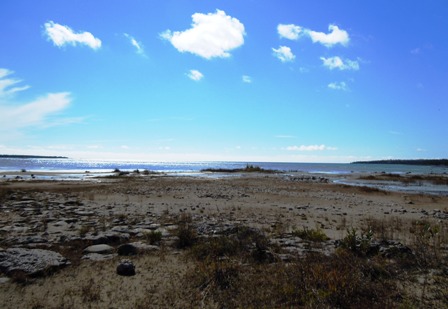
The next morning we proceeded to the Head of Trails in the Cyprus Lake portion of the Bruce National Park. We discovered that the trail we intended to use, to reach the Georgian Bay shoreline and the Bruce Trail, was closed for construction. Luckily there was an alternative, but longer route. The morning was cool, overcast and windy. When we reached the shoreline of Georgian Bay the waves that were crashing onto the rocky beaches and the limestone cliffs had the photographers trying to capture the feel of the moment.See photo below and to the right.
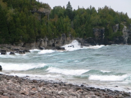
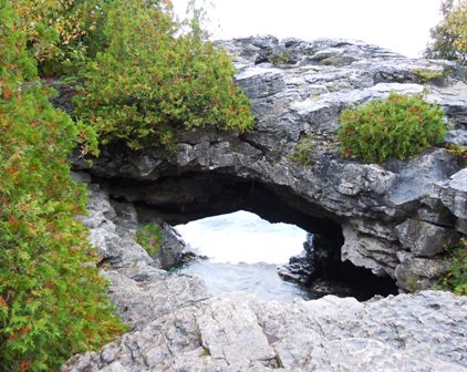
Between the spray from the waves and some light, intermittent rain we made slow progress on this very rocky and rugged section of the trail. Nonetheless, everyone enjoyed the views from the cliff tops and exploring the areas at the Arch and the Grotto. The waves entering the Grotto were most interesting. However, the dull day, and the wave action meant that we were not able to see the light from the underwater entrance (80 feet below the water.) to the Grotto.
By the time we stopped for a late lunch on the cobble beach between Marr Lake and Georgian Bay it was raining more steadily. Due to the extra distance and the slower than expected progress due to the wet and rugged terrain we calculated that it would likely be dark before we would reach our intended finish point. We decided to return to the van, via some of the other trials in the Cyprus Lake area of the National Park. This meant that we did not get to see Overhanging Point. Even if we had made it there Kendra had been adamant that she would not pose for pictures at the tip of the point.
After an exhilarating day on the trail we headed back to Tobermory Lodge to clean up and enjoy a batch of homemade Chili, etc.
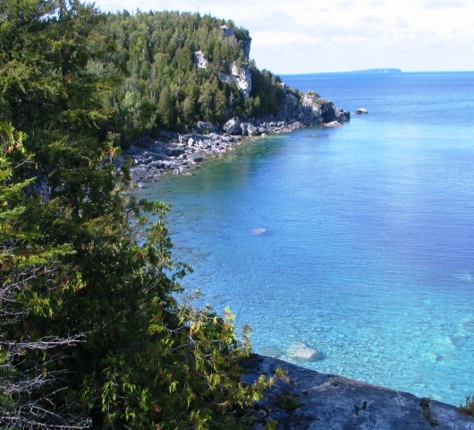
For our second day we returned to the same Head of Trails area and took the same trail down to Georgian Bay. Then we turned right and headed south on the Bruce Trail. This time the weather was calm and turned sunny as the day progressed. The views of the rocky beaches, limestone cliffs and the beautiful water of Georgian Bay were enjoyed by all.
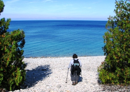
Our hike took us past Stormhaven camping area to the cobble beach at Halfway Dump. (This beach was described by one of our group as very large grains of white sand. Note that despite considerable searching, none of these rounded grains of sand proved to be much use for stone skipping on the water.)
Along the way, there were a couple of places on the cliff top sections of the trail where crevasse jumping was necessary, much to the concern of one member of the group.
At dinner in Tobermory that evening a number of the group enjoyed a meal of fresh Lake Huron Whitefish.
The weather on day 3 was pleasant again. After ensuring everyone had found a suitable selection of souvenirs and gifts we headed to the Singing Sands part of the Bruce National Park. This is on the Lake Huron side of the Bruce Peninsula. Unlike the limestone cliffs of the Niagara Escarpment on the Georgian Bay side of the Peninsula, the Lake Huron side has flat limestone and sand shorelines that slope gently into the lake. The flat limestone areas are referred to as Alvars. Some sections of Alvar along the Lake Huron shoreline have excellent collections of embedded fossils.
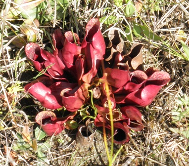
The Singing Sands area was established to protect a diverse collection of somewhat rare plants. We set off to search for fossils and rare plants. The fossils were much fewer and farther apart than I had seen in other sections of the Lake Huron shore. We did have better luck in finding some of the unusual plants. Everyone enjoyed the bug eating Pitcher Plants. Although all but one had lost its stem and seed head, the bright red pitchers were dramatic. (The pitchers are formed by the curled leaves of the plant. These are designed to trap water and insects, which are then digested by the plant, for nourishment.)
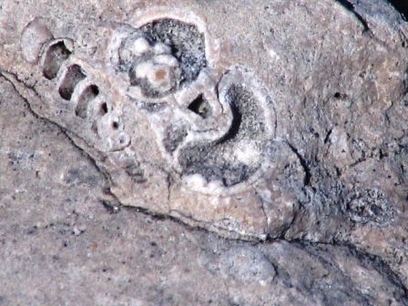
Having had only limited success in finding fossils at Singing Sands we headed to another section of shoreline. Our top fossil hunter, Monte, found a few better specimens, so that everyone could get some sense of what we had been trying to find.
After another pleasant dinner in Tobermory, we worked on sharing pictures and packing up for the trip home.
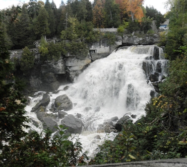
On Friday morning we set off down the Peninsula in convoy. Our last adventure together was a brief exploration of the area at Inglis Falls Conservation Area, near Owen Sound. The volume of water falling over Inglis Falls is much less than that of Niagara Falls. However, the height is about the same. (Both fall over the Niagara Escarpment.) Since it is not a straight drop, Inglis Falls is perhaps more interesting. It is also on the Bruce Trail. As a result the driving group could now claim to have seen the start and finish of the Bruce Trail (Niagara Falls to Tobermory.) as well as a special section along the way.
Enjoying one of my favorite hiking areas were Kendra Cross, Betty Petty, Owen Holbrook, Monty Simmons, Lin Fa Lee and Bob Fanning reporting.
 Friday, September 24, 2010
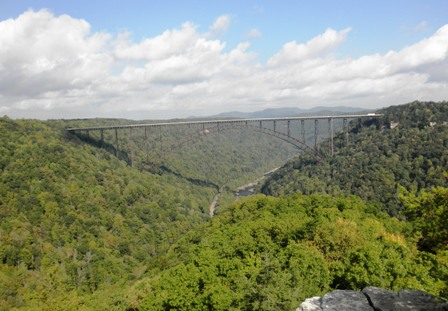
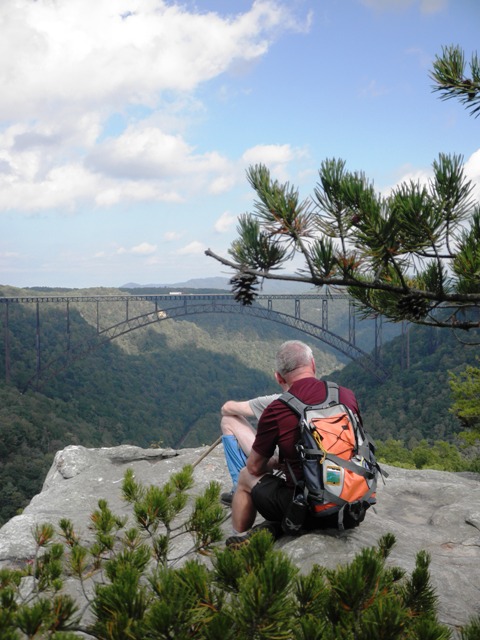
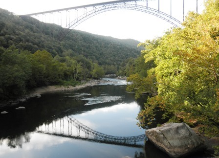
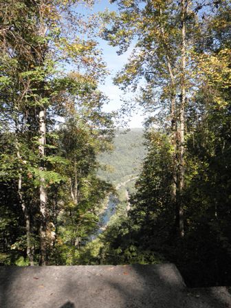
The three of us who were driving to Canada (Owen Holbrook, Monty Simmons, and Betty Petty) met in time to pick up our rental car from Sears at Northgate. Then we set out for Beckley, WV. We arrived at the New River Gorge a little too late to catch the ranger at the Park Headquarters. We walked down the steps to the tourist view of the bridge near the Ranger Station then headed across the road to a camping area where there was a large congregation of folks to see if they could help us with some information. They were unable to do that but tried to sign us up for the West Virginia Search and Rescue event that was happening on Saturday in the park. (Turns out we should have signed up as the next day we were informed that all sorts of good stuff was given out to the attendees). Saturday, September 25, 2010 We hiked between 8 and 9 miles in the New River Gorge National Scenic River Park. It was a very interesting day. We started off with a 1.8 mile trail recommended by the park ranger out to an overlook where we had a spectacular view of the New River Bridge. It was far, far better than the scenic overlook at the Park Headquarters Visitor Center that most people see and we spent 30-45 minutes there taking it in. It was an in-out hike so we made a loop from 3-4 other short trails in the same park. It happened that a state-wide training exercise was being held for all WVA search and rescue people. The trail system was crawling with S&R people and dogs looking for an elderly man named 'Jake'. We had fun talking to several of them. There were search plane over flights and late in the day even a Blackhawk helicopter. We bummed some cold water and a diet coke off one very nice lady. We had lunch beside this parking lot which was full of R&R people. It was only a couple of miles back to our car and so far everything we had done had been relatively level. We decided we needed a bit more of a challenge and there was a trail that was only a mile but listed as 'difficult' that went down into the gorge to an old mine site.
|
|
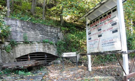
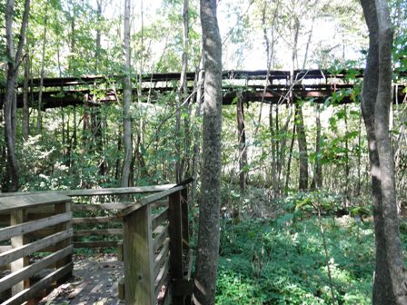
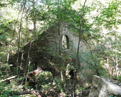
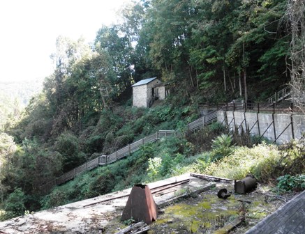 We explored the area around the mine which had several buildings and explanatory boards.To the right is pictured one closed off entrance to the mine. To the left is pictured the electrical building which has been partially restored. Please note the wooden stairs decending the mountain below it. From the mine site there was a wooden stair down to the town level beside the river where the miners and their families lived. At the time the mine was active there was a cable car which ran from the top down to the mine and town. Other than that the only access to the town was via the stairs. One guide said 820 steps for the stairs, another said 800+, but Owen counted 799. |
 |
 We did go all the way down to the river where Owen got stung twice by yellow jackets. We were tired by the time we got back to the top of all those stairs! We rested a bit before we continued our climb out of the gorge and the walk back to our car.
|
|
 However we revived enough to drive the one-way road down to the old bridge that the New River Gorge replaces. It was just about sunset and the views were gorgeous. There was a couple paddling under the bridge on surfboards and I took a picture of them.
|
|
Sunday, September 26, 2010
We then drove on to Niagara Falls, NY. We had some interesting adventures driving around Buffalo looking first for a motel and then for the Falls themselves. We managed to get to the Falls in time to see the nightly light show and we also managed to walk most of the footpaths out on Goat Island in the dark. Unfortunately my camera was still attached to my pack which was back in the trunk of the car, so I did not get any pictures. Oh well, I thought; I will get some in the morning.
Monday, September 27, 2010
We crossed over the border into Canada at Niagara Falls. The Canadian border guards made us get out of our vehicles, and opened every piece of luggage that we had, but we had no problems.
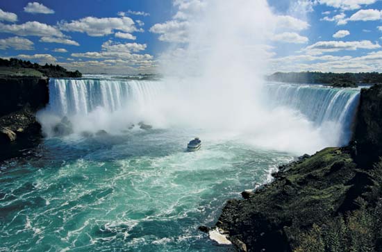
We crossed that morning because we wanted to be sure to see the view of the Falls from the Canadian side and to take the Maid of the Mist tour. The tourist buses were already rolling in and we ended up parking quite a ways up the hill from the park. We had walked most of the way down the hill, being in a hurry to get to the Maid of the Mist ticket office before it became too crowded, when I remembered that my camera was still attached to my pack! So I will have to content myself with available pictures of the falls taken by someone else .
Truly the Canadian viewpoint is much better than the American side, mainly because you can see the entire breadth of the falls, while on the American side you can only see the individual pieces of it. The Maid of the Mist tour was worth it; they ensured that everyone got thoroughly wet and experienced the power of the water coming over the falls.
We of course had to be on top at the front of the boat to make sure that we got the maximum experience. This meant that when we got off the boat, we were at the back of the group waiting to crowd into the 16 person elevators to get back up to the top of the escarpment. I said If there were stairs, I would take them. Owen said You want stairs? and opened the door to the fire escape and took off up the stairs. Monty and I followed him like idiots, just as we had in W VA. We heard someone start up behind us, but stop. Gasping for breath, after a couple of flights, he turned and went back down. We looked up and all we could see was stairs retreating in the distance, but we could still hear Owen going. Eventually we came to an exit to a service road behind the building and were able to walk back to the street. I later read, on-line, that the building was 13 stories high. On to Tobermory!!
 We departed Tobermory driving in caravan with the others the length of the Georgian Penisula to Inglis Falls. We walked a short distance down the Bruce Trail here in order to get a better view of the falls.
|
|
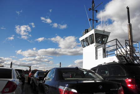
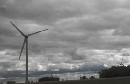 After leaving the others at Inglis Falls, we drove south through Ontario toward Detroit. We were impressed by the number and extent of wind farms in this area. We stopped at a small local restaurant for one last meal of Georgian whitefish. We crossed over the St. Clair waterway on a ferry to re-enter the US. We got to Detroit about rush hour which proved to not be as bad as I had feared and then drove on to Lima, Ohio before stopping for the night. This allowed us to make it back to Chattanooga before the car rental place closed for the day saving us a day's car rental.
|
|
Last updated: 5 December 2010
