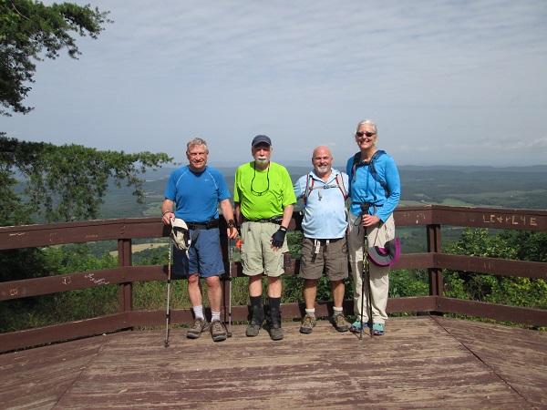
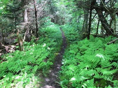
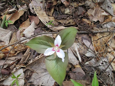
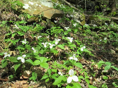
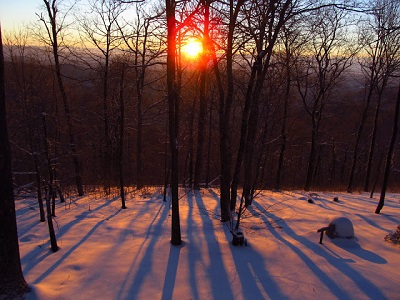
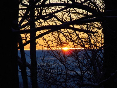
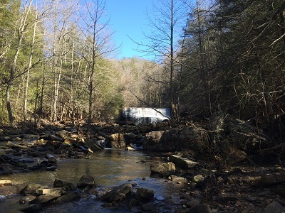
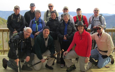
It was a good morning for a hike. The temperature was about 95 degrees and the sun was shining. We started the 1,180 foot climb about 9:30. It took us to the top of the falls and then to the top of John's Mountain in 1.4 miles. It was a clear day and the view was great. There was a good bit of poison ivy along the initial part of the trail. We returned back to the falls along the upper loop trail. There was ample water coming over the falls for a pretty view. We took a brief break to enjoy the falls. We returned by way of the lower loop trail for a total 4.5 mile hike. Hikers included Diehl and Merry Boggs, Bo Rudder and Tim Chomyn
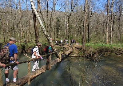
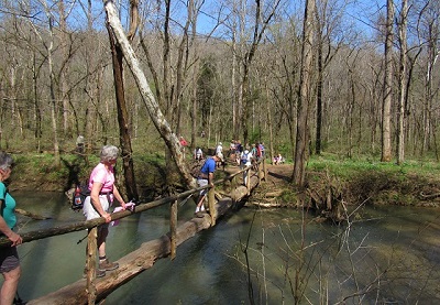
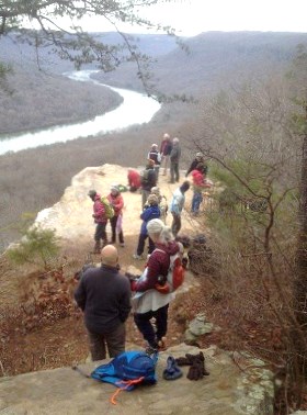
picture from Tim
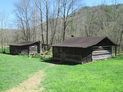
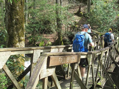
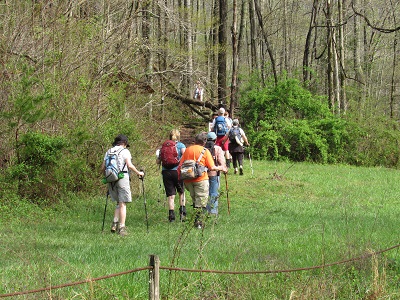
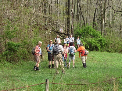
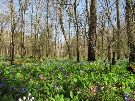
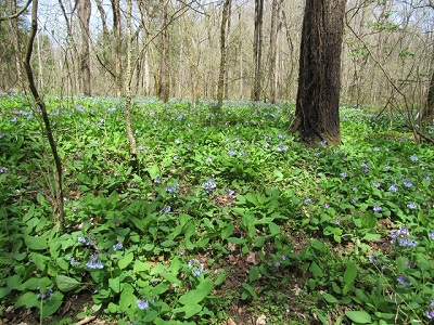
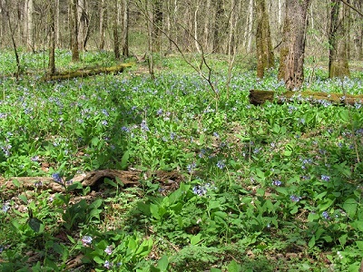
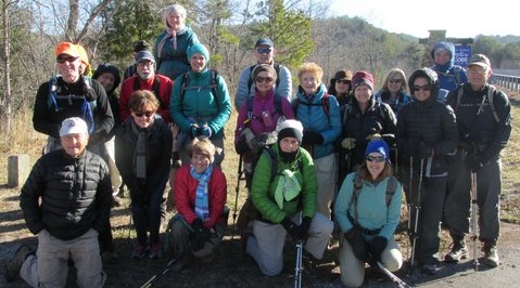
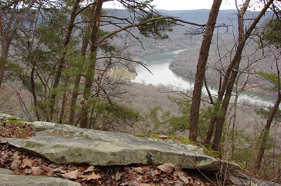
This new area is near the city and is a pretty 5 mile (if you do a figure 8 and get it all!) trail, well marked and laid out to show off the Nick-a-Jack Lake. There are impressive boulders, ups and downs, a pond and nearby sink hole. Having been in early spring I can assure you wildflowers are in abundance. You can print maps from TVA.gov or check your route from the map on the kiosk at the parking area and trail head. To get there take 24 W to exit 158, go down the ramp and turn left, drive under the freeway and a short distance more until you spot the Cedar Mountain sign on the right hand side of the road which points to the gravel entrance on the left. It was heating up by the time we finished and the humidity surrounded us so 26 hikers went their separate ways to home, errands, The Purple Daisy, or Miss Bs. Happy to find this nearby jewel were: Louis Spencer, Bob Rahn, Renee Grace, Boe Rudder, Tom Carter, Wayne Chambers, Cecile Shenouda, Kathy Seymour, Wanda McCarter, Patti Giles, Tim Chomyn, Gary Petty, Gwen Brimer, Sue Christensen, Larry Parks, Tom Long, Linda Busby, Suz Riggle, Bill Kinnaman, Susan Garrett, John Rowland, Gail Stokes, Nancy Hoover, Beverly Ligon, Hank Konigsmark, Suzanne Dorough, Wendy Gunn and Che Carico, reporting.
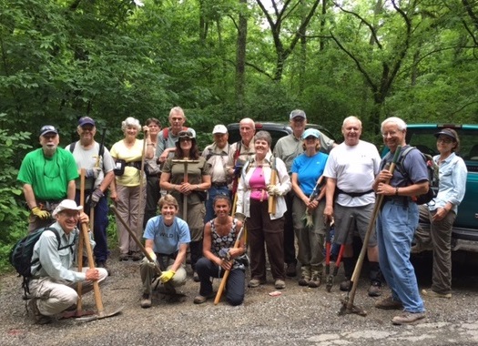
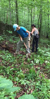
We met with a half-dozen other groups to honor National Trails Day by taking on several trail maintenance projects around the Hiwassee River. After coffee and some delicious cinnamon rolls, we listened to brief remarks from the Cherokee National Forest rangers, then introductions from the leaders of the trail organizations represented. Then we dispersed to our projects. Most of our group did some much needed brushing out of the upper section of Gee Creek Trail, beyond the water falls. Although the creek crossings were more than a little bit challenging, we persevered, finally deciding to just do some boots-on wading. But we did get a great deal of work done, much to our satisfaction and to the pleasure of Ranger Matt Henry. And after the work was done we were rewarded with hot dogs and cold drinks (and more cinnamon rolls!) back at our meeting place! Representing our club were Bill Kinnaman, Boe Rudder, Ralph Van Pelt, our leader Steve Barnes, and John Rowland reporting.
Most of our hikers are familiar with the Clear Creek, Benton Falls, and Clemmer trail loop from 64 up the mountain and down. Today we stayed on top and explored a route beginning at the parking lot above the lake. The first section was on the Azalea trail, then left onto the Clear Creek trail which in a short distance splits left away from the Arbutus trail, right at the intersection with the Rim Rock trail, right again on the Clemmer trail and on up this trail to the intersection with the Benton Falls trail and the entrance to the waterfall area. There was an abundance of lush ferns, Mountain Laurel, and we did spot the coveted flame azaleas. The waterfall was lovely and it was a nice refreshing surprise for first timers. There are more trails to be accessed from the Benton Falls trail and that had been our plan. However, frequent thunder off in the distance made us leery of completing the Slick Rock loops before rain set in. So we decided to complete our loop via the Benton Falls trail back to the lake (some hiked the trail around the lake) and the parked cars. There are great new maps available at the ranger station at the bottom of the mountain. Glad for new trails and no missteps were: Suzanne Dorough, Renee Grace, Bill Kinnaman, Tom Carter, Wayne Chambers, Gwen Brimer, Larry Parks, Patti Giles, Linda Busby, Cecile Shenouda, Beverly Ligon, Barry Ligon, Bob Rahn with "grands" Nick and Jordon, Wendy Gunn, Barbara McCollum, Bill Slack, Duane Baker, Kathy Seymour, Charlie Breeding, Gary Petty, Gwen Brimer, Susan Garrett, Boe Rudder, Wanda McCarter, and Che Carico reporting.
A shuttle was placed from Huskey Gap to the Sugarland Mountain trailhead on Clingman's Dome Road and off we stepped onto this beautiful sequence of trails. Though the temperature forecast was for high 80s, there were breezes and the forest was so very damp, cool, and fragrant. Plentiful ferns greeted us on the first section as we hiked down the mountain. Rhododendrons were blooming along the way also. At the Rough Creek intersection we lunched and then divided into two groups - one heading down Rough Creek to then hike on the Little River trail to the Huskey Gap trail up and out. 3 of our hikers turned left on Little River and hiked an extra 3.6 miles to campsite 30 and back to join us. The other group hiked straight on the Sugarlands trail to the intersection with the Huskey Gap trail and out to Newfound Gap Road. This group graciously expedited the gathering of the cars, which meant "some of us" stepped off of the trail not having to wait the @ hour for the retrieval. Thanks! Memorable was the vast blow down on the Rough Creek trail, the varied greens of the ferns on the Sugarlands and the Huskey Gap trails as they carpeted the forest floor, the profuse Mountain Laurel which spread out in the forest like we have never seen before, the wild boar siting, a turkey that took flight after rustling the underbrush, the bear activity signs posted near campsites, the fungi growing on the trees that was red in color and looked like it had been varnished, and the flame azaleas. Tom Long had a cooler with favorite beverages iced down at trail's end - just not regular Coke! Always impressed by the Smokies trails were: Tom Long, Sarah Frost, Gwen Brimer, Boe Rudder, Jerry Wright, Debbie Lambert, Barbara McCollum, Sonja Parker, Beth Jones, Bill Kinnaman, John Rowland, Bob Butterfield, and Che Carico reporting and Wayne Chambers leading. Bob, Sarah, Barbara, Sonja, and Beth camped at Elkmont Saturday night and on Sunday, facilitated by Tom Long, hiked from the AT at Clingman's Dome down the Goshen Prong trail, and out via the Little River trail. They caught the very special firefly show!
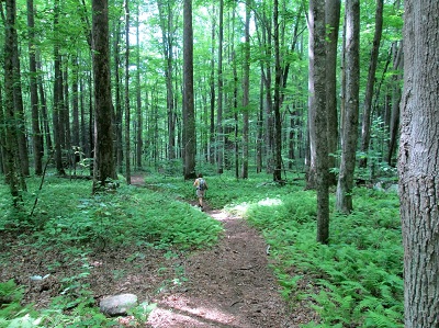
pictures from Barbara
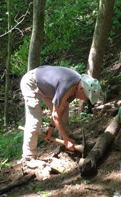
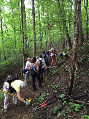
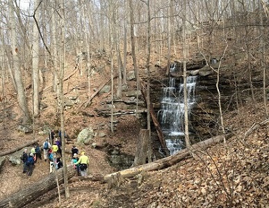
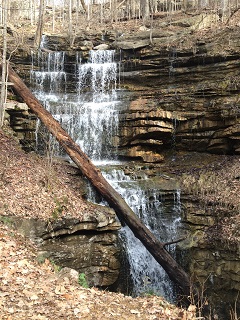
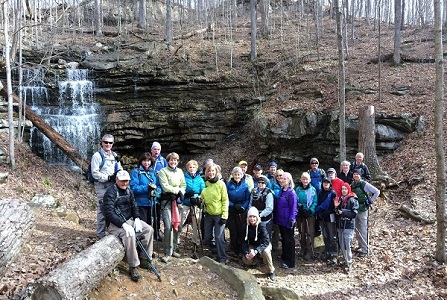
It was a work day today! Bill, Stormy and Rick Huffines had gone before us and flagged a reroute of the loop trail to bypass the service road that has been a part of the loop. Last fall our group built water bars on this section. They were recently destroyed by fire fighting vehicles due to an arson fire set in the woods. It was decided not to replace the water bars as this road may be used again to gain access. With loppers, Pulaskis, garden rakes, chainsaws, Mc Leods, a rock bar, and pick/mattocks the crew worked hard until the "whistle blew" for "quittin' time". Lunches were enjoyed in the serenity of the woods. Giving back today were: Bill Kinnaman, Stormy McGauley, Rick Huffines, Debbie Lambert, Jack Lambert, Renee Grace, Larry Parks, Susan Garrett, Jean Dickinson, John Rowland, Gary Petty, Boe Rudder, Donald Box, Jennie Chandler, Sarah Frost, Tom Long, Wayne Chambers and Che Carico.
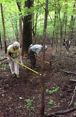
pictures from Stormy
Eight of us met guest hiker, Mistie, in the parking lot for the Savage Gulf Ranger Station prior to beginning our pleasant 8¼-mile hike. Leisurely we began on the Savage Day Loop Trail, detoured onto the South Rim Trail for a mile or so to one of my favorite overlooks (the “Step Down” overlook). Backtracking to the Savage Day Loop (with a visit to the base of Savage Falls), we progressed onto the North Rim Trail to a lunch break at an overlook. Returning again to the Savage Day Loop, we completed the loop back to the Ranger Station. Enjoying a beautiful day, the companionship, and brilliantly blooming mountain laurel were Madelaine Box, Joyce Campbell, Tim Choymn, Mistie Clements, Tom Long, Sonja Parker, John Rowland, Boe Rudder, and Donald Box, reporting.
picture from Madelaine
When our absent leader, Che, asked Renee over the phone if we had a good hike, Renee told her, "Well, there was some drama!" True, but the lost eventually recognized the error of their ways, turned themselves around, and returned to the flock. As Bill has earlier noted, when She isn't here to lead us the wheels always seem to come off! But other than that the day was quite pleasant; we saw quite a few nice mountain laurel blossoms along the farther reaches of the Day Loop. The falls were nice, not roaring with a huge water volume, but still a pretty sight. And for most of the group, lunch at The Cookie Jar in Dunlap was a treat as always. The hikers (who hopefully learned a lesson in sticking together) were Art Dees, Bill Kinnaman, Bob Rahn, Boe Rudder, Gail Stokes, Hank Konigsmark, Kathy Seymour, Larry Parks, Renee Grace, Stormy McGauley, Susan Garrett, Tim Chomyn, John Dever, and John Rowland reporting.
The morning of May 16th started off overcast and rainy at Enterprise South Nature Park. As a result a number of the participants decided not to hike. However, four of us (Tom Long, Steve Barnes, Kathy Seymour and her hiking Papillon, and I) decided to start in the rain. We had not hiked five minutes when the rain ceased. We continued to hike, crisscrossing numerous trails for the next 2.5 hours before returning to our cars. We hiked just over seven miles. The trails were fairly easy and in great shape despite the previous day’s heavy rains. A great way to start the weekend. Boe Rudder reporting. Reports from the Field
What a great day to be invited by Gwen and Ronnie Brimer to come down to their 500 acre farm near Lafayette for hiking and a covered dish lunch! The Brimers co-own the property with their daughter Kristin and son-in-law Chris Curtis. They have owned the property 4 years and in that time have worked very hard bush hogging, opening and marking hiking trails, building and repairing out buildings, and making remarkable improvements to the existing farm house. Blue, red, and white blazes marked the choice of trails based on distance each person wanted to hike. They were not without steep ups and downs, there were beautiful wild flowers (especially Mountain Laurel) still in bloom, views from mountain tops, rock hopping creeks, and we had Ronnie on the gator to come and show us the way when we made a wrong turn after failing to pay close attention to Gwen's trail route descriptions! Renee, Bob, and Charlie wet their hooks in the lake, but not enough fish were caught to make a meal. The delicious lunch featuring a variety of sandwiches, salads, fruit, desserts, tea, lemonade and beer was enjoyed at tables throughout the rambling house and on the long screened porch that extends the entire length of the front of the house. Celebrating a beautiful day, gracious hospitality, and long friendships were: Charlie and Agnes Breeding, Renee Grace, Bill Kinnaman, Bob and Karen Rahn, Suzanne Dorough, Wanda McCarter, Linda Busby, Cecile Shenouda, Gordon Sweenie, Jennie Chandler, Mary Hannon, Trish Appleton, Debbie Lambert, Wayne Chambers, Larry Parks, Sarah Frost, Tim and Elaine Chomyn, Patti Giles, Barbara McCollum. Gail Stokes, Tom Long, Nancy Hoover, Bill and Pat Slack, Kathy Seymour, Anne and Pete Rittenberry, Teresa Dean, Che Carico reporting, and Gwen and Ronnie Brimer hosting.
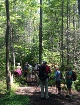
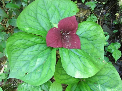
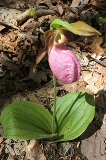
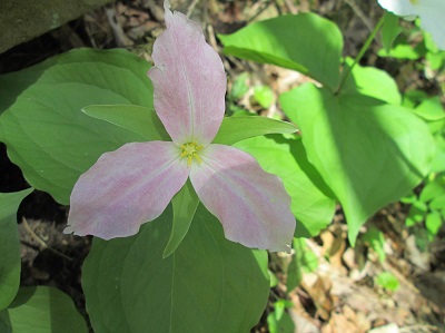
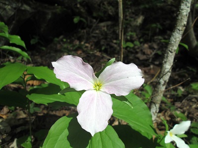
The Ace Gap trail is one of the easiest 11+ mile hikes in the Smokies but that is all relative! We found it not to be as flat as we were expecting, but quite beautiful! Having met in Ooltewah and leaving promptly at 7, we were on the trail by 10. It wasn't long until the first Pink Lady Slipper was spotted, giving us hope the forest floor at a remembered spot would be covered with them. Sure enough, about 2 miles in we found the spot covered with Catesby Trillium, Dwarf Iris, and more Lady Slippers than ever seen in one place. Finding these lovely flowers here is one of the reasons our dear friend Arlene Swallows began to name Ace Gap as her favorite trail. As a tribute to her memory we read the poem that John had published in the newsletter with her pictures and we spread a vial of her ashes among the flowers. Surviving a snake encounter and another of Wayne's Smokies treks were: Wanda McCarter, Tom Long, Larry Parks, Suzanne Dorough, Sarah Frost, Tim Chomyn, Charlie Breeding, Debbie Lambert, Gwen Brimer, Susan Garrett, Margaret Newton, Priscilla Watts, Boe Rudder, Bill Kinnaman, Kathy Seymour, Stormy McGauley, Teresa Dean, Che Carico reporting, and Wayne Chambers leading.
Snake encounter in Wanda's words: " I wasn't worried about snakes on this trail since it is well traveled, not only by us, but also by a large group from the Smoky Mtn Hiking Club ahead of us on the trail. I was hiking relatively close behind Wayne; Suzanne was directly behind me and Susan behind her. I usually look down while hiking, but was trying to hear Wayne so I was looking forward. Wayne, unaware, must have stirred up the snake by his pole placement. I somehow caught a glimpse of movement below me and looking down I knew immediately it was a very large snake moving extremely fast across my boot tips, slithering back and forth. It was so fast, I saw his big fat body and his tail whipping left and right but not his head. His tail hit my ankle as I was screaming and jumping back into Suzanne, who then jumped back into Susan (Key Stone Cops!). Since I followed its movements into the leaves I was able to point it out to Wayne and he confirmed it to be a big fat copperhead!"
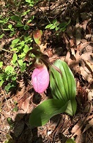
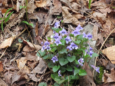
Off in search of the elusive Lady Slipper
pictures from Teresa
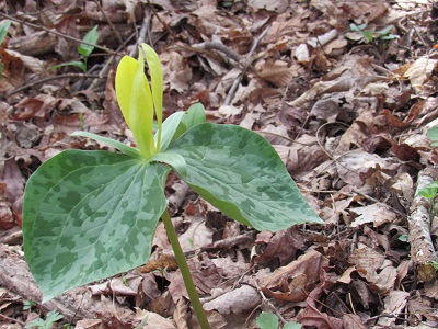
Bill and I backpacked from Thunder Rock Camp to the Hiwassee in Reliance, TN - 17.7 miles. Our hike began with a steady climb up to the top of No Name Mountain (2,853'), passing the intersection of Rock Creek Trail. The BMT continues up with a steady 15% grade, but with the cool temps and stiff breeze we cruised right up to the top where the BMT turns left and the Dry Pond Lead trail continues straight. We began descending down into Deep Gap and bumped into the Kimsey Mtn. Hwy. Looking carefully we saw the DOUBLE DIAMOND blaze and turned before reaching the gate and the road. All along the trail we were seeing spotlights of orange and white throughout the woods. Early spring flowers bordered the path and the Mountain Laurel were just popping out keeping the Trillium (deep burgundy/white/yellow) company. It was like being in a fairyland. Of course, the trail immediately starts UP again to the top of Brock Mtn. (2,400') and then wanders down to Piney Flats Branch where there is a delightful little creek. Bill tromped across in his waterproof boots and I rock hopped to a big moss covered tree and hooched across on my hands and knees. The trail ascended up to a flat piney area where we called it quits for the day and pitched camp. Bill had fun showing off his new Thermarest backrest that connects to his sleeping pad, while I sat on a knotty ol' log and took his picture. Our tents where pitched on about 4" of duff where we slept warm and cozy with no interruptions from the critters. The next morning we were on our way by sunrise and soon crossed McFarland Hwy and continued to descend down to White Oak Flats Rd. Walking along Lost Creek was enchanting....HUGE trilliums (Trilliums on steroids)...I thought I was in a Jurassic garden. After we made it back to Bill's car our first stop was Webb's Store for a Cold Diet Coke and a Energy drink. By the way, the only humans we bumped into were a couple driving on the Kimsey Mountain Highway. JD reporting.
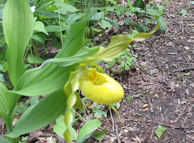
A Wake Robin and a Yellow Lady Slipper --- pictures from JD
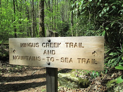
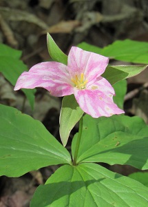
A backpacking trip had been planned for today. Wisdom prevailed and Wayne changed from a 1 night - 2 day backpacking trip up Big Creek to a day hike including Mingus Creek and Newton Bald due to storms in the forecast for Friday night and Saturday. Even this plan was almost thwarted as the Mingus Creek Trail was closed for park ranger weapon firing practice at the firing range that is on this trail. Wayne talked the ranger into letting us go on up the trail as we would surely get beyond the firing range before their practice began. So UP we went 5.8 miles with an elevation gain of over 3000 feet. We enjoyed a leisurely lunch at Deeplow Gap (about halfway) and then continued UP to the junction with the Newton Bald trail. Here at the junction Wayne allowed a welcomed break before starting DOWN the 4.7 miles back to our cars. We enjoyed basking in the sunshine and kidding Monty and Bob for sharing a pillow as they tried to catch a little nap. Flowers of note: Painted Trillium, Phlox, Blue Kohosh, Anemone, Squaw Root, Wild Geranium, Bluets, many Showy Orchis, May Apples, white Trillium, Bishop's Cap, Maiden Hair fern, Dolls Eye, Solomon Seal and Solomon Plume. Lots of rushing creek water along the way, little rock hops, views of surrounding mountains, siting of a surviving American Chestnut, and the fragrance of damp woods. Well fed in Andrews at Monte Alban and home late were: Carolyn Brannon (a new hiker), Monty Simmons, Barbara McCollum, Sonja Parker, Bob Butterfield, Beth Jones, Che Carico reporting, and Wayne Chambers leading.
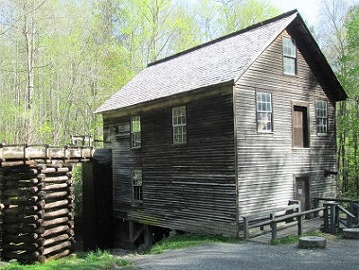
Mingus Mill at the trailhead
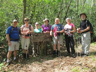
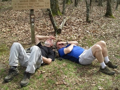
Started out with everyone upright; didn't end up that way! --- pictures from Barbara
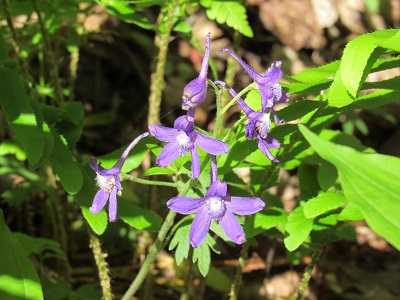
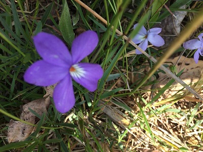
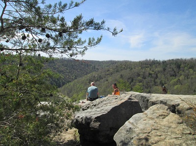
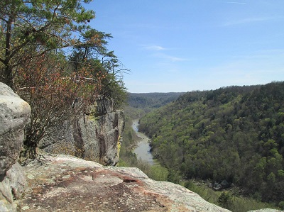
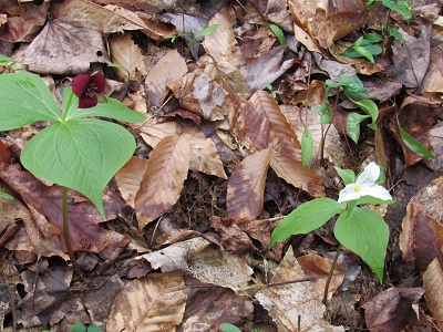
Shake Rag Hollow on the Sewanee Perimeter trail is famous for its diversity of wildflowers! After parking just outside the Sewanee campus stone gates you will descend (following blue blazes) down a rocky path featuring creeks and waterfalls into the gorge below. Here the trail becomes reasonably flat as it runs under great overhangs. Every week in April will feature different blooming wildflowers. The best today were the lavender Phaecelia mixed in with the deep purple Larkspur spreading through the forest as far as the eye could see. Also spotted was a Wood Poppy, Dolls Eye in early blooming stage, Dutchman's Britches, Squaw Root, and pink Lady Slippers. This portion of the trail is only 1.8 miles and ends with a steep climb up to Green's View. At this point we continued left and followed the rim along the Beckwith Point Trail back to our parked cars. Then off to lunch at Papa Ron's and shopping at the Mountain Outfitter. Pleased by the beauty of this trail were: Bill Kinnaman, Boe Rudder, Gwen Brimer, John Rowland, Kathy Seymour, Linda Busby, Margaret Newton, Patricia Smith, Patti Giles, Renee Grace, Stormy McGauley, Sue Christensen, Susan Garrett, Suzanne Dorough, Teresa Dean, Tim Chomyn, Tom Carter, Trish Appleton, Wanda McCarter, Sonja Parker, Susan Schott, Tom Long, Barbara McCollum, Cecile Shenouda, Wayne Chambers, Larry Parks, Tom Carter, John Dever, Susan Dever, and Che Carico reporting.
Some of the myriad of wildflowers seen
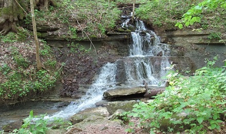
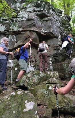
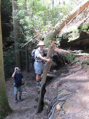
A small waterfall and a large(!) rock bluff to climb
Still climbing up the bluff, then finally up on top
A nice view of the valley, then on to lunch at Papa Ron's --- pictures from Teresa and John
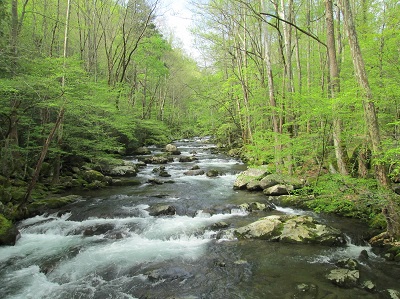
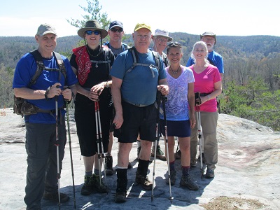
We went in search of three things today, and we found all three of them - some tough but rewarding hiking, some great views, and an abundance of wildflowers. Some chose the "easier" route, up Mt Sterling trail and down Baxter Creek trail, while others chose the opposite route beginning with the challenge of climbing Baxter Creek trail.
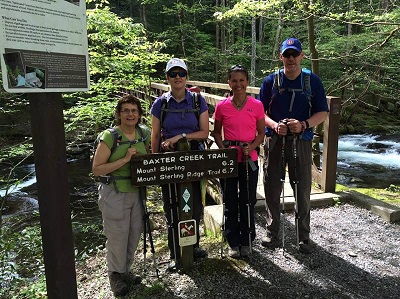
Starting out from the footbridge over Big Creek
A key swap solved the transportation problem of dealing with the two different starting and ending points. Those hardy souls who climbed Baxter Creek were in agreement about it's toughness; those who went up Mt Sterling trail thought it was quite a chore in itself, and we felt that even going downhill on Baxter Creek was not an easy trek. But all agreed on the beauty of Baxter Creek trail, especially the lush greens of the upper portion. And we were all smitten by the wildflowers that often seemed to cover entire hillsides on both trails. There were trout lilies, squirrel corn, white trillium, spring beauties, painted trillium, purple phacelia, yellow trillium, dwarf crested iris, and wild geraniums a-plenty. We even spotted a couple clumps of showy orchis at hike’s end!
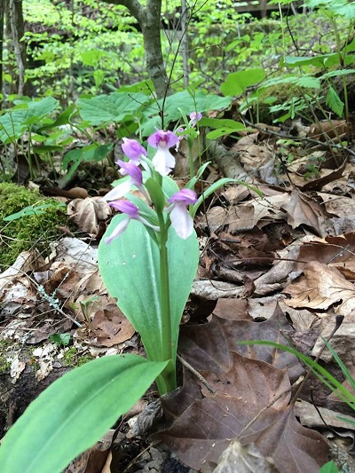
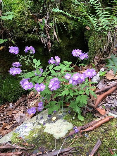
Showy Orchis, top left; Phacelia, top right; Painted Trillium lower left; Wild Geranium lower right
Just when you've conquered Baxter Creek Trail, now you gotta climb this!
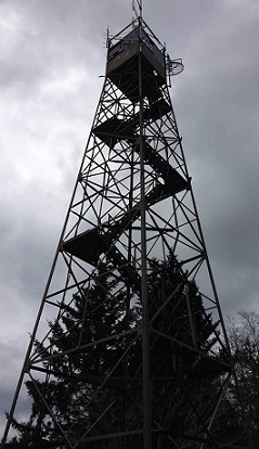
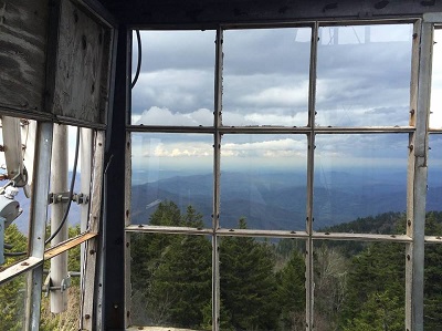
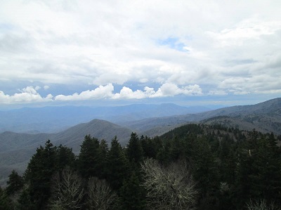
It wasn't the nicest of days, being mostly cloudy, and thus the views from Mt Sterling tower weren't very picture-worthy, but nonetheless impressive.
Pictures from Barbara
And we were in our cars on the way to dinner before any rain fell. For five of the eight hikers, it was their first trip to Mt Sterling and their first time on either trail. Thanks to co-leader Bob Butterfield who led the group that went up Baxter Creek, including Sarah and Tim Frost, Barbara McCollum, and Beth Jones. Those going the other way were Che Carico, Kathy Seymour, and John Rowland reporting.
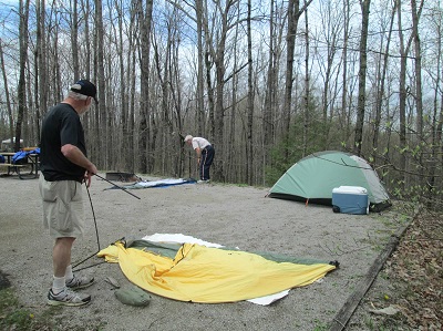
While I had my cereal Friday morning, I checked the radar and was pleased to see the swath of yellow and orange and red had almost cleared Big South Fork up there and Soddy-Daisy down here. We met in a light sprinkle and had some of that on up past our pit stop in Crossville, but the weather had cleared quite a bit before we stopped for lunch. By the time we got to the campground, it was quite pleasant. We set up the basics of camp and had time to do the scheduled 4.6 mile hike to O&W Railroad Bridge.
There was a lot of wet footing, a precursor of what we found all weekend. And the river had gone wild! The low footbridge that we were going to use Sunday to start that hike was completely under water! But that day's hike was quite pleasant, with a pretty afternoon, wildflowers, and the interesting old bridge.
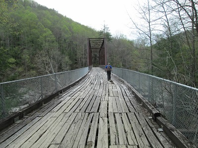
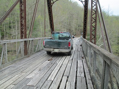
The old bridge can still hold a pickup truck!
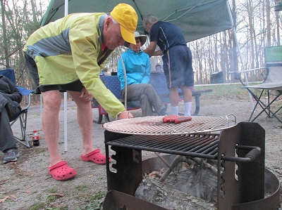
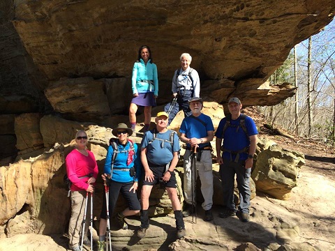
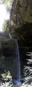
The evening was nice, with a hotdog cookout. And it was a cool sleeping night. Saturday we did the Twin Arches Loop down to Jake's Place, with a side trip to Slave Falls, then on to Charit Creek Lodge, and back up to Twin Arches - 8.9 miles for the day.
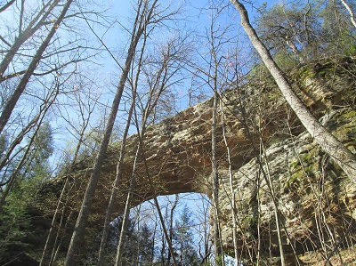
Going down under the North Arch, then on to Slave Falls
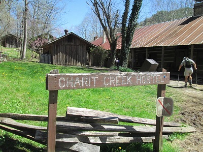
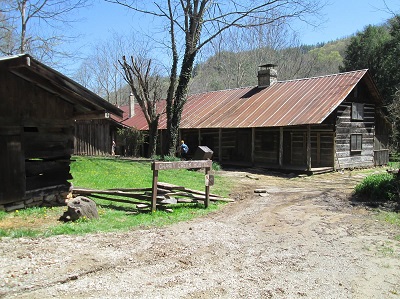
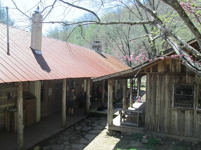
Charit Creek Lodge
Under the South Arch, then on top of it
We saw lots more wildflowers and a pretty falls, took a nice break at the lodge, and marveled at the awesome arches. We had hamburgers and a couple leftover hotdogs for dinner. It was a little chillier sleeping night, but lots of stars overhead before we retired. Sunday we checked on that footbridge, and while we could now see it, there was considerable damage and it was impassable, and probably had been for a while, being blocked off at the far end. But just as we were about to go in search of a "Plan B", we found that across the nearby highway bridge there was a set of steps going down to a dirt and gravel path headed right toward the point where our trail would pick up on the far side; we were back in business! So we did the planned 5.6 miles out to Angel Falls Overlook and back. It was another warm day with many more wildflowers, including quite a few bluebells!
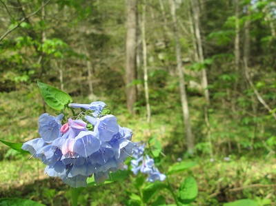
Trillium and Bluebells on the way to Angel Falls Overlook
Angel Falls Overlook
pictures from Barbara
Banter was great during the days and around the campfire at night. The food was good, and the weather was great, especially considering I expected Friday to be a washout. We did 19.1 miles of hiking, most or all of it new to most of the hikers; that was especially nice, hearing the "wow's", etc. And the campground and the park itself were new to most; but now they may have gotten spoiled! The gang consisted of Barbara McCollum, Sonja Parker, Sarah and Tim Frost, head chef Bob Butterfield, Wayne Chambers, Monty Simmons, Patricia Smith who joined us Saturday evening, and John Rowland reporting.
The Piney River trail is in another of the Pocket Wilderness areas created by Bowaters. It is one of our favorites for its diversity of flowers and the river or Duskin Creek running beside it any time of the year. The lower trailhead is on the left as you arrive at the river and recreation area "at the bottom" or at either Newby Camp (which adds an extra mile) or Duskin Creek bridge "at the top" (end to end 10 miles). Walden Mtn. Rd. to Duskin Creek has become deeply rutted as it is a logging road. It is the same to access Newby Camp but not as much of it to drive. Today we chose not to place a car shuttle or organize a key swap and all began at the lower trail head. This meant at least a 4 mile walk into our chosen lunch spot and then return. Since it had rained the night before, the many rocks on the trail were very slippery and McDonald Branch was tricky to cross for the same reason. So not a good plan as the roughest part of this trail had to be walked two times! Several hikers fell but with no serious injuries. White Trillium, Stinking Benjamin, Spring Beauty, Anemone, Jacks, Little Brown Jug, Spotted Mandarin, and Wild Oats were dominant. John trekked on to Rock House Branch, Debbie led several on the spur to the "bathtub", and Bill hiked the trail to Twin Rocks. Remaining in good spirits despite the hard work carefully crossing the many rocks were: Wanda McCarter, Wayne Chambers, Suz Riggle , Patti Giles, Bob Rahn, Larry Parks, Renee Grace, Sarah Frost, John Rowland, Suzanne Dorough, Susan Garrett, Sue Christensen, Gwen Brimer, Reggie Jay, Trish Appleton, Linda Busby, Bill Kinnaman, John Dever, Che Carico reporting, John Rowland and Debbie Lambert leading.
Starting out from the parking area
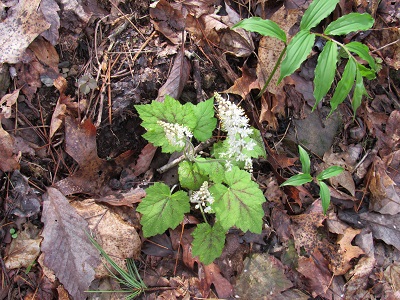
Foam Flower and Blood Root
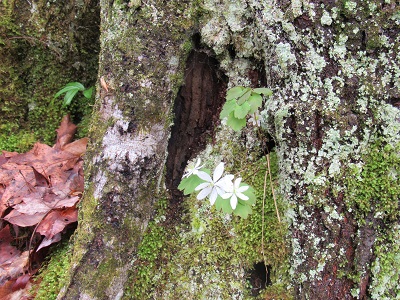
White Trillium and Trout Lilly
White Trillium and lunch break
Longspur Violet and Yellow Trillium
pictures from John
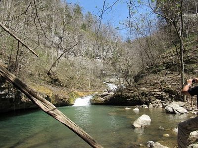
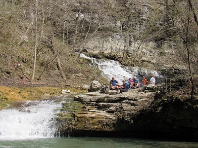
This hike today was sponsored by Chattanooga Outdoor and led by Bob Butters (an original CHC member!) and James Eubank. The occasion was to celebrate the rerouting and reopening of the trail on the mountain above NickaJack Lake. Debbie Lambert and I went to check it out along with Weston, Ellie, and Emery Carico. We found it to be beautiful and splendid with spring wildflowers! Perhaps the most splendid was the Phacelia in full bloom and covering the tops of the huge rocks. You can check this trail out at www.tva.gov, choose "River Recreation", "Recreation Trails", and "Nickajack" for Google directions and a map. We hiked 4 miles but you can cover 6 miles with a little backtracking. We will be taking you there, Che Carico reporting.
Although forecast for high temp of 75, 34 hikers set off to hike the "Alabama Side" trail to the Walls of Jericho. This area is one of our favorites for the wonderful wildflowers, especially the Virginia Bluebells. On the downhill trek to Mill Creek, we were rewarded with masses of Spring Beauty and Hepatica.
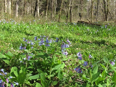
Upon arriving at the bottom we walked up the "Tennessee Side" trail just a bit and did find fully in bloom the wonderful forest floor covered in bluebells, Dutchmen's Breeches, and Phlox. John was so happy !!!
Across Mill Creek is a bench and a smaller patch of the bluebells. The trail continues on to another bridge crossing of Turkey Creek, passes the very old Clark Cemetery with campsite nearby, and onto a more narrow, rocky, creek- side portion (1/2 mile) of the trail. Blood Root, Twin Leaf, Anemone, Trout Lily, and Stone Crop were spotted along this section. A rock hopping across Turkey Creek is almost always required to cross again and gain access to the Walls of Jericho amphitheater.
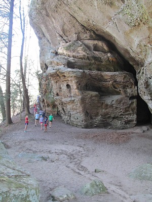
Put your gear down and go on up to what looks like the end of the amphitheater. Climb up to the level above and view the rear falls at the very end and the deep hole into which they disappear.
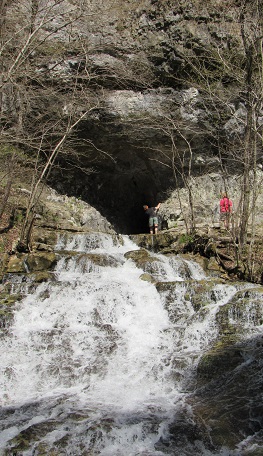
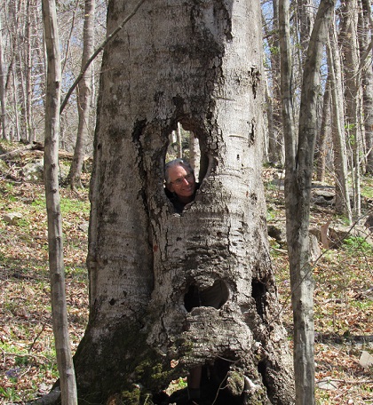
Then check out the water pouring out of the wall itself. And along the way somebody's always got to pose in the hollow tree; it's a tradition!
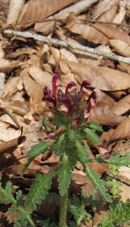
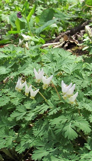
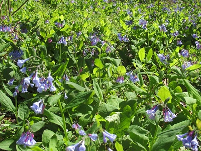
Some close-ups of Lousewort or Wood Betony and Dutchman's Breeches, and more Bluebells
First time to the area and veterans alike basking in the sun for lunch were: Wanda McCarter, Bill LaRoque, Nancy Hoover, Debbie Lambert, Wayne Chambers, Larry Parks, Bill Kinnaman, Renee Grace, Jennie Chandler, Linda O'Neil, Suzanne Dorough, Susan Garrett, Bob Butterfield, Teresa Dean, Bob Rahn, Sarah Frost, Sonja Parker, Sue Christensen, Diehl Boggs, Merrie Boggs, Shirley Wright, Margaret Newton, Tom Carter, Wendy Gunn, Trish Appleton, Charlie Breeding, Barry Ligon, Beverly Ligon, Patsy Smith, Linda Busby, Karen, Bill Whiteside, Che Carico reporting, and John Rowland leading. We have been carrying small portions of Arlene's cremains to sprinkle in special places. Did so today among the bluebells along a trail she dearly loved.
pictures from John
After 8 CHC members cancelled out, Steve Barnes called me for Bill's phone number to find out if Bill wanted to continue with their plan to hike Lost Creek on the Benton MacKaye Trail. I didn't bother asking Steve if I could join the hike because I felt Steve was going to cancel it. Bill calls me a few minutes later to ask if I wanted to go. The hike was on!! We arrived at the trail head and started our hike at 9:30AM in the brisk 30 degree morning air; with blue skies and a slight breeze we were in for a treat. We marveled at the beauty of Lost Creek and the many spring flowers encountered on our trek. We took the time to explore interesting fauna, unique forest areas off trail and unusual rock formations. Lunch break was on a sandbar along a tranquil section of Lost Creek...very 'zen' moment. We had such fun putting our high tech Tennessee waders on (held up with rubber bands) and tromping across a small tributary creek flowing into Lost Creek. We were back at the car by 2:30PM refreshed and excited about our hike. Jean Dickinson reporting.
pictures from JD
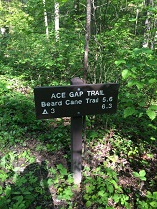
It was raining as we approached the exit to the Smokies headed to Top of the World and begin this hike. All suited up we took off down the Gold Mine trail. By the time we came to the intersection with Cooper Road it had stopped and remained dry with mostly clouds and some sunshine for the remainder of the hike. The Beard Cane trail has been closed for several years due to trees felled by the tornado. Evidence of the damage was all around us as we bottomed out and extensive cleanup is still needed. The trail passed through a now field where briars are growing up due to the sunlight coming onto this part of the trail. Lots of water flowed in the creek and we had to cross 36 times each way, often with no choice but to step into the water. After a pause at the bottom of the last .6 miles uphill to the junction with Ace Gap, all forged on and rested there on logs in the gap. The return was uneventful with the sun coming out for a while. There is no way to avoid the steady uphill .8 of a mile back to the trail's beginning and some of the veteran hikers warned this would seem tough after hiking 17 miles according to Art's gps. The rain had returned to dampen efforts to put on dry socks and clothes. Weary yet jubilant and well fed at Venti's were: Art Dees, Beth Jones, Barbara McCollum, Gwen Brimer, Wanda McCarter, Susan Garrett, Boe Rudder, Sarah Frost, Stormy McGauley, Charlie Breeding, Joyce Campbell, Che Carico reporting, and Wayne Chambers leading.
picture from Barbara & Beth
Virgin Falls near Sparta is one of our favorite (in spite of long drive) hikes. Now we have discovered more trails in the Bridgestone/Firestone Centennial Wilderness. Today, led by Jim Hardy ,(TC Varner, Judy Varner, Carol Deakins and Don Deakins had done some scouting previously) we hiked the 8.1 mile loop of the Yellow Bluff, the trailhead for which you will find on down the road from the Virgin Falls trailhead. At first the trail gently descends into Scott's Gulf. The canyon was formed by the Caney Fork River. From Boar Hog Gap Overlook you will look down into the canyon and at the river below. Upon reaching the canyon floor, after passing several waterfalls, the loop turns downstream to the gorge bottom with boulder fields, rock bluffs, and a wilderness decorated by Blood Root, Trillium and Trout Lilies. We enjoyed our lunch perched on rocks beside the fast moving and cascading Caney Fork River. Following the old Scott's Gulf Road .4 miles steeply uphill ( an elevation gain of 550 feet), we stopped off at the Joe Holloway Rockhouse near the end of the loop. Stepping back onto Scott's Gulf Road the loop is completed by turning right and hiking another .5 miles to where the loop began. Big game hunts affect this area, so always check the dates. Hikers today: Suzanne Dorough, Bill Needham, Tim Chomyn, Bob Rahn, Larry Parks, Susan Garrett, Linda Busby, Sue Christensen, Boe Rudder, Wendy Gunn, Gwen Brimer, Charlie Breeding, Jane Ellett, Tom Long, Jean Dickinson, Carol Deakins, TC Varner, Judy Varner, Wanda McCarter, Patti Giles, Wayne Chambers, John Rowland, Renee Grace, Bill Kinnaman, Bill LaRoque, Suz Riggle, John Dever, Don Deakins, Che Carico reporting, and Jim Hardy leading.
The morning was cool and pleasant as we gathered in the parking lot just across from the Kidde trail. After exchanging our morning pleasantries, and my usual pre-hike speech, we set off for Skyuka Springs. We walked along the gravel road through the Nature Center, stopping along the way to enjoy some early Spring flowers. As we walked along the Lower Truck Trail, everyone enjoyed getting to know our new hikers, and sharing stories of past hikes and life experiences. After enjoying a nice lunch break at Skyuka Springs, we walked back to the Nature Center, going around the pond to see the turtles and fish. Those along for this pleasant hike, on a beautiful day were Jerry Wright, Wayne and Vicki Chambers, Robin Raya, Donald and Madelaine Box, Jane Seale, Kellie Yarbrough and Lindy Johnson. Hike leader Kendra Cross, reporting.
picture from Madelaine
In the absence of our sweet Che, the group met to hike in the Ocoee Gorge led by newbie leader, Reggie Jay. From Thunder Rock Campground, 24 hikers strolled on the Rhododendron Trail to the intersection of Bear Paw Loop and climbed .25 miles to a right turn on the trail. About another mile, we intersected with the Chestnut Mountain Loop and turned right and followed it on the northern route until we hit the TR Express Trail back down to Thunder Rock Campground. A nice, mild almost-spring day! Hike leader was pleased to get everyone back without a loss! Attendees were Boe Rudder, Patti Giles, Sue Christensen, Wanda McCarter, Suzanne Dorough, Linda Busby, Gary Petty, Pat Appleton, Charlie Breeding, Stormy McGauley, Sarah Frost, Tim Chomyn, Wayne Chambers, Bill Kinnaman, Bob Rahn, Renee Grace, Bill Needham, Larry Parks, Sonja Parker, Becky Braddock, Jean Dickinson, Art Dees, Susan Garret, with Reggie Jay reporting.
picture from Reggie
Despite the forecast of almost inevitable rain, a nice group of us ventured out anyway. Maybe it was just a serious case of cabin fever! But it wasn't all that bad, just a light sprinkle the first hour or so and the last half-hour; nothing that a little rain gear couldn't handle. The several small creek crossings were more challenging than usual; but the upside was that Abrams Creek was full and swift, all the cascades along the way were splashing with whitewater, and Abrams Falls was roaring. The tornado-damaged area is still impressive, but it does provide more views of the creek below. When we finished the hike Tom Long, Beth Jones, Barbara McCollum, Sarah and Tim Frost, Reggie Jay, and Bob Butterfield grabbed their camping gear and retraced their steps back to campsite #1 to spend the night and hike up Cooper Road and Goldmine trails on Sunday. Sonja Parker, Donald Box (great to see him back on the trail!), and I dined at Pizza Ventri in Vonore on our way home. John Rowland reporting.
 |
 |
pictures from Reggie
The regular Wednesday group canceled the hike today because of the rain. The newly-formed Foul Weather Subset of the Wednesday Group hiked anyway! It was a light-to-steady rain for most of our 5 mile loop atop Raccoon Mountain. We didn't see any mountain bikers; in fact we didn't see anyone else on the trails, making for a peaceful hike. We sloshed through puddles, and JD and Bill used sticks to create temporary water bars. During the last mile, JD noticed that the sky was brighter and, sure enough, it stopped raining. The clouds/fog also began to lift from the nearby reservoir and the river far below. Enjoying being outdoors, even wet, were Sarah Frost, Bill Kinnaman, Jean Dickinson, and Elizabeth O'Connor, hike leader.
picture from JD
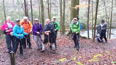
After several weeks of rain, ice, and snow, it was sunny and 60 degrees for a great hike on Georgia’s Pinhoti Section 21 (formerly known as Section 8) from Mack White Gap near Summerville to the Narrows picnic area. Even though this section is officially listed as 11.2 miles, the hike leader decided earlier to eliminate the last two miles of road walking which was appreciated by all hikers at 9.2 miles. The car shuttle was already in place thanks to Tom, Sonja, and Beth when hikers met in Summerville at 9:00 a.m. We were on the trail by 9:30 a.m. and finished by 2:15 p.m. The group enjoyed some beautiful ridge walking and views of Chattooga County along with a warm, sunny spot for lunch. A couple of minor stream crossings, stories about the 1981 Corpsewood murders which happened nearby, and a cohesive group made for a very pleasant walk in the woods. Hikers included: Sarah Frost, Tim Frost, Wayne Chambers, Tom Long, Beth Jones, Reggie Jay, Doug Graydon, Bill Slack, Sonja Parker, Ralph Van Pelt, Gayle Monk, Kathy Steinbruegge, and Barbara McCollum reporting.
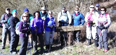
picture from Barbara
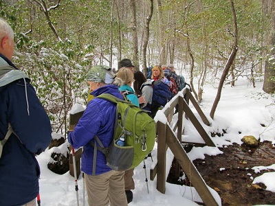
It was a little cold as we began our hike, and there was still snow on the ground from earlier in the week. Everyone enjoyed the camaraderie as we swapped stories of past hikes, told each other about future hikes, and talked about other great places to go. Those along for a nice walk in the woods: Tom Long, Bob Seale, Joe Terringer, Tim and Sarah Frost, Patrick and Rosemary Lavin, John Rowland, Jerry Wright and hike leader Kendra Cross
It snowed in Georgia two nights before our planned departure for Len Foote Hike Inn so with some concern we gathered data and met at the Ringgold Cracker Barrel to make a final decision. Roads were reported on the 24th to be fearsome in the Atlanta area. An Amicalola Falls State Park ranger reported that all park roads were open and clear, but the local sheriff said "I would not come if I were you!" Surely you know we took off down the road to give it a try. The result was an easy passage to the park, check in, and 33 hikers began their hike to the Inn knowing we might indeed get snowed in the next day. All arrived in time for the tour and delicious hot dinner at the Inn, the new snowflakes having begun their fall at 3pm with only a few of our hikers still in route.
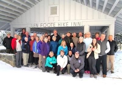
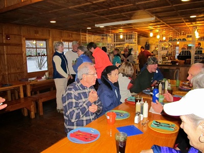
first picture from Barbara; second from Susan Schott
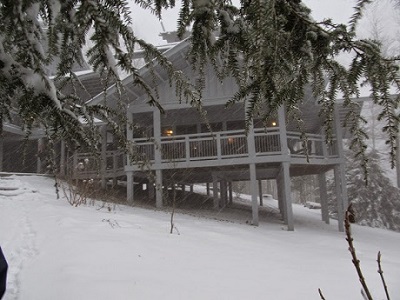
These flakes got bigger and bigger, continued until after midnight, and piled up at least 6 inches of fresh (not icy) powder.
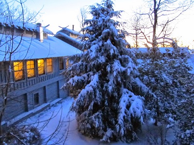
A winter wonderland was revealed on Thursday morning by a brilliant sunrise. Indeed the report was that park roads had been cleared and Georgia highways were also clear as our homes and roads in the Chattanooga area had been hit the hardest!
After a great hot breakfast, checking out, and taking a moment of reflection by sprinkling a vial of our precious Arlene Swallows' cremains in the fresh snow ("Lest we forget"), we started down the trail.
No more than 3 hours later the last hiker stepped off of the trail all safe and sound, overwhelmed by the beauty that had surrounded us.
last 8 pictures from Susan Schott
Some headed home immediately to see if they could get to their homes, and some went to the town of Ellijay to find a burger - that was all we could find as many restaurants were closed. Reports are that all made it home safely as a good bit of melting had occurred by late afternoon. Blessed by the beauty and camaraderie of this trip were: Jack Clayton, Charlie Breeding, Suzanne Dorough, Wanda McCarter, Reggie Jay, Nancy Hoover, Sarah Frost, Merry Boggs, Diehl Boggs, Tim Simmons, Boe Rudder, Linda Rudder, Art Dees, Ashley Dees Siegel, Renee Grace, Tim Grace, Susan Schott, Martha Parker, Debbie Lambert, Susan Garrett, Barbara McCollum, Stormy McGauley, Larry Hill, Bob Butterfield, Larry Parks, Bill LaRoque, Sonja Parker, Linda Busby, Gwen Brimer, Owen Holbrook, Sue Christensen, Che Carico reporting and Wayne Chambers planning and leading. PS: Charlie, Jack, Bob, Barbara, Gwen, Linda, Reggie, and Larry Hill stayed over on Thursday night. Some hiked on out to the Springer Mtn. "jump off for the AT" and back and some hiked the trails surrounding the Inn and continued working the "big puzzle"! That evening a rousing song fest was enjoyed with new to have arrived hikers. Reports were of another delicious meal, breakfast, and then a somewhat slippery trail for their return on Friday. Put this trip on your Bucket List for next year!
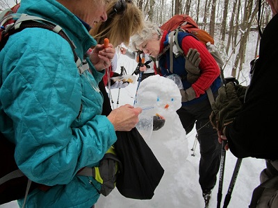
Valentines Day turned out to be a perfect day for hiking. We started with a short “pow-wow” with Bill explaining the upcoming car shuttle, regrouping on the trail and our lunch spot. Bill asked if anyone had not hiked this trail; 3 raised their hands. Before heading off to our cars, Bill handed each of the ladies a candy heart. Once on the trail the speedy hikers took off after receiving a reminder from Bill to stop at 11AM and wait for everyone to re-group. Our next stop after re-grouping was our lunch break by the creek in the grove of evergreens. Our big hurdle of the day was crossing the creek which was running high. There were 3 modes of crossing; the first was slipping plastic bags over one's boots, securing them with rubber bands and simply walking across. The more daring of the group chose to rock hop, and the third group chose to roll up the hiking pants, put on their water shoes and freeze. Hikers were Sarah & Tim Frost, Boe Rudder, Gwynn Brimer, Mary Ketterer, Merry & Diehl Boggs, Kathy Seymour, Randy Morris, Shirley Wright, Reggie Jay, Gary Petty, Jean Dickinson reporting, and leader Bill Kinnaman.
picture from JD
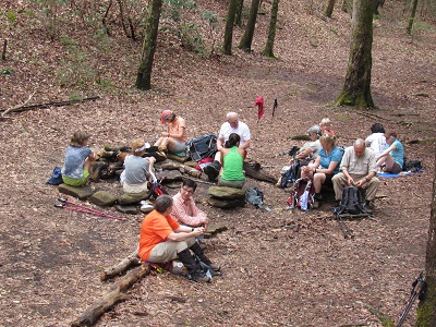
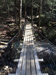
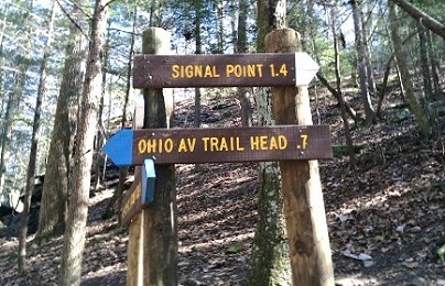
Always appreciate the wealth of trails in our area and today especially on Signal Mountain. Thirty hikers met up at the Ohio Avenue trail head, then carpooled to the soccer fields near the Signal Mountain Middle/High School. We accessed the blue perimeter trail, then turned right on the private land trail to Mushroom Rock. Here you meet the CT which leads to Edward's Point and beyond. The route had ups and downs, beautiful evergreens and streams often spilling over and becoming waterfalls. Lunch was at Edward's Point with the radiant sunshine above and the swollen Tennessee River snaking below. Instructions were to follow the white blazes until they came to the orange trail (left and up the creek to hike the Bee Branch Loop) or the blue trail (cross the swinging bridge and exit out to Ohio Avenue). We enjoyed seeing the wonderful signs many of our group had helped erect to make the way clear for hiking in the Rainbow Lake area. While good maps can be found at atlas.utc.edu/signalmtn/, the Signal Mtn Parks Board is nearing completion of folding pocket maps. At the kiosk at Ohio Avenue is a new sign-in box for reporting problems needing correcting on the trails and also to register so you can be found if you fail to return home! Having a great time today were: Tom Carter, Patti Giles, Tom Weldon, Hank Koningsmark, Sue Christensen, Gwen Brimer, Renee Grace, Linda Busby, Sarah Frost, Wendy Gunn, Pete Rittenberry, Wayne Chambers, Charlie Breeding, Susan Garrett, Debbie Lambert, Wanda McCarter, Suzanne Dorough, Trish Appleton, Boe Rudder, John Rowland, Louis Spencer, Margaret Newton, Stormy McGauley, Bob Rahn, Bill Kinnaman, Bill LaRoque, Gary Petty, Jean Dickinson, Teresa Dean, and Che Carico, reporting. We found out today that we have first class first aide attendants as many gathered around to tend to Patti Giles' wound after she fell into a sharp rock. Kudos to those of you who brought out of your packs just what was needed to get Pattie bandaged up and out of the woods to then seek trained medical assistance. Patti hiked out on her own, had 5 stitches taken at a medical clinic, is taking antibiotics, and reports that she is "just fine"!
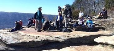
Group photo at Mushroom Rock and lunch at Edward's Point
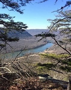
Tennessee River Gorge and bridge over Middle Creek
Some of our signs and water over the dam at Rainbow Lake; pictures from Teresa
With nearly a full moon in the western sky, hikers took off along the Chickamauga levee at 7:30 AM from the intersection of Shallowford and North Moore Roads on February 7th. About ten minutes into the hike it was possible to see the rising sun through the trees in the east. The temperature was in the low thirties which made it nearly ideal for a brisk walk. The first part of the hike took us past a variety of wildlife -- various birds and even a coyote -- to Brainerd Road and Lee highway where we enjoyed chatting over a relaxed breakfast at the IHOP Restaurant. From there, members of our group selected from different options: some finished there; some hiked back to their vehicles where we had started; others continued hiking along the levee and trail to Camp Jordan where they went around part of that perimeter trail before heading back to the levee and their vehicles either at IHOP or at our hike’s beginning. Depending on the route taken, the hikers covered from two and a half miles to a little over ten miles. The weather was pleasant, and a good time was had by all. There were eleven hikers willing and able to avoid the temptation to sleep in on a Saturday morning. A few of them were hiking with the group for the first time. Those attending were Tim and Elaine Chomyn, Tim and Sarah Frost, Ned and Pattie Giles, John and Frances Habecker, Michael and Barbara McMahan, John Rowland, and John Habecker reporting.
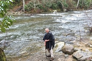
Looking for a short hike, a nice waterfall, and a special treat for lunch, we headed for Sewanee. Well, one vehicle got hung up in truck traffic and ended up going to Manchester, but we talked them back to the trailhead parking area (what did we do before cell phones?). We made a short side trip to Morgan's Steep to admire the views down into the valley around Cowan, and to begin drooling over the prospects of lunch there. Then we dropped down to Bridal Veil Falls, which was splashing quite nicely after recent rains. We ascended back to the main trail, then continued on back up to the bluff to complete the loop. On the way back along the bluff we did our best to find where a "Yes" had been carved into a rock as an answer to a long ago proposal; we think we found the spot, but not actually finding the "Yes", we weren't quite sure. Maybe next time. About half of us then enjoyed a wonderful lunch at Sernicola's in Cowan, a special request from Renee which we were all quite willing to help fulfill! Che had the baked tomato and cheese appetizer that Renee had last time - you know the one that has to have its own license plate when they wheel it out from the kitchen! Hikers, including some new faces, were Art Dees, Bill Needham, Bill Kinnaman, Bill LaRoque, Boe Rudder, Charlie Breeding, Debbie Lambert, Che Carico, Hank Konigsmark, Larry Parks, Nancy Hoover, Patti Giles, Renee Grace, Stormy McGauley, Suzanne Dorough, Teresa Dean, Tom Weldon, Wanda McCarter, Wayne Chambers, Wendy Gunn, Sonja Parks, Sharon Hogan, Karen Richie, Bill Whiteside, Clifford Ackerson, Gwen Brimer, Barry Ligon, Beverly Ligon, Linda Busby, John Rowland reporting.
pictures from Teresa
Sunny and 52 degrees--as good as it gets for January 31st. It was a perfect weather day for an 8.2-mile hike on the Gahuti Backcountry Trail at Fort Mountain State Park near Chatsworth, Georgia. Fourteen hikers enjoyed the challenging ups and downs of the Gahuti as well as the great vistas of the north Georgia mountains. No hike is complete without a couple of mixups, but that’s what makes our group fun and interesting. Lost keys, missing the trail to the lake, lunch on the run, and hurt toes didn’t dampen our enthusiasm. Everyone was accounted for, keys were found, toes are healing, and the day ended as it started--a perfect hiking day. Hikers included Boe Rudder, Reggie Jay, Wayne Chambers, Bob Butterfield, Tim Frost, Sarah Frost, John Rowland, Margaret Newton, Beth Jones, Tim Chomyn, John Hyler, John Bell, Steve Barnes, and Barbara McCollum reporting.
picture from Beth
Totally plagiarizing Chris O'Connor's hike last fall, the Wednesday group hiked what was a chunk of new trails for most, and trails not visited in a long while for the rest. We started at the far end of the Brush Creek trail system, and soon divided (not altogether smoothly...) into two groups; one took the longer route that winds along the lake above Ocoee #3 dam, the rest took the shorter route directly to Boyd's Gap Overlook parking area. After a short break we started the new part of the day's trails, descending Boyd's Gap Trail to have lunch at the kayak launch area by the upper reaches of the Ocoee. Then we followed the Old Copper Road to the Whitewater Center, crossed the bridge there, and continued down-river on the Rhododendron Trail with wonderful views of the river to Thunder Rock Campground. Hikers were Elizabeth O'Conner, Sarah Frost, Louis Spencer, Stormy McGauley, Margret Newton, Larry Parks, Bill Kinnaman, Barbara McCollum, Reggie Jay, Elaine Richie and guest, Wanda McCarter, Charlie Breeding, Art Dees, Tim Chomyn, Trish Appleton, Renee Grace, Patti Giles, JD Dickinson, Boe Rudder, Tom Long, Che Carico, John Rowland reporting.
picture from JD
On a chilly but sunny Saturday, we met at the trailhead parking area near the Visitors Center. Due to the mountain bike trails being closed there was very little traffic in Enterprise South. We had a good mix of new members and longer term members and proceeded at a moderate pace along the Poe Run Path. The 5+ mile hike included a combination of Poe Run, Hidden Lake Trail, Hidden Lake Overlook, Boulder Point and Deer Hollow with a brief water/snack break at the picnic area near Hidden Lake. In spite of a lot of recent rainfall the trails were mostly dry as they are well maintained with a established bed of mulch. After the first half-mile section of level creek-side trail we strolled through a series of rolling hills enjoying the long winter views. The designers did a nice job of preserving the property’s heritage with the winding patrol roads and concrete magazines previously used to store TNT intact. Enjoying a pleasant morning, good conversation, and a respite from the recent clouds were Sarah and Tim Frost, Joe Teringer, Kristin Holritz, Michelle Anderson, Elizabeth and Chris O’Connor and Steve Barnes, reporting.
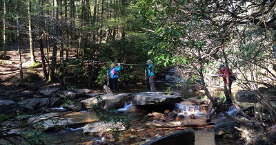
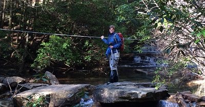
What a perfect day to return to Sparta and Virgin Falls! With new hikers in tow we headed out hoping not to be stopped at the Big Laurel Creek cable crossing that is 1.5 miles into the hike. John left early and went ahead to throw more big rocks at this crossing if needed. As it turned out, boots stayed on, the cable seemed to have been tightened for more secure grasping, and all made the crossing safely. Big Laurel Creek meanders alongside for the first part, then after the crossing it runs more rapidly as the trail turns downhill to Big Laurel Falls. From here the trail levels for a while until it intersects with the trail to Sheep Cave. We chose to hike this loop in a counterclockwise direction, pleased with the water pouring out of Sheep Cave and quite impressed with the volume and energy of Virgin Falls. Lunch was here in spots of sunshine. Many hiked on up to the top of Virgin Falls with some crossing the creek at the top of the falls and looping back down over rugged and steep terrain. After leaving Virgin Falls the trail takes a steep but short climb away from the river and then rock and rolls back to Big Laurel Falls. Here the trail begins that steep uphill climb to finally reach the campground, level ground, and the crossing again with the help of the cable. The temperature for this day's hike was perfect as cool enough to keep the steep climbs comfortable. Rains in days prior had filled the streams and waterfalls - just what we had hoped for. Hoping to return another day to catch the spring wildflowers were: Debbie Lambert, Louis Spencer, Charlie Breeding, Margaret Newton, Sue Christensen, Barbara McCollum, Wendy Gunn, Tim Chomyn, Wayne Chambers, Larry Parks, Jack Clayton, Reggie Jay, Renee Grace, Sarah Frost, Suz Riggle, Suzanne Dorough, Wanda McCarrter, John Rowland (only one to hike spur to Martha's Pretty Point), Boe Rudder, Tom Weldon, Susan Garrett, Patti Giles, Stormy McGauley, Teresa Dean, Tom Long, and Che Carico, reporting.
Virgin Falls
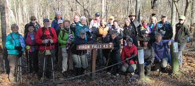
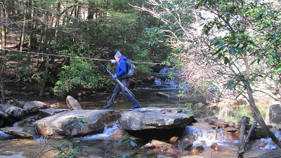
Group photo and crossing the creek using the cable
Big Laurel Falls pictures from Teresa and Barbara
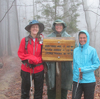
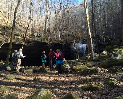
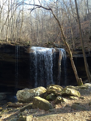
In January the trails at upper elevations in the Smokies usually have ice and snow making them difficult to hike. Not so today as hikers started up the Kanati Fork trail. After 2.9 miles Thomas Divide is reached. The lovely gap here provided a perfect lunch spot. At this junction some our faster hikers had turned right and hiked the 1.8 mile section to Newfound Gap Road and back to then follow behind those who had turned left to head toward the Newton Bald trail. And yes that group did catch up and pass the ones who opted to catch the additional short section another day! As Tim Chomyn was one of the hikers who chose the extra 3.6 mile section, he saved some of his SPECIAL brownies to share with the "shorter distance" (11.4 miles) hikers when he caught up with them! He had hauled three Tupperware containers up the mountain as our group was too large today for just one batch. What a guy! The evergreens were outstanding against the "black lace" leafless hardwoods. Run offs did have perhaps more water than usual, but not too much to rock hop. We met quite a few other hikers and got a real good look at Elk at Oconaluftee. Out to enjoy another great Smokies hike were: Tom Long, Debbie Lambert, Gwen Brimer, Sarah Frost, Tim Frost, Reggie Jay, Eric Anderson, Michelle Anderson, Barbara McCollum, Bob Butterfield, Janet Hale, Beth Jones, Tim Chomyn, Joyce Campbell, Karen Smith, Che Carico reporting and Wayne Chambers leading.
Having lots of rain lately the hiker's set off from the gate at the end of Barker Camp Road to pick up the CT and hike to Stevenson's Branch camp site. This section of CT is fairly new and just one more piece of the trail as it heads north. We can surely thank those CTC volunteers who have been so instrumental in building these trails - they are carefully laid out in a beautiful wilderness - this one at the top of Montlake Mountain. The trail is accessed via a gate that is usually locked - with a 1.1 mile gravel road that winds downhill, bearing right, and joining the CT with an easy to spot sign. Bear left at the sign. Fairly level and with some ups and downs for a while, eventually it cuts right and down into the gorge steeply with switchbacks leading to Cooper's Creek. Crossing this creek, the trail then leads to the campground beside a waterfall. Today the water was swift, deep, and cold, so hungry hikers sat down beside Cooper's Creek (not crossing it) and found some warmth as the sun began to break through the clouds. Not disappointed as the lunch spot by the creek was beautiful were: Louis Spencer, Susan Garrett, Gwen Brimer, Debbie Lambert, Trish Appleton, Suzanne Dorough, Wanda McCarter, Margaret Newton, Joyce Campbell, Larry Parks, Wayne Chambers, Patti Giles, Wendy Gunn, Renee Grace, Charlie Breeding, Teresa Dean, Tom Long, Suzanne Riggle, and Che Carico, reporting.
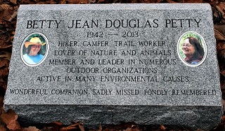
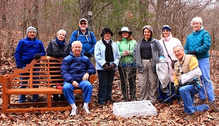
Several of us gathered to see first-hand Betty's bench and the newly installed marker. They are in a very nice location, at a trail junction just a short walk from the road near the Chattanooga Nature Center headquarters building, but far enough up into the woods to represent Betty's love of the wilderness. We admired the workmanship of both the bench and the marker, and took a few minutes to share memories of our dear friend. This will now be a wonderful place to reflect on all that she meant to us and to the larger area outdoor community.
Well we didn't have any snow, but we more than made up for it with a gazillion and forty-two icicles (I counted them myself - whew)! The creeks were running full, Sycamore Falls was strong, icicles were hanging everywhere, and ice covered rocks were abundant. The views at and on the way to Raven Point were great as usual, but the ice down in the upper gorge was the star of the show today. On the way back I stopped halfway down the descent from the rim down the Doghole Trail and looked at the wonderous display of ice. My comment was, "Some people think we're crazy out here hiking in this cold; but they've never seen this!" Enjoying the beautiful day and the beautiful scenery were Sarah and Tim Frost, Shirley Wright, Amy Wright, Gwen Brimer, Bob Butterfield (who continued on to camp at Small Wilds that night!), and John Rowland reporting.
Certainly cold today (high would be @ 32), but 16 came out to hike from the Trenton trailhead up to the lower falls via the Sitton's Gulch trail. Daniel's Creek was filled with rushing and roaring water. We encountered no ice on the trail as had been expected and the Daniel's Creek bridge and wooden steps needed for access to the lower falls were fine for passing. The viewing deck at the lower falls was, however, covered with ice and beckoned the reckless to try a little ice skating! Monty joined us as his home is nearby and he told us of interesting cave openings on the bluff near the beginning of the trail. We plan to return in the spring to enjoy the abundance of wild flowers on the lower section of the trail, to explore the caves, and to visit his favorite barbeque restaurant in Trenton. Off for lunch at Mellow Mushroom, the movie Wild, or errands were: Wayne Chambers, John Rowland, Susan Garrett, Weston Carico, Ellie Carico, Emery Carico, Debbie Lambert, Gwen Brimer, Margaret Newton, Jennie Chandler, Trish Appleton, Suzanne Dorough, Sue Christensen, Elizabeth O'Conner, Monty Simmons, and Che Carico, reporting.
Not the prettiest of days, but not too chilly, and we did see a little sunlight for maybe half an hour early on. But we had a great turnout; what a way to kick off the new year! After setting up the car shuttle, the whole gang proceeded down to Indian Rock House and then on to Snoopers Rock. For a few it was their first look from that marvelous vantage point. From there Gwen led a group of four back the way we had come, thus creating a new version of the moderate hike option for this annual outing. The rest of us hiked the short connection back up to Tower Road. At that point most ended their hike and left in the waiting shuttle vehicles. Seven of us crossed the road and headed for the Mullen's Cove part of the hike. After lunch at Hemlock campsite, we stopped briefly at Mullen's Cove overlook, then continued on, especially enjoying the section that follows along Short Creek. Hiking the easy part were Becky Braddock, Bill Kinnaman, Shirley Wright, Teresa and Mac Dean, Karen Dale, Lindy Johnson, Faye and Melvin Nunez, Sue Christensen, and Kathy Seymour. The moderate hikers were Bill LaRoque, Marian and Bob Hull, and co-leader Gwen Brimer. Doing the whole loop were Joe Teringer, Louis Spencer, Merry and Diehl Boggs, Janet Hale, Joyce Campbell, and John Rowland reporting.
Last updated: April 28, 2015