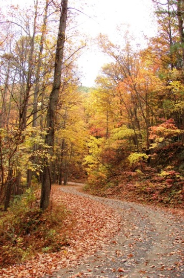
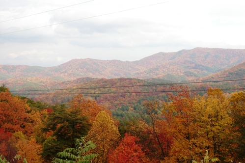
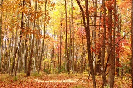
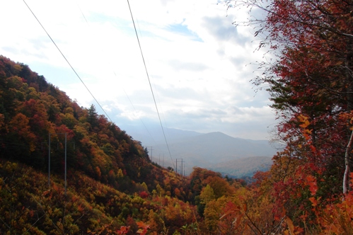
Kimsey Highway, Forest Service road 68, is a single track Jeep road with passing turnouts that runs between Harbuck, TN and Greasy Creek,TN through the Cherokee National Forest. Both are located in Polk County, TN which is bisected by the Ocoee Ranger District of the Cherokee National Forest. Its 15 mile length traverses some of the most rugged terrain in the eastern US. It is a long slow drive from end-to-end but offers a unique view of the forest. Since it runs close to the top of the ridge it offers many good views. At one point it passes under a TVA power Right of Way which provides unrestricted views in two directions. You may be able to go the entire length of the road without seeing another vehicle
This road has been proposed as an alternate route for the US 64 expansion known as Corridor K. US 64 is the route through Ocoee Gorge. It is a narrow two lane road that provides access to the whitewater rafting and kayaking traffic on the Ocoee as well as east-west truck traffic trying to avoid using I40 between Ashville and Chattanooga. It appears to be relatively unused compared to the Ocoee Gorge.
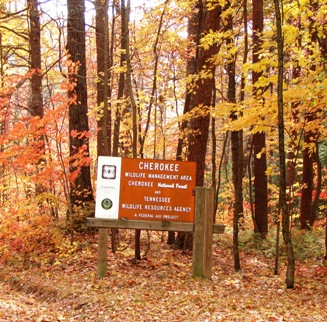
However this area has more users than initially meet the eye. This rugged forest is excellent black bear habitat and also is home to deer, wild boars, wild turkeys and grouse. On any fall weekend during hunting season finds most every turnout occupied with a hunters vehicle.This steep rugged terrain with minimal human noise and impact provides an excellent environment for game animals to rear their young in the spring and summer and also provides easy access for hunters in the fall. There are also some excellent trout streams coming out of this undisturbed area and a favorite local campground is nearby.
During the rest of the year it provides access to the forest by mountain bike and horse enthusiasts and access to the Benton MacKaye Trail at three different points. The Benton MacKaye trail is a long distance trail that runs from Springer Mountain in Georgia to the north edge of the Smokies where it rejoins the Appalachian Trail.It is gaining national recogntion as a major long distance trail and was recently featured in a NY Times article. The trail is recognized by its distinctive diamond white blaze as contrasted to the white rectangular blaze of the Appalachian Trail.
Kimsey Highway is a very historic route through these mountains. While the present route is named for the man who had it constructed in 1920, Dr Lucius , it generally follows and old Cherokee Indian path across Little Frog Mountain. This route was in use by the Cherokee long before white settlers arrived. The Ocoee River gorge was so wild, steep and dangerous that the Cherokee rarely used it prefering the route of the Kimsey Highway instead. The white settlers continued to use the Indian path until copper was discovered in Copper Hill and a new road was dug out through the Gorge between 1851 and 1853 to facilitate the hauling of copper ore to the railhead in Cleveland, TN. At this point the old Indian Trail fell into disuse until Dr. Kimsey constructed his road in 1920.
Today this road is still pretty much like it was in 1920. It is probably wider and better constructed than the old Indian Trail, but it can still give one the feeling of the Indian country prior to white settlement. It was also used as a mail route prior the the construction of the Copper Road. There is a grave of a mail carrier who died on the route near the road. This site is marked by the Forest Service.
 This area has never been inhabited and is still a truly wild area although it has been logged in the past. This wild character is why Little Frog Mountain, also known as Kimsey Mountain, is today a designated Wilderness.